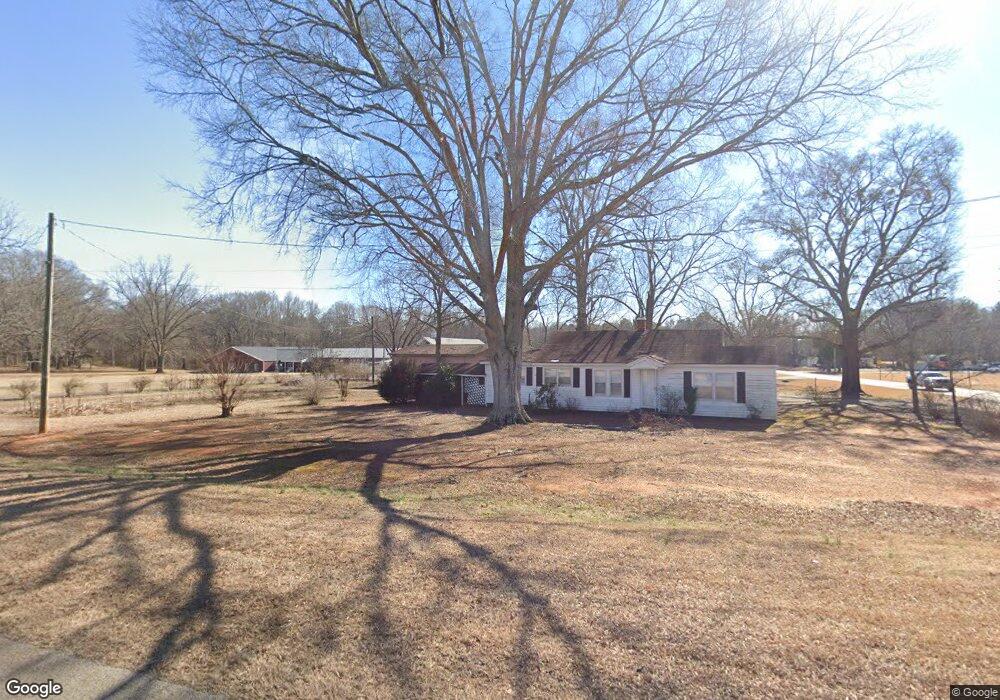
1001 Ruth Jackson Rd Bogart, GA 30622
Estimated Value: $247,310 - $430,000
--
Bed
--
Bath
1,378
Sq Ft
$276/Sq Ft
Est. Value
About This Home
This home is located at 1001 Ruth Jackson Rd, Bogart, GA 30622 and is currently estimated at $379,828, approximately $275 per square foot. 1001 Ruth Jackson Rd is a home located in Oconee County with nearby schools including Rocky Branch Elementary School, Malcom Bridge Middle School, and North Oconee High School.
Ownership History
Date
Name
Owned For
Owner Type
Purchase Details
Closed on
Apr 18, 2024
Sold by
Hardigree Hilda
Bought by
Hilda G Boyd Irrevocable Trust and Dupre Brenda H
Current Estimated Value
Create a Home Valuation Report for This Property
The Home Valuation Report is an in-depth analysis detailing your home's value as well as a comparison with similar homes in the area
Home Values in the Area
Average Home Value in this Area
Purchase History
| Date | Buyer | Sale Price | Title Company |
|---|---|---|---|
| Hilda G Boyd Irrevocable Trust | -- | -- |
Source: Public Records
Tax History Compared to Growth
Tax History
| Year | Tax Paid | Tax Assessment Tax Assessment Total Assessment is a certain percentage of the fair market value that is determined by local assessors to be the total taxable value of land and additions on the property. | Land | Improvement |
|---|---|---|---|---|
| 2024 | $53 | $75,516 | $22,408 | $53,108 |
| 2023 | $57 | $69,608 | $20,748 | $48,860 |
| 2022 | $48 | $58,191 | $16,598 | $41,593 |
| 2021 | $51 | $51,572 | $15,090 | $36,482 |
| 2020 | $51 | $48,184 | $13,718 | $34,466 |
| 2019 | $40 | $44,964 | $11,928 | $33,036 |
| 2018 | $36 | $38,508 | $10,844 | $27,664 |
| 2017 | $36 | $33,924 | $9,037 | $24,887 |
Source: Public Records
Map
Nearby Homes
- 0 Monroe Hwy Unit 1025452
- 1010 Garland Dr
- 1640 Madison Ct
- 6601 Hog Mountain Hwy - Hwy 53 Unit PARCEL B
- 2479 Eisenhower Ave
- 1665 Eisenhower Ave
- 3377 Clayton Dr
- 3451 Clayton Dr
- 1216 Ray's River Run
- 0 Whitehead Rd Unit CL335631
- 0 Whitehead Rd Unit 10574962
- 0 Us 78 Hwy
- 1 Us 78 Hwy
- 2130 Keeneland Dr
- 2130 Keeneland Dr
- 3164 Malcom Estates Dr
- 0 Ruth Jackson Rd Unit 10582108
- 00 Ruth Jackson Rd
- 1021 Bedford Trail
- 3240 Monroe Hwy
- 2781 Monroe Hwy
- 2781 Monroe Hwy
- 2780 Monroe Hwy
- 2711 Monroe Hwy
- 2881 Monroe Hwy Unit 501
- 1060 Ruth Jackson Rd
- 2820 Monroe Hwy
- 2850 Monroe Hwy
- 1100 Ruth Jackson Rd
- 2770 Monroe Hwy
- 2691 Monroe Hwy
- 2881 Monroe Hwy Unit 803
- 2881 Monroe Hwy Unit 701
- 2881 Monroe Hwy Unit 503
- 2881 Monroe Hwy
- 2881 Monroe Hwy Unit 703
- 2881 Monroe Hwy Unit 601
- 2881 Monroe Hwy Unit 801
- 2881 Monroe Hwy Unit 603
- 2881 Monroe Hwy Unit 501