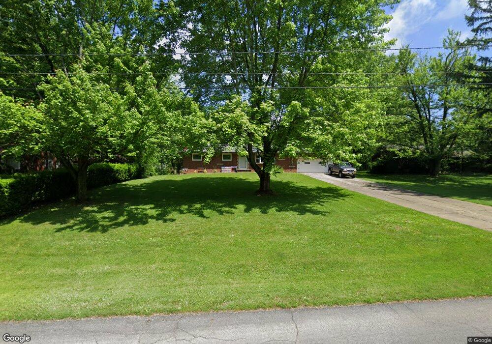
1001 Stump Rd New Franklin, OH 44319
Estimated Value: $213,000 - $249,000
3
Beds
2
Baths
1,152
Sq Ft
$196/Sq Ft
Est. Value
About This Home
This home is located at 1001 Stump Rd, New Franklin, OH 44319 and is currently estimated at $226,110, approximately $196 per square foot. 1001 Stump Rd is a home located in Summit County with nearby schools including St. Francis de Sales School and SS Philip and James Elementary.
Ownership History
Date
Name
Owned For
Owner Type
Purchase Details
Closed on
Nov 17, 2021
Sold by
Steele Mark E and Steele Sheryl L
Bought by
Steele Mark E and Steele Sheryl L
Current Estimated Value
Purchase Details
Closed on
Jul 19, 1996
Sold by
Stevenson Michael M
Bought by
Steele Mark E and Steele Sheryl L
Home Financials for this Owner
Home Financials are based on the most recent Mortgage that was taken out on this home.
Original Mortgage
$85,000
Outstanding Balance
$6,184
Interest Rate
8.31%
Mortgage Type
New Conventional
Estimated Equity
$219,926
Create a Home Valuation Report for This Property
The Home Valuation Report is an in-depth analysis detailing your home's value as well as a comparison with similar homes in the area
Home Values in the Area
Average Home Value in this Area
Purchase History
| Date | Buyer | Sale Price | Title Company |
|---|---|---|---|
| Steele Mark E | -- | None Available | |
| Steele Mark E | $103,000 | -- |
Source: Public Records
Mortgage History
| Date | Status | Borrower | Loan Amount |
|---|---|---|---|
| Open | Steele Mark E | $85,000 |
Source: Public Records
Tax History Compared to Growth
Tax History
| Year | Tax Paid | Tax Assessment Tax Assessment Total Assessment is a certain percentage of the fair market value that is determined by local assessors to be the total taxable value of land and additions on the property. | Land | Improvement |
|---|---|---|---|---|
| 2025 | $2,701 | $62,584 | $14,175 | $48,409 |
| 2024 | $2,701 | $62,584 | $14,175 | $48,409 |
| 2023 | $2,701 | $62,584 | $14,175 | $48,409 |
| 2022 | $2,466 | $46,704 | $10,577 | $36,127 |
| 2021 | $2,474 | $46,704 | $10,577 | $36,127 |
| 2020 | $2,432 | $46,710 | $10,580 | $36,130 |
| 2019 | $2,612 | $45,310 | $7,200 | $38,110 |
| 2018 | $2,256 | $45,310 | $7,200 | $38,110 |
| 2017 | $2,137 | $45,310 | $7,200 | $38,110 |
| 2016 | $2,117 | $40,180 | $7,200 | $32,980 |
| 2015 | $2,137 | $40,180 | $7,200 | $32,980 |
| 2014 | $2,123 | $40,180 | $7,200 | $32,980 |
| 2013 | $2,113 | $40,220 | $7,200 | $33,020 |
Source: Public Records
Map
Nearby Homes
- 6090 Manchester Rd Unit 6096
- 781 Leeman Dr
- 6387 Hampsher Rd
- 715 Highland Park Dr
- 5983 Weaver Rd
- 451 Yager Rd
- 6407 Southview Dr
- 0 W Comet Rd Unit 5079117
- 7060 Manchester Rd
- 4851 Manchester Rd
- S/L 14,15 Shakes Hotel Dr
- 8714 Greenmeadow Ave NW
- 0 Babst Ave NW
- 6 Shrakes Hotel Dr
- 4 Shrakes Hotel Dr
- 7 Shrakes Hotel Dr
- 5 Shrakes Hotel Dr
- 3 Shrakes Hotel Dr
- 4881 S Main St
- 4698 Manchester Rd
- 991 Stump Rd
- 1011 Stump Rd
- 1012 Stump Rd
- 1004 Stump Rd
- 1033 Stump Rd
- 994 Stump Rd
- 984 Stump Rd
- 6020 Manchester Rd
- 1022 Stump Rd
- 1041 Stump Rd
- 1030 Stump Rd
- 6052 Manchester Rd
- 6048 Manchester Rd
- 1061 Stump Rd
- 1038 Stump Rd
- 6060 Manchester Rd
- 1052 Stump Rd
- 6068 Manchester Rd
- 5982 Manchester Rd
- 1065 Stump Rd