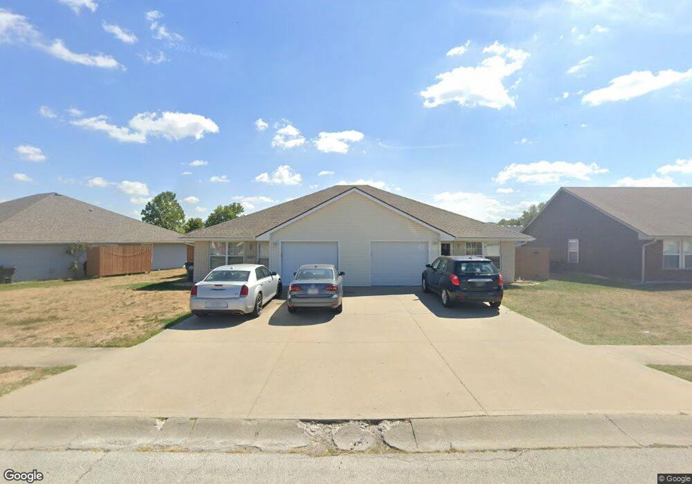
1001 SW Sandy Ln Grain Valley, MO 64029
Estimated Value: $298,000 - $354,000
6
Beds
4
Baths
2,174
Sq Ft
$149/Sq Ft
Est. Value
About This Home
This home is located at 1001 SW Sandy Ln, Grain Valley, MO 64029 and is currently estimated at $325,004, approximately $149 per square foot. 1001 SW Sandy Ln is a home with nearby schools including Grain Valley High School.
Ownership History
Date
Name
Owned For
Owner Type
Purchase Details
Closed on
Jan 2, 2013
Sold by
Calton Ila J
Bought by
C2 Grain Valley Llc
Current Estimated Value
Purchase Details
Closed on
Sep 30, 2005
Sold by
Leblanc Hubert O and Leblanc Mary P
Bought by
Calton Ila J and Ila J Calton Trust
Home Financials for this Owner
Home Financials are based on the most recent Mortgage that was taken out on this home.
Original Mortgage
$120,000
Interest Rate
5.76%
Mortgage Type
Fannie Mae Freddie Mac
Purchase Details
Closed on
Oct 26, 2000
Sold by
David L Arnold Construction Inc
Bought by
Leblanc Hubert O and Leblanc Mary P
Home Financials for this Owner
Home Financials are based on the most recent Mortgage that was taken out on this home.
Original Mortgage
$101,250
Interest Rate
7.89%
Mortgage Type
Purchase Money Mortgage
Create a Home Valuation Report for This Property
The Home Valuation Report is an in-depth analysis detailing your home's value as well as a comparison with similar homes in the area
Home Values in the Area
Average Home Value in this Area
Purchase History
| Date | Buyer | Sale Price | Title Company |
|---|---|---|---|
| C2 Grain Valley Llc | -- | None Available | |
| Calton Ila J | -- | Stewart Title Of Kansas City | |
| Leblanc Hubert O | -- | Security Land Title Co |
Source: Public Records
Mortgage History
| Date | Status | Borrower | Loan Amount |
|---|---|---|---|
| Previous Owner | Calton Ila J | $120,000 | |
| Previous Owner | Leblanc Hubert O | $101,250 |
Source: Public Records
Tax History Compared to Growth
Tax History
| Year | Tax Paid | Tax Assessment Tax Assessment Total Assessment is a certain percentage of the fair market value that is determined by local assessors to be the total taxable value of land and additions on the property. | Land | Improvement |
|---|---|---|---|---|
| 2025 | $3,837 | $47,742 | $7,040 | $40,702 |
| 2024 | $3,693 | $46,579 | $6,815 | $39,764 |
| 2023 | $3,693 | $46,579 | $5,647 | $40,932 |
| 2022 | $3,273 | $36,100 | $4,019 | $32,081 |
| 2021 | $3,196 | $36,100 | $4,019 | $32,081 |
| 2020 | $2,846 | $31,708 | $4,019 | $27,689 |
| 2019 | $2,788 | $31,708 | $4,019 | $27,689 |
| 2018 | $2,597 | $27,596 | $3,498 | $24,098 |
| 2017 | $2,530 | $27,596 | $3,498 | $24,098 |
| 2016 | $2,530 | $26,904 | $4,104 | $22,800 |
| 2014 | $2,262 | $23,921 | $4,276 | $19,645 |
Source: Public Records
Map
Nearby Homes
- 1024 Christie Ln
- 209 SW Cross Creek Dr
- 200 Cross Creek Ln
- 207 Pebblebrook St
- 725 SW Tisha Ln
- 636 SW Lakeview Dr
- 640 SW Crestview Dr
- 714 SW Brome Dr
- 509 SW Joseph Ct
- 506 SW Meadowood Dr
- 1215 SW Lone Star Ct
- 1418 SW Blue Branch Dr
- 1214 SW Windcrest Ct
- 621 SW Tisha Ln
- 401 S Minter Rd
- 1219 SW Windcrest Ct
- 518 South St
- 913 SW Abar Dr
- 512 Broadway St
- 1309 SW Graystone Cir
- 0 Sandy Ln
- 1005 SW Sandy Ln
- 995 SW Sandy Ln
- 30612 Duncan Rd
- 1009 SW Sandy Ln
- 1002 SW Sandy Ln
- 931 SW Sandy Ln
- 1006 Sandy Ln
- 416 SW Graystone Dr
- 1010 SW Sandy Ln
- 316 Lois Ln
- 418 SW Graystone Dr
- 927 SW Sandy Ln
- 414 SW Graystone Dr
- 412 SW Graystone Dr
- 1013 SW Sandy Ln
- 420 SW Graystone Dr
- 930 SW Sandy Ln
- 1014 SW Sandy Ln
- 312 Lois Ln