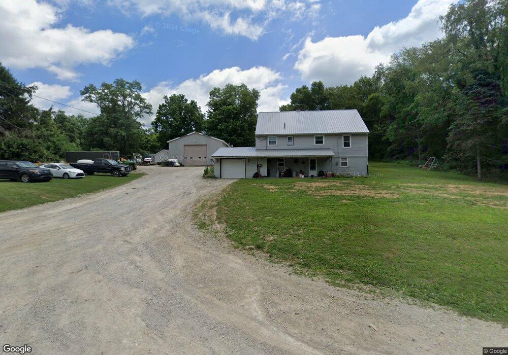
1001 Twp Rd 133 West Salem, OH 44287
Estimated Value: $135,781 - $328,000
2
Beds
1
Bath
1,456
Sq Ft
$157/Sq Ft
Est. Value
About This Home
This home is located at 1001 Twp Rd 133, West Salem, OH 44287 and is currently estimated at $228,195, approximately $156 per square foot. 1001 Twp Rd 133 is a home located in Ashland County with nearby schools including Northwestern Elementary School and Northwestern Middle School.
Ownership History
Date
Name
Owned For
Owner Type
Purchase Details
Closed on
Aug 3, 2020
Bought by
Smole Jesse
Current Estimated Value
Purchase Details
Closed on
Oct 27, 2009
Bought by
Sustersic John P and Sustersic Kathy J
Purchase Details
Closed on
Apr 2, 2009
Purchase Details
Closed on
Oct 23, 2008
Sold by
Traylinek Timothy M and Mattie Autumn N
Purchase Details
Closed on
Oct 30, 2002
Sold by
Fugate Dan R
Bought by
Traylinek Timothy M
Purchase Details
Closed on
Feb 14, 1994
Bought by
Fugate Dan R
Create a Home Valuation Report for This Property
The Home Valuation Report is an in-depth analysis detailing your home's value as well as a comparison with similar homes in the area
Home Values in the Area
Average Home Value in this Area
Purchase History
| Date | Buyer | Sale Price | Title Company |
|---|---|---|---|
| Smole Jesse | -- | -- | |
| Sustersic John P | -- | -- | |
| -- | -- | -- | |
| -- | $55,300 | -- | |
| Traylinek Timothy M | $89,000 | -- | |
| Fugate Dan R | $50,000 | -- |
Source: Public Records
Tax History Compared to Growth
Tax History
| Year | Tax Paid | Tax Assessment Tax Assessment Total Assessment is a certain percentage of the fair market value that is determined by local assessors to be the total taxable value of land and additions on the property. | Land | Improvement |
|---|---|---|---|---|
| 2024 | $1,310 | $36,000 | $6,760 | $29,240 |
| 2023 | $1,247 | $36,000 | $6,760 | $29,240 |
| 2022 | $1,172 | $29,990 | $5,630 | $24,360 |
| 2021 | $1,184 | $29,890 | $5,530 | $24,360 |
| 2020 | $1,123 | $29,990 | $5,630 | $24,360 |
| 2019 | $1,124 | $28,080 | $5,500 | $22,580 |
| 2018 | $1,090 | $28,080 | $5,500 | $22,580 |
| 2017 | $1,090 | $28,080 | $5,500 | $22,580 |
| 2016 | $977 | $25,510 | $4,990 | $20,520 |
| 2015 | $973 | $25,510 | $4,990 | $20,520 |
| 2013 | $1,122 | $28,250 | $4,980 | $23,270 |
Source: Public Records
Map
Nearby Homes
- 999 Township Road 133
- 568 County Road 175
- 164 State Route 302
- 1137 County Road 175
- 58 State Route 42
- 174 County Road 700
- 10212 Lattasburg Rd
- 203 County Road 1302
- 17 Andrew Ct
- 413 N Main St
- 156 U S 250
- 486 Township Road 1275
- 87 County Road 620
- 195 County Road 620
- 0 Township Road 1275
- 566 County Road 175
- 80 S Lincoln St
- 1346 Ohio 89
- 1129 Cinnamon Dr S
- 9657 W Smithville Western Rd
- 1001 Twp 133
- 1001 Township Road 133
- 1005 Township Road 133
- 1011 Township Road 133
- 1011 Twp Rd 133
- 988 Township Road 133
- 1004 Township Road 133
- 0 Twp Road 133 Unit 3706309
- 0 Twp Road 133 Unit 3935563
- 984 Township Road 133
- 1019 Township Road 133
- 1019 Twp Rd 133
- 1016 Township Road 133
- 149 Ohio 604
- 174 State Route 604
- 152 State Route 604
- 160 State Route 604
- 158 State Route 604
- 150 State Route 604
- 1021 Township Road 133