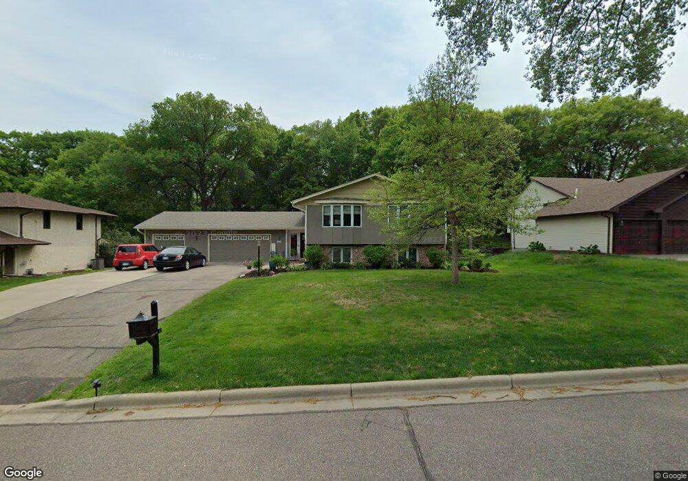
1001 W 155th St Burnsville, MN 55306
Estimated Value: $461,402 - $502,000
4
Beds
3
Baths
1,414
Sq Ft
$336/Sq Ft
Est. Value
About This Home
This home is located at 1001 W 155th St, Burnsville, MN 55306 and is currently estimated at $475,101, approximately $335 per square foot. 1001 W 155th St is a home located in Dakota County with nearby schools including Impact Academy at Orchard Lake Elementary School, Kenwood Trail Middle School, and Lakeville South High School.
Ownership History
Date
Name
Owned For
Owner Type
Purchase Details
Closed on
Jul 23, 2020
Sold by
Gunderson Laura and Watson David R
Bought by
Schwab Ricky and Schwab Jennifer
Current Estimated Value
Home Financials for this Owner
Home Financials are based on the most recent Mortgage that was taken out on this home.
Original Mortgage
$353,780
Outstanding Balance
$314,291
Interest Rate
3.2%
Mortgage Type
New Conventional
Estimated Equity
$160,810
Purchase Details
Closed on
Aug 29, 1997
Sold by
Trask Randall and Trask Bernadatte
Bought by
Watson David
Create a Home Valuation Report for This Property
The Home Valuation Report is an in-depth analysis detailing your home's value as well as a comparison with similar homes in the area
Home Values in the Area
Average Home Value in this Area
Purchase History
| Date | Buyer | Sale Price | Title Company |
|---|---|---|---|
| Schwab Ricky | $372,400 | Edina Realty Title Inc | |
| Watson David | $157,000 | -- |
Source: Public Records
Mortgage History
| Date | Status | Borrower | Loan Amount |
|---|---|---|---|
| Open | Schwab Ricky | $353,780 |
Source: Public Records
Tax History Compared to Growth
Tax History
| Year | Tax Paid | Tax Assessment Tax Assessment Total Assessment is a certain percentage of the fair market value that is determined by local assessors to be the total taxable value of land and additions on the property. | Land | Improvement |
|---|---|---|---|---|
| 2024 | $5,362 | $435,400 | $100,700 | $334,700 |
| 2023 | $5,362 | $438,800 | $97,900 | $340,900 |
| 2022 | $4,622 | $408,600 | $97,700 | $310,900 |
| 2021 | $4,294 | $361,200 | $85,000 | $276,200 |
| 2020 | $4,816 | $334,800 | $80,900 | $253,900 |
| 2019 | $4,404 | $335,000 | $77,100 | $257,900 |
| 2018 | $4,122 | $314,700 | $73,400 | $241,300 |
| 2017 | $3,973 | $291,400 | $69,900 | $221,500 |
| 2016 | $3,605 | $272,300 | $66,600 | $205,700 |
| 2015 | $3,414 | $248,013 | $61,221 | $186,792 |
| 2014 | -- | $248,231 | $60,091 | $188,140 |
| 2013 | -- | $225,995 | $54,370 | $171,625 |
Source: Public Records
Map
Nearby Homes
- 15455 Fremont Ave S
- 1005 Hilloway Cir
- 15203 Greenhaven Way
- 594 Stonewood Ln
- 344 Stonewood Place
- 15017 Orchard Dr
- 900 Windemere Way
- 15003 Windemere Ln
- 15012 Willa Ct
- 1212 Hillside Ln
- 15080 Buck Hill Rd
- 15100 Eileen Cir
- 101 Oak Shore Dr
- 15250 Stevens Ave
- 16045 Oak Shore Dr
- 2204 Wildwood Ct
- 2300 Wildwood Ct
- 14900 Viewcrest Ln
- 14920 Sharon Ln
- 230 Maple Island Rd
- 1005 W 155th St
- 909 W 155th St
- 1004 Kaymar Ln
- 1009 W 155th St
- 905 W 155th St
- 1008 Kaymar Ln
- 1000 W 155th St
- 1000 155th St W
- 1000 Kaymar Ln
- 908 W 155th St
- 1004 W 155th St
- 908 Kaymar Ln
- 1012 Kaymar Ln
- 1016 Kaymar Ln
- 1008 W 155th St
- 901 W 155th St
- 901 155th St W
- 900 W 155th St
- 904 Kaymar Ln
- 1012 W 155th St