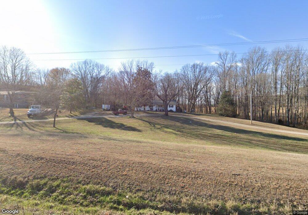
1001 W Point Rd Lawrenceburg, TN 38464
Estimated Value: $135,000 - $252,000
--
Bed
2
Baths
1,826
Sq Ft
$108/Sq Ft
Est. Value
About This Home
This home is located at 1001 W Point Rd, Lawrenceburg, TN 38464 and is currently estimated at $196,564, approximately $107 per square foot. 1001 W Point Rd is a home located in Lawrence County with nearby schools including David Crockett Elementary School, Ingram Sowell Elementary School, and Lawrenceburg Public Elementary School.
Ownership History
Date
Name
Owned For
Owner Type
Purchase Details
Closed on
May 19, 2023
Sold by
Flesher Kevin
Bought by
Mcdonald David and Mcdonald Jill
Current Estimated Value
Purchase Details
Closed on
Apr 7, 2006
Sold by
Mccarter Harvey L
Bought by
Larie Mccarter Harvey
Purchase Details
Closed on
Oct 25, 1969
Bought by
Mccarter Harvey L and Mccarter Martha
Create a Home Valuation Report for This Property
The Home Valuation Report is an in-depth analysis detailing your home's value as well as a comparison with similar homes in the area
Home Values in the Area
Average Home Value in this Area
Purchase History
| Date | Buyer | Sale Price | Title Company |
|---|---|---|---|
| Mcdonald David | $35,000 | None Listed On Document | |
| Larie Mccarter Harvey | $47,400 | -- | |
| Barry Gobble | $1,500 | -- | |
| Donald Bigham | $2,000 | -- | |
| Mccarter Harvey L | -- | -- |
Source: Public Records
Mortgage History
| Date | Status | Borrower | Loan Amount |
|---|---|---|---|
| Previous Owner | Mccarter Harvey L | $58,000 |
Source: Public Records
Tax History Compared to Growth
Tax History
| Year | Tax Paid | Tax Assessment Tax Assessment Total Assessment is a certain percentage of the fair market value that is determined by local assessors to be the total taxable value of land and additions on the property. | Land | Improvement |
|---|---|---|---|---|
| 2025 | $730 | $36,300 | $0 | $0 |
| 2024 | $730 | $36,300 | $8,750 | $27,550 |
| 2023 | $730 | $36,300 | $8,750 | $27,550 |
| 2022 | $730 | $36,300 | $8,750 | $27,550 |
| 2021 | $532 | $17,975 | $5,075 | $12,900 |
| 2020 | $532 | $17,975 | $5,075 | $12,900 |
| 2019 | $532 | $17,975 | $5,075 | $12,900 |
| 2018 | $532 | $17,975 | $5,075 | $12,900 |
| 2017 | $532 | $17,975 | $5,075 | $12,900 |
| 2016 | $532 | $17,975 | $5,075 | $12,900 |
| 2015 | $492 | $17,975 | $5,075 | $12,900 |
| 2014 | $489 | $17,850 | $5,075 | $12,775 |
Source: Public Records
Map
Nearby Homes
- 0 Hoyt Dr
- 47 Long Branch Rd
- 112 Oakdale Dr
- 0 Long Branch Rd
- 876 W Point Rd
- 528 W Point Rd
- 1610 Hilltop Dr
- 303 Shady Ln
- 1800 Grandaddy Rd
- 1814 Grandaddy Rd
- 307 Stribling Rd
- 1708 Deer Hollow Dr
- 309 Stella Ave
- 0 Devin St
- 307 Stella Ave
- 499 Pettus St
- 347 Waterloo Rd
- 15 Clifton Rd
- 415 Bumpas Rd
- 411 Bumpas Rd
- 1005 W Point Rd
- 1011 W Point Rd
- 19 Spring Creek Rd
- 1015 W Point Rd
- 996 W Point Rd
- 1019 W Point Rd
- 6 Spring Creek Rd
- 21 Spring Creek Rd
- 986 W Point Rd
- 1029 W Point Rd
- 5 Adams Rd
- 1035 W Point Rd
- 980 W Point Rd
- 36 Spring Creek Rd
- 1045 W Point Rd
- 1048 W Point Rd
- 69 Long Branch Rd
- 15 Long Branch Rd
- 131 Hoyt Dr
- 121 Hoyt Dr