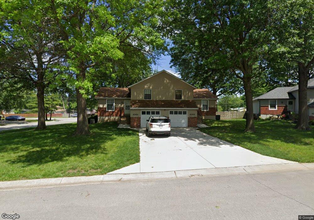
1001 W Sheridan St Olathe, KS 66061
Estimated Value: $281,000 - $332,109
4
Beds
4
Baths
1,776
Sq Ft
$175/Sq Ft
Est. Value
About This Home
This home is located at 1001 W Sheridan St, Olathe, KS 66061 and is currently estimated at $310,027, approximately $174 per square foot. 1001 W Sheridan St is a home located in Johnson County with nearby schools including Rolling Ridge Elementary School, Oregon Trail Middle School, and Olathe West High School.
Ownership History
Date
Name
Owned For
Owner Type
Purchase Details
Closed on
Oct 14, 2022
Sold by
Betzen Gregory A and Betzen Mary Barbara
Bought by
Whitsitt Ryan D and Whitsitt Hannah G
Current Estimated Value
Home Financials for this Owner
Home Financials are based on the most recent Mortgage that was taken out on this home.
Original Mortgage
$265,000
Outstanding Balance
$119,938
Interest Rate
5.89%
Mortgage Type
Seller Take Back
Estimated Equity
$190,089
Create a Home Valuation Report for This Property
The Home Valuation Report is an in-depth analysis detailing your home's value as well as a comparison with similar homes in the area
Home Values in the Area
Average Home Value in this Area
Purchase History
| Date | Buyer | Sale Price | Title Company |
|---|---|---|---|
| Whitsitt Ryan D | -- | Platinum Title |
Source: Public Records
Mortgage History
| Date | Status | Borrower | Loan Amount |
|---|---|---|---|
| Open | Whitsitt Ryan D | $265,000 |
Source: Public Records
Tax History Compared to Growth
Tax History
| Year | Tax Paid | Tax Assessment Tax Assessment Total Assessment is a certain percentage of the fair market value that is determined by local assessors to be the total taxable value of land and additions on the property. | Land | Improvement |
|---|---|---|---|---|
| 2024 | $2,972 | $27,002 | $5,873 | $21,129 |
| 2023 | $3,132 | $27,589 | $5,343 | $22,246 |
| 2022 | $2,955 | $25,323 | $4,647 | $20,676 |
| 2021 | $2,783 | $22,632 | $4,647 | $17,985 |
| 2020 | $2,648 | $21,356 | $4,229 | $17,127 |
| 2019 | $2,689 | $21,528 | $4,229 | $17,299 |
| 2018 | $2,550 | $20,286 | $4,229 | $16,057 |
| 2017 | $2,255 | $17,791 | $3,548 | $14,243 |
| 2016 | $2,005 | $16,261 | $3,229 | $13,032 |
| 2015 | $1,984 | $16,100 | $3,229 | $12,871 |
| 2013 | -- | $14,260 | $3,229 | $11,031 |
Source: Public Records
Map
Nearby Homes
- 1106 W Sheridan St
- 1200 W Sheridan St
- 812 S Troost St
- 617 S Grant St
- 531 S Oscar St
- 600 W Elm St
- 573 W Loula St
- 1604 W Cedar St
- 1545 W Park St
- 706 S Kansas Ave
- 507 W Park St
- 233 S Chambery Dr
- 1952 W Ferrel Dr
- 1425 W Poplar St
- 721 S Chestnut St
- 1947 W Oak St
- 990 S Cedar Hills St
- 109 E Cedar St
- 335 S Water St
- 1952 W Fredrickson Cir
- 1007 W Sheridan St
- 1002 W Sheridan St
- 1006 W Sheridan St
- 1011 W Sheridan St
- 1000 W Sheridan St
- 1008 W Sheridan St
- 1023 W Sheridan St
- 1013 W Sheridan St
- 1012 W Sheridan St
- 1012 W Sheridan St Unit 5
- 645 S Edgemere Dr
- 641 S Edgemere Dr
- 1014 W Sheridan St
- 1017 W Sheridan St
- 1018 W Sheridan St
- 637 S Edgemere Dr
- 1008 W Virginia Ln
- 1020 W Sheridan St
- 1010 W Virginia Ln
- 801 S Edgemere Dr