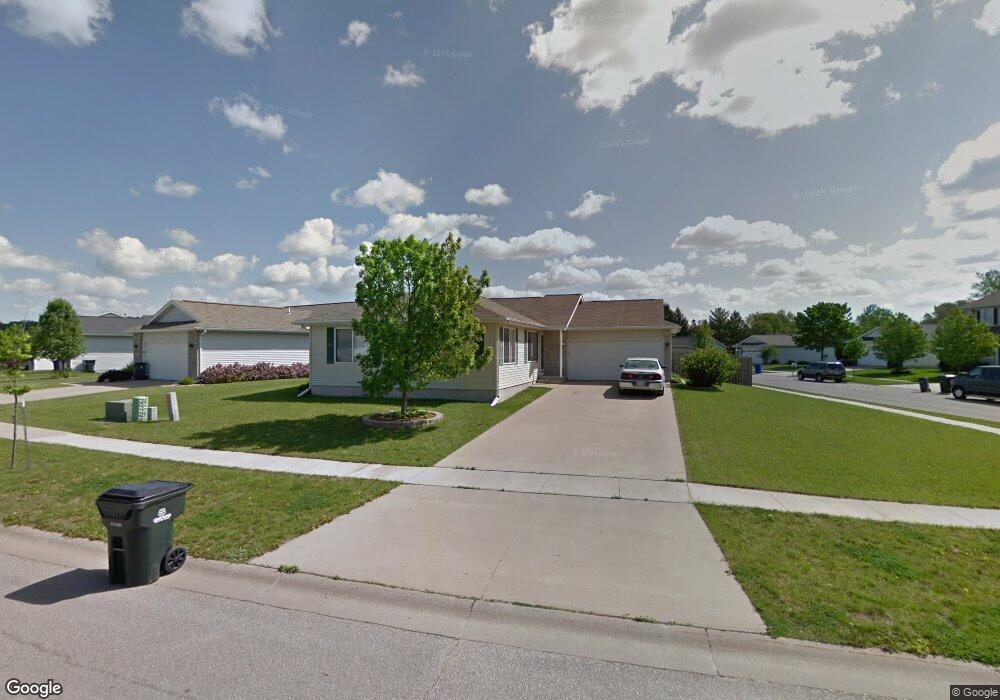
1001 Wolf Dr NW Cedar Rapids, IA 52405
Estimated Value: $284,000 - $335,000
4
Beds
3
Baths
2,375
Sq Ft
$131/Sq Ft
Est. Value
About This Home
This home is located at 1001 Wolf Dr NW, Cedar Rapids, IA 52405 and is currently estimated at $309,978, approximately $130 per square foot. 1001 Wolf Dr NW is a home located in Linn County with nearby schools including Maple Grove Elementary School, Taft Middle School, and John F. Kennedy High School.
Ownership History
Date
Name
Owned For
Owner Type
Purchase Details
Closed on
Oct 6, 2017
Sold by
Freeman Real Estate Lc
Bought by
Grimm Mackenzie R and Grimm Matthew
Current Estimated Value
Home Financials for this Owner
Home Financials are based on the most recent Mortgage that was taken out on this home.
Original Mortgage
$201,286
Outstanding Balance
$167,950
Interest Rate
3.78%
Mortgage Type
FHA
Estimated Equity
$142,028
Purchase Details
Closed on
May 14, 2014
Sold by
Federal Home Loan Mortgage Corporation
Bought by
Freeman Real Estate Lc
Home Financials for this Owner
Home Financials are based on the most recent Mortgage that was taken out on this home.
Original Mortgage
$203,500
Interest Rate
4.12%
Mortgage Type
Future Advance Clause Open End Mortgage
Purchase Details
Closed on
Oct 22, 2013
Sold by
Kimm William Terry and Kimm William
Bought by
Federal Home Loan Mortgage Corporation
Purchase Details
Closed on
Aug 18, 2006
Sold by
Stockdale Greg and Stockdale Alison M
Bought by
Kimm William Terry
Home Financials for this Owner
Home Financials are based on the most recent Mortgage that was taken out on this home.
Original Mortgage
$149,160
Interest Rate
7%
Mortgage Type
Unknown
Purchase Details
Closed on
Feb 15, 2005
Sold by
Stockdale Greg and Stockdale Alison M
Bought by
Stockdale Greg and Stockdale Alison M
Home Financials for this Owner
Home Financials are based on the most recent Mortgage that was taken out on this home.
Original Mortgage
$136,800
Interest Rate
4.87%
Mortgage Type
New Conventional
Purchase Details
Closed on
Jul 23, 2001
Sold by
Kacs Lc
Bought by
Stockdale Greg
Home Financials for this Owner
Home Financials are based on the most recent Mortgage that was taken out on this home.
Original Mortgage
$121,762
Interest Rate
10.75%
Purchase Details
Closed on
Aug 28, 2000
Sold by
Covington Lyle J and Covington James B
Bought by
Terry Family Trust
Create a Home Valuation Report for This Property
The Home Valuation Report is an in-depth analysis detailing your home's value as well as a comparison with similar homes in the area
Purchase History
| Date | Buyer | Sale Price | Title Company |
|---|---|---|---|
| Grimm Mackenzie R | -- | None Available | |
| Freeman Real Estate Lc | $163,500 | None Available | |
| Federal Home Loan Mortgage Corporation | $179,392 | None Available | |
| Kimm William Terry | $186,000 | All American Escrow & Title | |
| Stockdale Greg | -- | -- | |
| Stockdale Greg | $143,000 | -- | |
| Terry Family Trust | -- | -- |
Source: Public Records
Mortgage History
| Date | Status | Borrower | Loan Amount |
|---|---|---|---|
| Open | Grimm Mackenzie R | $201,286 | |
| Previous Owner | Freeman Real Estate Lc | $203,500 | |
| Previous Owner | Kimm William Terry | $149,160 | |
| Previous Owner | Stockdale Greg | $136,800 | |
| Previous Owner | Stockdale Greg | $121,762 | |
| Closed | Stockdale Greg | $14,325 |
Source: Public Records
Tax History
| Year | Tax Paid | Tax Assessment Tax Assessment Total Assessment is a certain percentage of the fair market value that is determined by local assessors to be the total taxable value of land and additions on the property. | Land | Improvement |
|---|---|---|---|---|
| 2025 | $4,446 | $275,600 | $58,600 | $217,000 |
| 2024 | $4,606 | $251,200 | $55,200 | $196,000 |
| 2023 | $4,606 | $251,200 | $55,200 | $196,000 |
| 2022 | $4,316 | $218,400 | $48,500 | $169,900 |
| 2021 | $4,448 | $208,300 | $41,800 | $166,500 |
| 2020 | $4,448 | $201,600 | $41,800 | $159,800 |
| 2019 | $3,942 | $182,900 | $33,500 | $149,400 |
Source: Public Records
Map
Nearby Homes
- 1211 Wolf Dr NW
- 4341 Beecher Ct NW
- 1608 Morris Ave NW
- 4524 E Ave NW
- 1722 Gardner Dr NW
- 602 Olive Dr NW
- 1209 39th Street Rd NW
- 408 Jacolyn Dr NW
- 410 Wiley Blvd NW
- 332 Bezdek Dr NW
- 3802 Richland Dr NW
- 448 Day St NW
- 281 Jacolyn Dr NW
- 332 Carter St NW
- 408 Day St NW
- 3407 H Ave NW
- 456 Mayberry Dr NW
- 3503 East Ave NW
- 236 Jacolyn Dr NW
- 3507 E Ave NW Unit F
- 1007 Wolf Dr NW
- 1012 Moose Dr NW
- 1013 Wolf Dr NW
- 908 Moose Dr NW
- 915 Moose Dr NW
- 921 Moose Dr NW
- 1018 Moose Dr NW
- 927 Moose Dr NW
- 1019 Wolf Dr NW
- 1008 Wolf Dr NW
- 902 Moose Dr NW
- 1016 Wolf Dr NW
- 907 Moose Dr NW
- 1024 Moose Dr NW
- 1025 Wolf Dr NW
- 1003 Moose Dr NW
- 1022 Wolf Dr NW
- 901 Moose Dr NW
- 822 Moose Dr NW
- 1009 Moose Dr NW
Your Personal Tour Guide
Ask me questions while you tour the home.