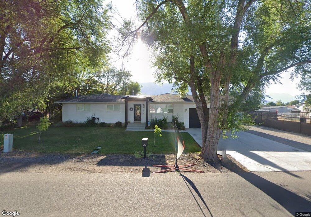
10010 N 6000 W Highland, UT 84003
Estimated Value: $756,000 - $938,387
5
Beds
3
Baths
2,598
Sq Ft
$331/Sq Ft
Est. Value
About This Home
This home is located at 10010 N 6000 W, Highland, UT 84003 and is currently estimated at $859,847, approximately $330 per square foot. 10010 N 6000 W is a home located in Utah County with nearby schools including Legacy Elementary School, Mountain Ridge Junior High School, and American Fork High School.
Ownership History
Date
Name
Owned For
Owner Type
Purchase Details
Closed on
Apr 23, 2020
Sold by
Macfarlane Fraser Gordon and Macfarlane Karen L
Bought by
Macfarlane Fraser G and Macfarlane Karen L
Current Estimated Value
Home Financials for this Owner
Home Financials are based on the most recent Mortgage that was taken out on this home.
Original Mortgage
$370,500
Outstanding Balance
$259,054
Interest Rate
3.6%
Mortgage Type
New Conventional
Estimated Equity
$600,793
Purchase Details
Closed on
Aug 30, 2019
Sold by
Macfarlane Fraser G and Macfarlane Karen L
Bought by
Macfarlane Fraser G and Macfarlane Karen L
Home Financials for this Owner
Home Financials are based on the most recent Mortgage that was taken out on this home.
Original Mortgage
$376,000
Interest Rate
3.7%
Mortgage Type
New Conventional
Purchase Details
Closed on
Oct 9, 2018
Sold by
Macfarlane Fraser Gordon and Macfarlane Karen L
Bought by
Macfarlane Fraser G and Macfarlane Karen L
Home Financials for this Owner
Home Financials are based on the most recent Mortgage that was taken out on this home.
Original Mortgage
$374,400
Interest Rate
4.5%
Mortgage Type
New Conventional
Purchase Details
Closed on
Sep 19, 2018
Sold by
Garner Gary M
Bought by
Macfarlane Fraser Gordon and Macfarlane Karen L
Home Financials for this Owner
Home Financials are based on the most recent Mortgage that was taken out on this home.
Original Mortgage
$374,400
Interest Rate
4.5%
Mortgage Type
New Conventional
Purchase Details
Closed on
May 21, 2018
Sold by
Griffith Robert B and Griffith Linda E
Bought by
Garner Gary M
Home Financials for this Owner
Home Financials are based on the most recent Mortgage that was taken out on this home.
Original Mortgage
$360,000
Interest Rate
4.4%
Mortgage Type
New Conventional
Purchase Details
Closed on
Apr 23, 2003
Sold by
Finch Laree Pehrson
Bought by
Finch Laree Pehrson and Finch Laree Pehrson
Purchase Details
Closed on
Jul 18, 2000
Sold by
Fry Grant R and Fry Loretta E
Bought by
Griffith Robert B and Griffith Linda E
Home Financials for this Owner
Home Financials are based on the most recent Mortgage that was taken out on this home.
Original Mortgage
$144,000
Interest Rate
8.37%
Create a Home Valuation Report for This Property
The Home Valuation Report is an in-depth analysis detailing your home's value as well as a comparison with similar homes in the area
Home Values in the Area
Average Home Value in this Area
Purchase History
| Date | Buyer | Sale Price | Title Company |
|---|---|---|---|
| Macfarlane Fraser G | -- | Sutherland Title Company | |
| Macfarlane Fraser Gordon | -- | Sutherland Title Company | |
| Macfarlane Fraser G | -- | First American Title Ins Co | |
| Macfarlane Fraser G | -- | First American | |
| Macfarlane Fraser G | -- | Accommodation | |
| Macfarlane Fraser Gordon | -- | First American Title | |
| Garner Gary M | -- | First American Title | |
| Finch Laree Pehrson | -- | Affiliated First Title | |
| Griffith Robert B | -- | Title West Title Co |
Source: Public Records
Mortgage History
| Date | Status | Borrower | Loan Amount |
|---|---|---|---|
| Open | Macfarlane Fraser Gordon | $370,500 | |
| Closed | Macfarlane Fraser G | $376,000 | |
| Closed | Macfarlane Fraser Gordon | $374,400 | |
| Previous Owner | Garner Gary M | $360,000 | |
| Previous Owner | Griffith Robert B | $144,000 |
Source: Public Records
Tax History Compared to Growth
Tax History
| Year | Tax Paid | Tax Assessment Tax Assessment Total Assessment is a certain percentage of the fair market value that is determined by local assessors to be the total taxable value of land and additions on the property. | Land | Improvement |
|---|---|---|---|---|
| 2025 | $3,280 | $426,580 | $415,800 | $359,800 |
| 2024 | $3,280 | $405,130 | $0 | $0 |
| 2023 | $3,015 | $401,665 | $0 | $0 |
| 2022 | $3,019 | $390,005 | $0 | $0 |
| 2021 | $2,572 | $495,000 | $235,800 | $259,200 |
| 2020 | $2,407 | $454,200 | $205,000 | $249,200 |
| 2019 | $1,897 | $374,500 | $205,000 | $169,500 |
| 2018 | $1,883 | $353,300 | $200,000 | $153,300 |
| 2017 | $1,830 | $183,315 | $0 | $0 |
| 2016 | $1,609 | $150,645 | $0 | $0 |
| 2015 | $1,524 | $135,190 | $0 | $0 |
| 2014 | $1,525 | $134,090 | $0 | $0 |
Source: Public Records
Map
Nearby Homes
- 5973 W 9960 N
- 9780 N 6000 W
- 6190 W 10050 N
- 11337 N 5950 W Unit 7
- 10197 N 5750 W
- 9947 N Yorkshire Ct
- 703 S 850 W
- 5586 W 10130 N
- 6399 W 10150 N
- 35 W 1350 N
- 6372 W 10400 N
- 1438 N 400 W
- 10434 N 6400 W
- 287 W 1360 N
- 6373 W 10500 N
- 179 W 1290 N
- 9924 N 6630 W Unit 9
- 5423 W Pebble Ln
- 5378 W 10130 N
- 356 W 1300 N
- 10024 N 6000 W
- 10006 N 6000 W
- 6012 W Thornton Ln Unit 11
- 6012 W Thornton Ln
- 10005 N 6000 W
- 6012 Thornton Ln
- 6005 W 10050 N
- 10058 N 6000 W
- 5972 W 9960 N
- 6022 W Thornton Ln
- 6022 Thornton Ln
- 6012 W 10050 N
- 6022 W 9960 N
- 6032 W 9960 N
- 6031 W 10050 N
- 5952 W 9960 N
- 6032 Thornton Ln
- 5973 W 9960 N Unit 8
- 10045 N 5920 W
- 6038 W 10050 N