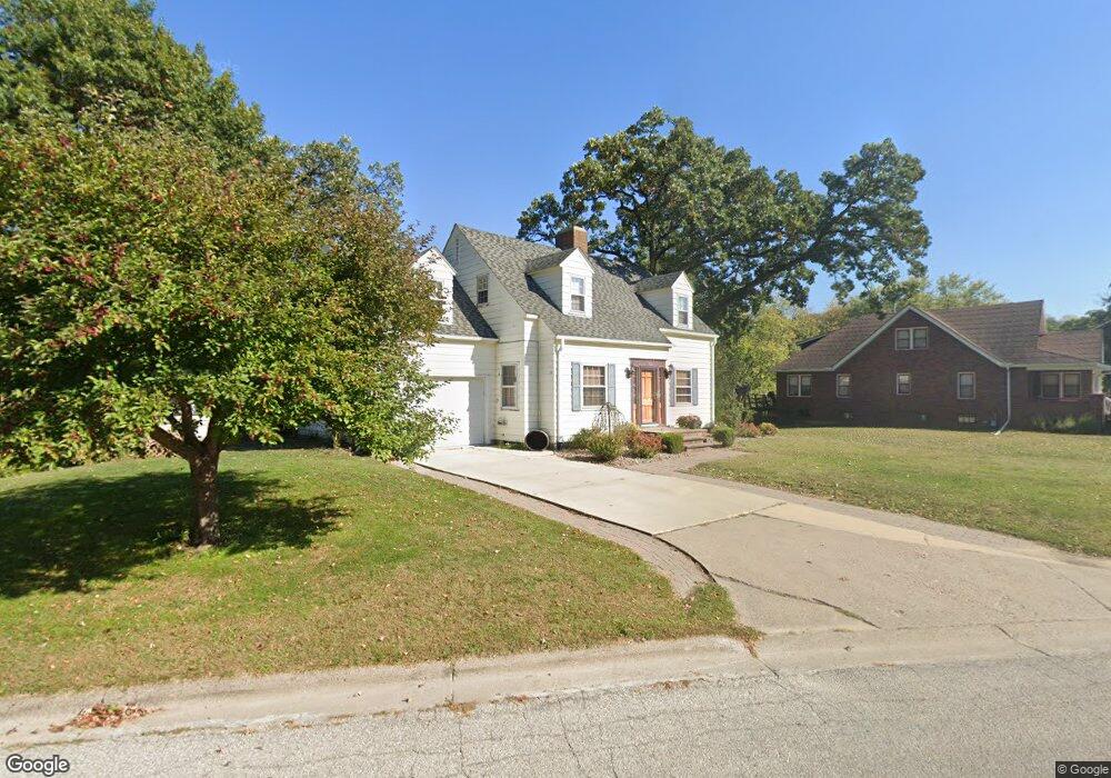
1002 1st St NW Elkader, IA 52043
Estimated Value: $173,000 - $220,000
4
Beds
2
Baths
1,578
Sq Ft
$122/Sq Ft
Est. Value
About This Home
This home is located at 1002 1st St NW, Elkader, IA 52043 and is currently estimated at $192,188, approximately $121 per square foot. 1002 1st St NW is a home located in Clayton County with nearby schools including Central Elementary School and Central Middle School/High School.
Ownership History
Date
Name
Owned For
Owner Type
Purchase Details
Closed on
Jun 11, 2024
Sold by
Troester Mark M and Troester Rondee L
Bought by
Medberry Dawn M
Current Estimated Value
Purchase Details
Closed on
Nov 27, 2013
Sold by
Kleaveland Jay C
Bought by
Troester Mark M and Troester Rondee L
Home Financials for this Owner
Home Financials are based on the most recent Mortgage that was taken out on this home.
Original Mortgage
$119,100
Interest Rate
4.3%
Mortgage Type
Future Advance Clause Open End Mortgage
Create a Home Valuation Report for This Property
The Home Valuation Report is an in-depth analysis detailing your home's value as well as a comparison with similar homes in the area
Home Values in the Area
Average Home Value in this Area
Purchase History
| Date | Buyer | Sale Price | Title Company |
|---|---|---|---|
| Medberry Dawn M | $165,000 | None Listed On Document | |
| Troester Mark M | $139,500 | None Available |
Source: Public Records
Mortgage History
| Date | Status | Borrower | Loan Amount |
|---|---|---|---|
| Previous Owner | Troester Mark M | $119,100 |
Source: Public Records
Tax History Compared to Growth
Tax History
| Year | Tax Paid | Tax Assessment Tax Assessment Total Assessment is a certain percentage of the fair market value that is determined by local assessors to be the total taxable value of land and additions on the property. | Land | Improvement |
|---|---|---|---|---|
| 2025 | $3,578 | $164,934 | $41,441 | $123,493 |
| 2024 | $3,248 | $153,391 | $36,036 | $117,355 |
| 2023 | $3,074 | $153,391 | $36,036 | $117,355 |
| 2022 | $2,844 | $126,643 | $32,760 | $93,883 |
| 2021 | $2,548 | $126,643 | $32,760 | $93,883 |
| 2020 | $2,548 | $118,778 | $32,760 | $86,018 |
| 2019 | $2,368 | $118,778 | $32,760 | $86,018 |
| 2018 | $2,368 | $113,265 | $32,760 | $80,505 |
| 2017 | $2,328 | $113,265 | $32,760 | $80,505 |
| 2015 | $2,392 | $112,972 | $19,148 | $93,824 |
| 2014 | $2,104 | $112,972 | $19,148 | $93,824 |
Source: Public Records
Map
Nearby Homes
- 707 N Main St
- 702 N Main St
- 710 Woodland Dr NW
- 301 N 1st St
- 302 N 3rd St
- 117 S Main St
- 209 2nd St SW
- 0 E Bridge St
- 247 Franzen Ridge Rd
- 249 Franzen Ridge Rd
- 26642 Iowa 13
- 27766 Highway 13
- 0 13 Hwy Unit NBR20255145
- 14149 Iowa 56
- 27455 Harbor Rd
- TBD Country Rd
- 0 Grandview Rd
- 305 S Russell St
- TBD Birch Rd
- 100 Volga St
- 1002 1st St NW
- 1002 NW First St
- 1006 1st St NW
- 106 Hill St NW
- 1003 1st St NW
- 102 Hill St NW
- 1011 1st St NW
- 908 1st St NW
- 1008 1st St NW
- 1001 1st St NW
- 1009 1st St NW
- 1013 1st St NW
- 1012 N 1st St
- 1012 1st St NW
- 812 Carter St NW
- 907 N Main St
- 814 Carter St NW
- 906 1st St NW
- 810 Carter St NW
- 1015 N 1st St