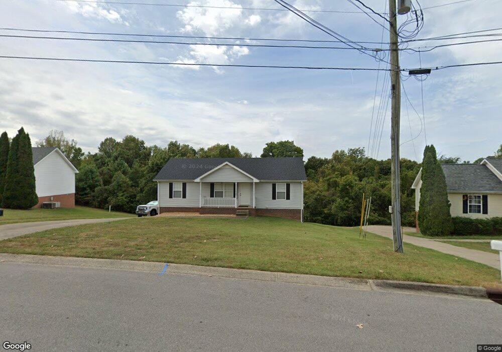
1002 Bobcat Dr Clarksville, TN 37042
Estimated Value: $226,000 - $244,000
--
Bed
2
Baths
1,080
Sq Ft
$217/Sq Ft
Est. Value
About This Home
This home is located at 1002 Bobcat Dr, Clarksville, TN 37042 and is currently estimated at $233,863, approximately $216 per square foot. 1002 Bobcat Dr is a home located in Montgomery County with nearby schools including West Creek Elementary School, Kenwood Middle School, and Kenwood High School.
Ownership History
Date
Name
Owned For
Owner Type
Purchase Details
Closed on
Aug 30, 2012
Sold by
Borris Jason S
Bought by
Perry Christopher S
Current Estimated Value
Home Financials for this Owner
Home Financials are based on the most recent Mortgage that was taken out on this home.
Original Mortgage
$95,510
Outstanding Balance
$66,120
Interest Rate
3.58%
Mortgage Type
VA
Estimated Equity
$167,743
Purchase Details
Closed on
Sep 12, 2005
Sold by
John Hadley
Bought by
Borris Jason S
Purchase Details
Closed on
Jun 23, 2004
Sold by
Young Joseph M
Bought by
John Hadley
Purchase Details
Closed on
May 28, 2004
Sold by
Young Joseph M
Bought by
John Hadley
Create a Home Valuation Report for This Property
The Home Valuation Report is an in-depth analysis detailing your home's value as well as a comparison with similar homes in the area
Home Values in the Area
Average Home Value in this Area
Purchase History
| Date | Buyer | Sale Price | Title Company |
|---|---|---|---|
| Perry Christopher S | $93,500 | -- | |
| Borris Jason S | $92,500 | -- | |
| John Hadley | $76,500 | -- | |
| John Hadley | $76,500 | -- |
Source: Public Records
Mortgage History
| Date | Status | Borrower | Loan Amount |
|---|---|---|---|
| Open | Perry Christopher S | $95,510 |
Source: Public Records
Tax History Compared to Growth
Tax History
| Year | Tax Paid | Tax Assessment Tax Assessment Total Assessment is a certain percentage of the fair market value that is determined by local assessors to be the total taxable value of land and additions on the property. | Land | Improvement |
|---|---|---|---|---|
| 2024 | $1,649 | $55,350 | $0 | $0 |
| 2023 | $1,649 | $31,100 | $0 | $0 |
| 2022 | $1,313 | $31,100 | $0 | $0 |
| 2021 | $1,313 | $31,100 | $0 | $0 |
| 2020 | $1,260 | $31,325 | $0 | $0 |
| 2019 | $1,260 | $31,325 | $0 | $0 |
| 2018 | $1,141 | $24,525 | $0 | $0 |
| 2017 | $328 | $26,475 | $0 | $0 |
| 2016 | $813 | $26,475 | $0 | $0 |
| 2015 | $1,116 | $26,475 | $0 | $0 |
| 2014 | $1,101 | $26,475 | $0 | $0 |
| 2013 | $1,110 | $25,325 | $0 | $0 |
Source: Public Records
Map
Nearby Homes
- 1030 Mile High Dr
- 1009 Fillmore Ct
- 1073 Bobcat Dr
- 1308 Sonja Dr
- 1419 Janet Way Dr
- 1354 Whitt Ln
- 657 Peachers Mill Rd
- 809 Amanda Dr
- 1496 Buchanon Dr
- 1145 Ishee Dr
- 1397 Shady Hill Ct
- 1478 McClardy Rd
- 472 Mirren Cir
- 722 Banister Dr
- 752 Crestone Ln
- 1412 McClardy Rd
- 1046 Dwight Eisenhower Way
- 744 Banister Dr
- 1202 Windchase Dr
- 714 Crestone Ln
- 1006 Bobcat Dr
- 998 Bobcat Dr
- 1009 Bobcat Dr
- 1005 Bobcat Dr
- 1010 Bobcat Dr
- 994 Bobcat Dr
- 1013 Bobcat Dr
- 0 Mile High Ct Unit 1828570
- 0 Mile High Ct Unit RTC2468155
- 0 Mile High Ct Unit 2280124
- 1022 Mile High Dr
- 1014 Bobcat Dr
- 990 Bobcat Dr
- 1033 E Monica Dr
- 1026 Mile High Dr
- 1031 E Monica Dr
- 1013 Mile High Dr
- 1017 Bobcat Dr
- 1035 E Monica Dr
- 1018 Bobcat Dr