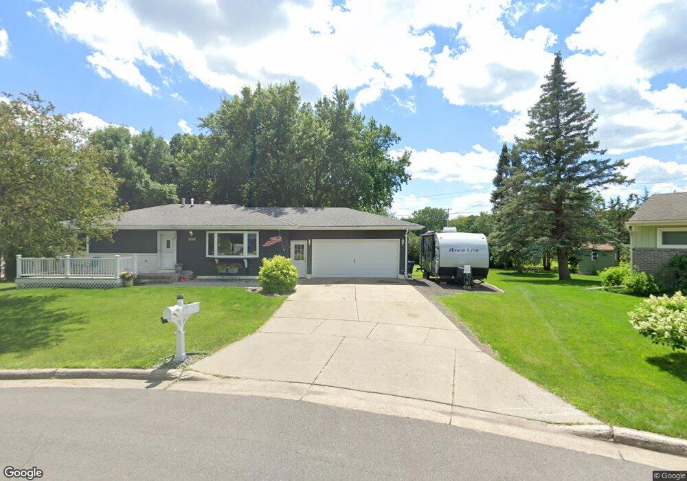
1002 Circle Ln Fergus Falls, MN 56537
Estimated Value: $256,000 - $301,000
4
Beds
2
Baths
2,080
Sq Ft
$130/Sq Ft
Est. Value
About This Home
This home is located at 1002 Circle Ln, Fergus Falls, MN 56537 and is currently estimated at $269,984, approximately $129 per square foot. 1002 Circle Ln is a home located in Otter Tail County with nearby schools including McKinley Elementary School, Cleveland Elementary School, and Adams Elementary School.
Ownership History
Date
Name
Owned For
Owner Type
Purchase Details
Closed on
Aug 12, 2020
Sold by
Thelen Leroy Leroy
Bought by
Lanoue Jamie Jamie
Current Estimated Value
Home Financials for this Owner
Home Financials are based on the most recent Mortgage that was taken out on this home.
Original Mortgage
$179,900
Outstanding Balance
$159,227
Interest Rate
2.88%
Estimated Equity
$110,757
Create a Home Valuation Report for This Property
The Home Valuation Report is an in-depth analysis detailing your home's value as well as a comparison with similar homes in the area
Home Values in the Area
Average Home Value in this Area
Purchase History
| Date | Buyer | Sale Price | Title Company |
|---|---|---|---|
| Lanoue Jamie Jamie | $179,900 | -- |
Source: Public Records
Mortgage History
| Date | Status | Borrower | Loan Amount |
|---|---|---|---|
| Open | Lanoue Jamie Jamie | $179,900 |
Source: Public Records
Tax History
| Year | Tax Paid | Tax Assessment Tax Assessment Total Assessment is a certain percentage of the fair market value that is determined by local assessors to be the total taxable value of land and additions on the property. | Land | Improvement |
|---|---|---|---|---|
| 2025 | $1,564 | $203,200 | $23,100 | $180,100 |
| 2024 | $1,744 | $151,700 | $23,100 | $128,600 |
| 2023 | $1,652 | $151,200 | $23,100 | $128,100 |
| 2022 | $1,564 | $165,200 | $0 | $0 |
| 2021 | $1,658 | $151,200 | $23,100 | $128,100 |
| 2020 | $1,602 | $139,400 | $21,200 | $118,200 |
| 2019 | $1,530 | $127,500 | $21,200 | $106,300 |
| 2018 | $1,322 | $127,500 | $21,200 | $106,300 |
| 2017 | $1,326 | $116,300 | $18,500 | $97,800 |
| 2016 | $1,240 | $111,600 | $18,500 | $93,100 |
| 2015 | $1,178 | $0 | $0 | $0 |
| 2014 | -- | $110,100 | $18,500 | $91,600 |
Source: Public Records
Map
Nearby Homes
- 702 E Beech Ave
- 1225 E Mount Faith Ave
- 1235 Mitchell Place
- 926 N Aurdal Ave
- 1110 Water Plant Rd
- 925 E Cavour Ave
- 402 E 14th St
- 1503 Opperman Bay Ct
- 1410 Ridgewood Dr
- 505 Northern Ave
- 732 Woodland Loop
- 815 E Vernon Ave
- 1420 Campus Dr
- 1430 Campus Dr
- 1418 Campus Dr
- 514 E Hampden Ave
- 2046 Northwood Ln
- 404 N Vine St
- 424 W Birch Ave
- 426 W Cherry Ave
- 1006 Circle Ln
- 1009 Circle Ln
- 1012 Circle Ln
- 1011 Circle Ln
- 1205 College St
- 1209 College St
- 1224 Somerset Rd
- 1005 Sunset Dr
- 1215 College St
- 1011 Sunset Dr
- 1216 Somerset Rd
- 919 Sunset Dr
- 1117 College St
- 903 Sunset Dr
- 1120 Somerset Rd
- 1120 Somerset Rd
- 1206 College St
- 1126 College St
- 1235 Somerset Rd
- 701 Sunset Dr
Your Personal Tour Guide
Ask me questions while you tour the home.