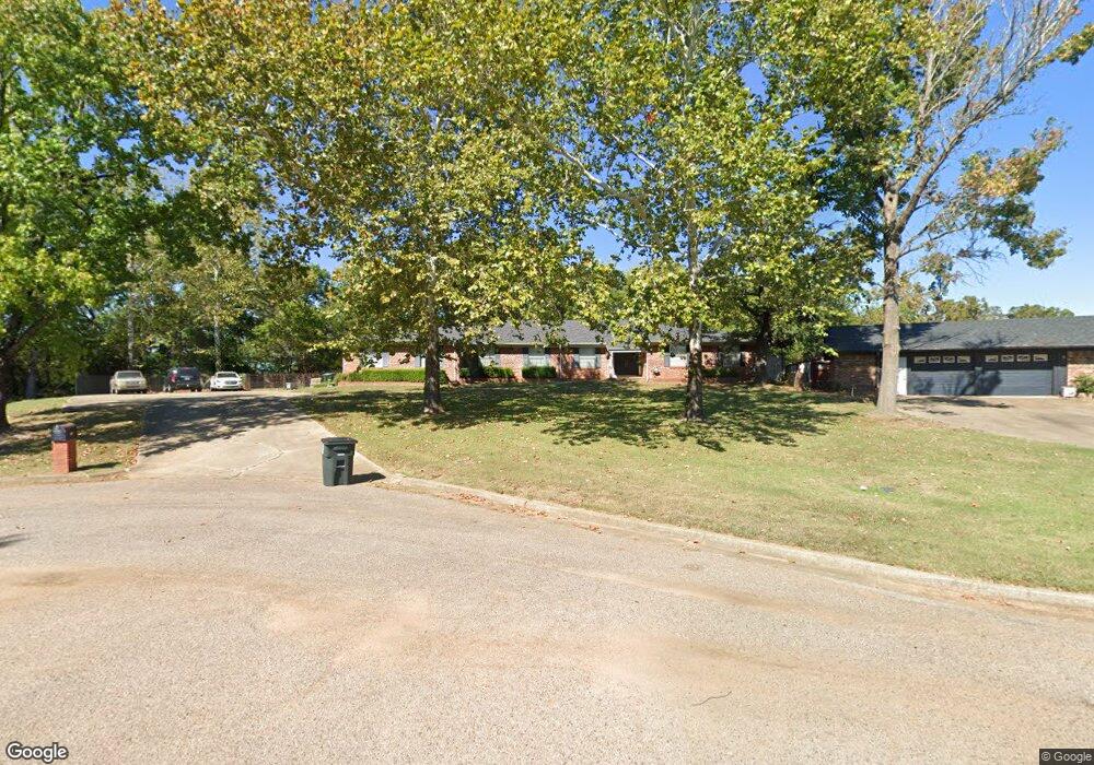
1002 Crooked Oak Place Durant, OK 74701
Estimated Value: $310,236 - $406,000
4
Beds
2
Baths
2,956
Sq Ft
$116/Sq Ft
Est. Value
About This Home
This home is located at 1002 Crooked Oak Place, Durant, OK 74701 and is currently estimated at $342,059, approximately $115 per square foot. 1002 Crooked Oak Place is a home located in Bryan County with nearby schools including Washington Irving Elementary School, Northwest Heights Elementary School, and Durant Intermediate Elementary School.
Ownership History
Date
Name
Owned For
Owner Type
Purchase Details
Closed on
Jun 23, 2022
Sold by
Mark Richard A
Bought by
Mark Julia
Current Estimated Value
Purchase Details
Closed on
Oct 26, 2019
Sold by
Mark Richard A and Mark Julia
Bought by
Mark Richard and Mark Julia
Home Financials for this Owner
Home Financials are based on the most recent Mortgage that was taken out on this home.
Original Mortgage
$202,000
Interest Rate
3.6%
Mortgage Type
New Conventional
Purchase Details
Closed on
Jul 24, 2004
Sold by
Mark Julia C
Bought by
Mark Richard A
Home Financials for this Owner
Home Financials are based on the most recent Mortgage that was taken out on this home.
Original Mortgage
$197,200
Interest Rate
6.4%
Mortgage Type
New Conventional
Purchase Details
Closed on
Jun 23, 1998
Sold by
Webster Larry and Webster Shirley
Bought by
Mark Richard and Mark Julia C
Create a Home Valuation Report for This Property
The Home Valuation Report is an in-depth analysis detailing your home's value as well as a comparison with similar homes in the area
Home Values in the Area
Average Home Value in this Area
Purchase History
| Date | Buyer | Sale Price | Title Company |
|---|---|---|---|
| Mark Julia | -- | -- | |
| Mark Richard | -- | Stewart Title Guaranty Co | |
| Mark Richard A | -- | Commonwealth Land Title | |
| Mark Richard | $178,000 | -- |
Source: Public Records
Mortgage History
| Date | Status | Borrower | Loan Amount |
|---|---|---|---|
| Previous Owner | Mark Richard | $202,000 | |
| Previous Owner | Mark Richard A | $197,200 |
Source: Public Records
Tax History Compared to Growth
Tax History
| Year | Tax Paid | Tax Assessment Tax Assessment Total Assessment is a certain percentage of the fair market value that is determined by local assessors to be the total taxable value of land and additions on the property. | Land | Improvement |
|---|---|---|---|---|
| 2025 | $2,233 | $24,076 | $2,270 | $21,806 |
| 2024 | $2,233 | $22,929 | $2,270 | $20,659 |
| 2023 | $2,233 | $21,837 | $2,270 | $19,567 |
| 2022 | $2,050 | $21,837 | $2,270 | $19,567 |
| 2021 | $2,100 | $21,837 | $2,270 | $19,567 |
| 2020 | $2,097 | $21,837 | $2,270 | $19,567 |
| 2019 | $1,993 | $21,976 | $2,270 | $19,706 |
| 2018 | $1,946 | $21,653 | $2,270 | $19,383 |
| 2017 | $1,871 | $20,952 | $2,270 | $18,682 |
| 2016 | $1,889 | $20,982 | $1,540 | $19,442 |
| 2015 | $1,882 | $20,981 | $1,980 | $19,001 |
| 2014 | $1,880 | $20,981 | $1,980 | $19,001 |
Source: Public Records
Map
Nearby Homes
- 927 Crooked Oak Dr
- 906 Briarwood Place
- 1107 Wilson St
- 988 Wilson St
- 921 Gail Farrell Dr
- 905 Brookside Dr
- 824 Wilson St
- 1019 Four Seasons Dr
- 1003 Four Seasons Dr
- 001 N Washington Ave
- 1110 Ada St
- 1715 Worley St
- 1832 Red Fox Rd
- 114 Wilson Loop
- 1521 N 10th Ave
- 0 Wilson St
- 00 Ed F Davis Rd
- 00031 Ed F Davis Rd
- 00030 Ed F Davis Rd
- 1512 N 10th Ave
- 917 Crooked Oak Dr
- 1005 Crooked Oak Place
- 921 Crooked Oak Dr
- 915 Crooked Oak Dr
- 1003 Crooked Oak Place
- 2408 N Washington Ave
- 923 Crooked Oak Dr
- 916 Crooked Oak Dr
- 920 Crooked Oak Dr
- 913 Crooked Oak Dr
- 914 Crooked Oak Dr
- 922 Crooked Oak Dr
- 2212 Dentwood Ct
- 2208 Dentwood Ct
- 909 Briarwood Place
- 911 Crooked Oak Dr
- 925 Crooked Oak Dr
- 910 Crooked Oak Dr
- 928 Crooked Oak Dr
- 908 Briarwood Place