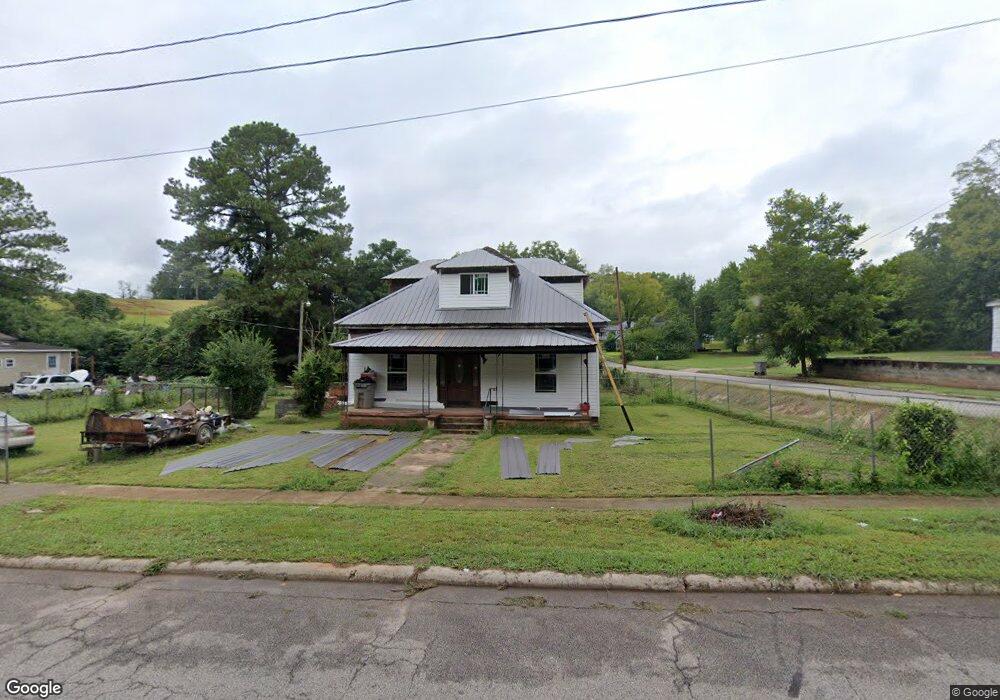
1002 Dunson St Lagrange, GA 30240
Estimated Value: $108,000 - $161,000
3
Beds
2
Baths
1,178
Sq Ft
$107/Sq Ft
Est. Value
About This Home
This home is located at 1002 Dunson St, Lagrange, GA 30240 and is currently estimated at $125,921, approximately $106 per square foot. 1002 Dunson St is a home located in Troup County with nearby schools including Berta Weathersbee Elementary School, Whitesville Road Elementary School, and Rosemont Elementary School.
Ownership History
Date
Name
Owned For
Owner Type
Purchase Details
Closed on
Aug 18, 2025
Sold by
Meriwether Edward
Bought by
Standards First Real Estate Llc and Standards 1St Real Estate Llc
Current Estimated Value
Purchase Details
Closed on
Apr 11, 2025
Sold by
Thrower Michael H
Bought by
Meriwether Edward
Purchase Details
Closed on
Apr 7, 2025
Sold by
Akery Terry
Bought by
Meriwether Edward
Purchase Details
Closed on
Mar 31, 2025
Sold by
Nelson Valanese
Bought by
Meriwether Edward
Purchase Details
Closed on
Mar 27, 2025
Sold by
Akery James
Bought by
Meriwether Edward
Purchase Details
Closed on
Mar 25, 2025
Sold by
Thrower Douglas Holden
Bought by
Meriwether Edward
Purchase Details
Closed on
Jul 7, 2020
Sold by
Meriwether Edward
Bought by
Nelson Valanese and Harris Antonio
Purchase Details
Closed on
Apr 7, 2018
Sold by
Shelton Oliver Leon
Bought by
Meriwether Edward
Purchase Details
Closed on
May 19, 1979
Sold by
Andrew H Reese
Bought by
Shelton Oliver L and Shelton Gladys E
Purchase Details
Closed on
May 18, 1979
Bought by
Andrew H Reese
Purchase Details
Closed on
Jan 1, 1952
Sold by
Callaway Comm Fdn
Create a Home Valuation Report for This Property
The Home Valuation Report is an in-depth analysis detailing your home's value as well as a comparison with similar homes in the area
Home Values in the Area
Average Home Value in this Area
Purchase History
| Date | Buyer | Sale Price | Title Company |
|---|---|---|---|
| Standards First Real Estate Llc | -- | -- | |
| Meriwether Edward | -- | -- | |
| Meriwether Edward | -- | -- | |
| Meriwether Edward | -- | -- | |
| Meriwether Edward | -- | -- | |
| Meriwether Edward | -- | -- | |
| Nelson Valanese | $16,000 | -- | |
| Meriwether Edward | $4,000 | -- | |
| Shelton Oliver L | $19,100 | -- | |
| Andrew H Reese | -- | -- | |
| -- | -- | -- |
Source: Public Records
Tax History Compared to Growth
Tax History
| Year | Tax Paid | Tax Assessment Tax Assessment Total Assessment is a certain percentage of the fair market value that is determined by local assessors to be the total taxable value of land and additions on the property. | Land | Improvement |
|---|---|---|---|---|
| 2024 | $526 | $19,280 | $2,240 | $17,040 |
| 2023 | $490 | $17,960 | $2,240 | $15,720 |
| 2022 | $471 | $16,880 | $2,240 | $14,640 |
| 2021 | $429 | $14,240 | $2,240 | $12,000 |
| 2020 | $429 | $14,240 | $2,240 | $12,000 |
| 2019 | $189 | $6,280 | $2,240 | $4,040 |
| 2018 | $14 | $2,460 | $2,240 | $220 |
| 2017 | $302 | $11,988 | $2,244 | $9,744 |
| 2016 | $294 | $11,720 | $2,244 | $9,476 |
| 2015 | $294 | $11,720 | $2,244 | $9,476 |
| 2014 | $281 | $11,268 | $2,244 | $9,024 |
| 2013 | -- | $11,268 | $2,244 | $9,024 |
Source: Public Records
Map
Nearby Homes
- 914 Todd St
- W W Crovat St
- 606 Poplar St
- 1301 Polk St
- 1300 Murphy Ave
- 1205 Park Ave
- 1311 Juniper St
- 1191 Whitesville St
- 101 Cedar St
- 501 Milam St
- 0 Bagley St
- 812 Elm St
- 900 B N Pkwy
- 109 Bell St
- 0 Boggs St Unit 10550243
- 0 Boggs St Unit 10550231
- 0 Boggs St Unit 10550239
- 0 Boggs St Unit 10550250
- 304 Butler St
- 206 Peachtree St
- 0 Dunson St Unit 8405157
- 0 Dunson St
- 1006 Dunson St
- 910 Dunson St
- 1008 Dunson St
- 908 Dunson St
- 1103 Truitt Ave
- 1009 Truitt Ave
- 1101 Truitt Ave
- 1010 Dunson St
- 1063 Polk Stree
- 906 Dunson St
- 1057 Polk St
- 1061 Polk St
- 1007 Truitt Ave
- 1012 Dunson St
- 1055 Polk St
- 1051 Polk St
- 1005 Truitt Ave
- 904 Dunson St