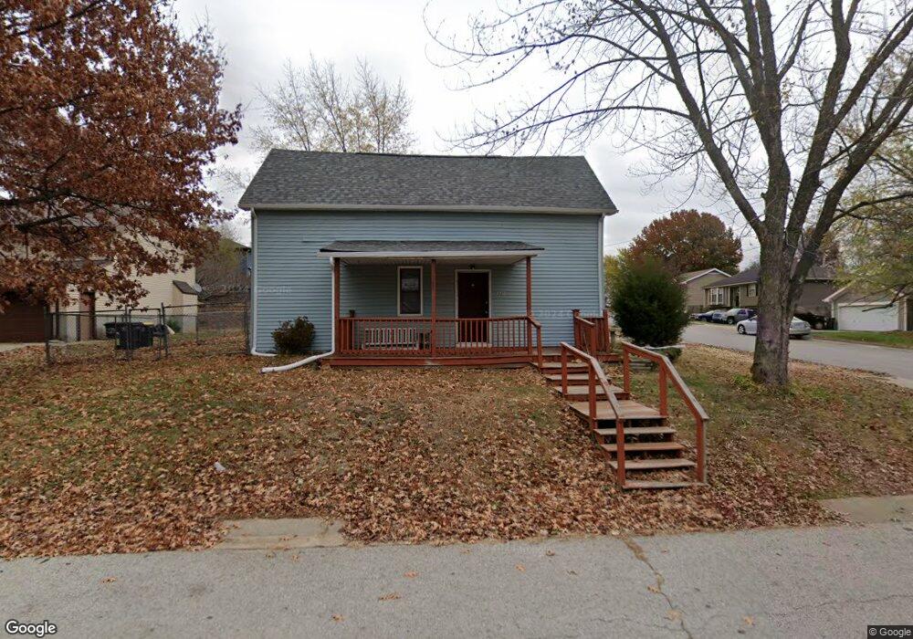
1002 N 3rd St Lansing, KS 66043
Estimated Value: $183,000 - $267,000
4
Beds
2
Baths
1,980
Sq Ft
$112/Sq Ft
Est. Value
About This Home
This home is located at 1002 N 3rd St, Lansing, KS 66043 and is currently estimated at $221,120, approximately $111 per square foot. 1002 N 3rd St is a home located in Leavenworth County with nearby schools including Lansing Elementary School, Lansing Middle 6-8, and Lansing High 9-12.
Ownership History
Date
Name
Owned For
Owner Type
Purchase Details
Closed on
Oct 1, 2003
Bought by
Litteral Elizabeth A
Current Estimated Value
Home Financials for this Owner
Home Financials are based on the most recent Mortgage that was taken out on this home.
Original Mortgage
$98,025
Outstanding Balance
$72,392
Interest Rate
5.98%
Mortgage Type
New Conventional
Estimated Equity
$148,728
Create a Home Valuation Report for This Property
The Home Valuation Report is an in-depth analysis detailing your home's value as well as a comparison with similar homes in the area
Home Values in the Area
Average Home Value in this Area
Purchase History
| Date | Buyer | Sale Price | Title Company |
|---|---|---|---|
| Litteral Elizabeth A | $93,650 | -- |
Source: Public Records
Mortgage History
| Date | Status | Borrower | Loan Amount |
|---|---|---|---|
| Open | Litteral Elizabeth A | $98,025 | |
| Closed | Litteral Elizabeth A | $103,000 |
Source: Public Records
Tax History
| Year | Tax Paid | Tax Assessment Tax Assessment Total Assessment is a certain percentage of the fair market value that is determined by local assessors to be the total taxable value of land and additions on the property. | Land | Improvement |
|---|---|---|---|---|
| 2025 | $2,404 | $19,255 | $4,804 | $14,451 |
| 2024 | $2,263 | $18,514 | $3,746 | $14,768 |
| 2023 | $2,263 | $17,802 | $3,746 | $14,056 |
| 2022 | $2,177 | $16,184 | $3,066 | $13,118 |
| 2021 | $2,058 | $14,456 | $3,066 | $11,390 |
| 2020 | $2,070 | $14,306 | $3,363 | $10,943 |
| 2019 | $1,986 | $13,719 | $3,363 | $10,356 |
| 2018 | $1,845 | $12,775 | $3,363 | $9,412 |
| 2017 | $1,794 | $12,402 | $3,363 | $9,039 |
| 2016 | $1,777 | $12,278 | $2,953 | $9,325 |
| 2015 | $1,771 | $12,278 | $2,953 | $9,325 |
| 2014 | $1,734 | $12,278 | $2,831 | $9,447 |
Source: Public Records
Map
Nearby Homes
- 1100 N 4th St
- 1102 N 4th St
- 134 Debra St
- 1102 N Main St
- 4 Eisenhower Rd
- 114 Emile St
- 1017 Pebble Beach Dr
- 1101 Pebble Beach Dr
- 00000 Brookwood St
- 530 Holiday Ct
- 20958 Ida St
- 950 Holiday Dr
- Lot 2 Eisenhower Rd
- 124 S Main St
- 202 S Main St
- 218 E Kay St
- 704 Highland Dr
- 728 Eisenhower Rd
- 215 E Mary St
- 541 Oregon St
Your Personal Tour Guide
Ask me questions while you tour the home.