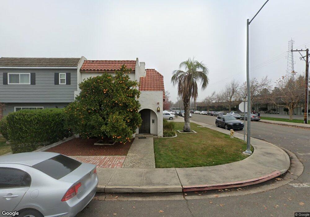
1002 N Palm St Turlock, CA 95380
Estimated Value: $263,000 - $347,000
2
Beds
1
Bath
1,426
Sq Ft
$203/Sq Ft
Est. Value
About This Home
This home is located at 1002 N Palm St, Turlock, CA 95380 and is currently estimated at $290,028, approximately $203 per square foot. 1002 N Palm St is a home located in Stanislaus County with nearby schools including Crowell Elementary School, Marvin A. Dutcher Middle School, and Turlock Junior High School.
Ownership History
Date
Name
Owned For
Owner Type
Purchase Details
Closed on
Jul 20, 2012
Sold by
Thomas Dale C
Bought by
Adams Alan C and Adams Elizabeth A
Current Estimated Value
Purchase Details
Closed on
Mar 25, 2005
Sold by
Todd Diane L
Bought by
Thomas Dale C and Thomas Robert Leland
Create a Home Valuation Report for This Property
The Home Valuation Report is an in-depth analysis detailing your home's value as well as a comparison with similar homes in the area
Home Values in the Area
Average Home Value in this Area
Purchase History
| Date | Buyer | Sale Price | Title Company |
|---|---|---|---|
| Adams Alan C | $82,500 | First American Title Company | |
| Thomas Dale C | -- | First American Title Company | |
| Thomas Dale C | $205,000 | Alliance Title Company |
Source: Public Records
Tax History Compared to Growth
Tax History
| Year | Tax Paid | Tax Assessment Tax Assessment Total Assessment is a certain percentage of the fair market value that is determined by local assessors to be the total taxable value of land and additions on the property. | Land | Improvement |
|---|---|---|---|---|
| 2025 | $1,093 | $101,582 | $30,779 | $70,803 |
| 2024 | $1,073 | $99,591 | $30,176 | $69,415 |
| 2023 | $1,071 | $97,639 | $29,585 | $68,054 |
| 2022 | $1,058 | $95,725 | $29,005 | $66,720 |
| 2021 | $1,043 | $93,849 | $28,437 | $65,412 |
| 2020 | $1,035 | $92,888 | $28,146 | $64,742 |
| 2019 | $1,018 | $91,068 | $27,595 | $63,473 |
| 2018 | $1,017 | $89,283 | $27,054 | $62,229 |
| 2017 | $994 | $87,533 | $26,524 | $61,009 |
| 2016 | $928 | $85,817 | $26,004 | $59,813 |
| 2015 | $919 | $84,529 | $25,614 | $58,915 |
| 2014 | $910 | $82,874 | $25,113 | $57,761 |
Source: Public Records
Map
Nearby Homes
- 133 E Syracuse Ave
- 1366 Geer Rd
- 333 N Palm St
- 326 Wolfe Ave
- 1032 Souza St
- 180 Almond Ave
- 401 Mitchell Ave
- 307 Almond Ave
- 311 Mitchell Ave
- 1036 N Olive Ave
- 309 N Center St
- 391 E Olive Ave
- 425 20th Century Blvd Unit A13
- 425 20th Century Blvd Unit D3
- 741 N Broadway
- 961 Wakefield Rd
- 100 Pedras Rd
- 1860 Loyola Way
- 951 E Main St
- 1311 Lyons Ave
- 1006 N Palm St
- 1010 N Palm St Unit 3
- 1014 N Palm St
- 1018 N Palm St
- 201 Starr Ave
- 205 Starr Ave
- 209 Starr Ave
- 213 Starr Ave
- 217 Starr Ave
- 1001 N Palm St
- 161 Starr Ave Unit D
- 161 Starr Ave
- 200 Bel Air Ct
- 230 Bel Air Ct
- 1092 N Palm St
- 250 Bel Air Ct
- 141 Starr Ave
- 170 Bel Air Ct
- 144 Starr Ave
- 270 Bel Air Ct