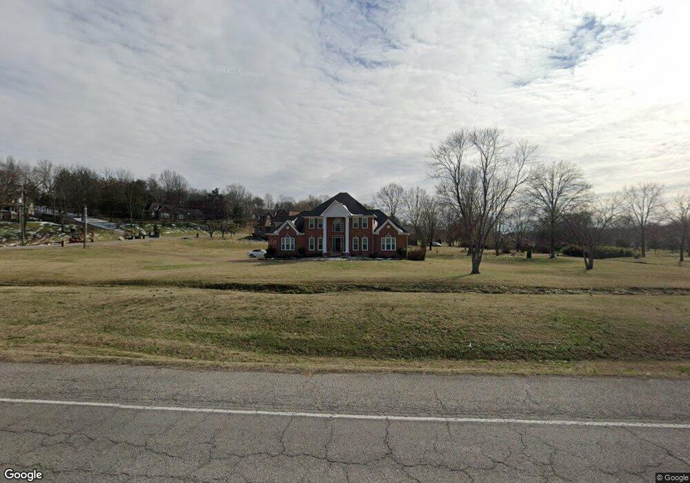
1002 Stirlingshire Dr Hendersonville, TN 37075
Estimated Value: $758,000 - $830,000
--
Bed
4
Baths
3,387
Sq Ft
$234/Sq Ft
Est. Value
About This Home
This home is located at 1002 Stirlingshire Dr, Hendersonville, TN 37075 and is currently estimated at $791,180, approximately $233 per square foot. 1002 Stirlingshire Dr is a home located in Sumner County with nearby schools including Beech Elementary School, T.W. Hunter Middle School, and Beech High School.
Ownership History
Date
Name
Owned For
Owner Type
Purchase Details
Closed on
Nov 15, 2022
Sold by
Wfc Durham Farm Owner Vii Llc
Bought by
Df Hendersonville Sfr Owner Llc
Current Estimated Value
Purchase Details
Closed on
Feb 18, 2005
Sold by
Brown Larry J and Brown Donna
Bought by
Fly Randall L and Fly Kristen C
Home Financials for this Owner
Home Financials are based on the most recent Mortgage that was taken out on this home.
Original Mortgage
$125,000
Interest Rate
5.69%
Mortgage Type
Purchase Money Mortgage
Create a Home Valuation Report for This Property
The Home Valuation Report is an in-depth analysis detailing your home's value as well as a comparison with similar homes in the area
Home Values in the Area
Average Home Value in this Area
Purchase History
| Date | Buyer | Sale Price | Title Company |
|---|---|---|---|
| Df Hendersonville Sfr Owner Llc | $3,734,864 | -- | |
| Fly Randall L | $254,500 | Amtitle & Escrow Llc |
Source: Public Records
Mortgage History
| Date | Status | Borrower | Loan Amount |
|---|---|---|---|
| Previous Owner | Fly Randall L | $125,000 |
Source: Public Records
Tax History Compared to Growth
Tax History
| Year | Tax Paid | Tax Assessment Tax Assessment Total Assessment is a certain percentage of the fair market value that is determined by local assessors to be the total taxable value of land and additions on the property. | Land | Improvement |
|---|---|---|---|---|
| 2024 | $2,563 | $180,400 | $47,875 | $132,525 |
| 2023 | $2,677 | $118,875 | $31,975 | $86,900 |
| 2022 | $2,689 | $118,875 | $31,975 | $86,900 |
| 2021 | $2,689 | $118,875 | $31,975 | $86,900 |
| 2020 | $2,689 | $118,875 | $31,975 | $86,900 |
| 2019 | $2,689 | $0 | $0 | $0 |
| 2018 | $2,343 | $0 | $0 | $0 |
| 2017 | $2,343 | $0 | $0 | $0 |
| 2016 | $2,343 | $0 | $0 | $0 |
| 2015 | -- | $0 | $0 | $0 |
| 2014 | -- | $0 | $0 | $0 |
Source: Public Records
Map
Nearby Homes
- 1002 W Stirling Ct
- 1111 Stirlingshire Dr
- 1003 Thistle Ct
- 1022 Tower Hill Ln
- 967 Luxborough Dr
- 1016 Luxborough Dr
- 210 the Hollows Ct
- 588 Gingerwood Ln
- 1063 Gadwall Cir
- 1032 Luxborough Dr
- 0 New Hope Rd Unit RTC3000799
- 0 New Hope Rd Unit RTC2582441
- 106B Timber Hills Rd
- 2712 Long Hollow Pike
- 420 Gingerwood Ln
- 1043 Dorset Dr
- 832 Westchester Cir
- Kingfisher Plan at Durham Farms
- Saybrook Plan at Durham Farms
- Shearwater Plan at Durham Farms
- 1006 Stirlingshire Dr
- 2927 Long Hollow Pike
- 1008 Stirlingshire Dr
- 1001 Stirlingshire Dr
- 2910 Long Hollow Pike
- 2931 Long Hollow Pike
- 1005 Stirlingshire Dr
- 1003 Stirlingshire Dr
- 1007 Stirlingshire Dr
- 1012 Stirlingshire Dr
- 1009 Stirlingshire Dr
- 2935 Long Hollow Pike
- 1011 Stirlingshire Dr
- 191 the Hollows Ct
- 1014 Stirlingshire Dr
- 2939 Long Hollow Pike
- 0 the Hollows Ct
- 1015 Stirlingshire Dr
- 193 the Hollows Ct
- 1004 W Stirling Ct