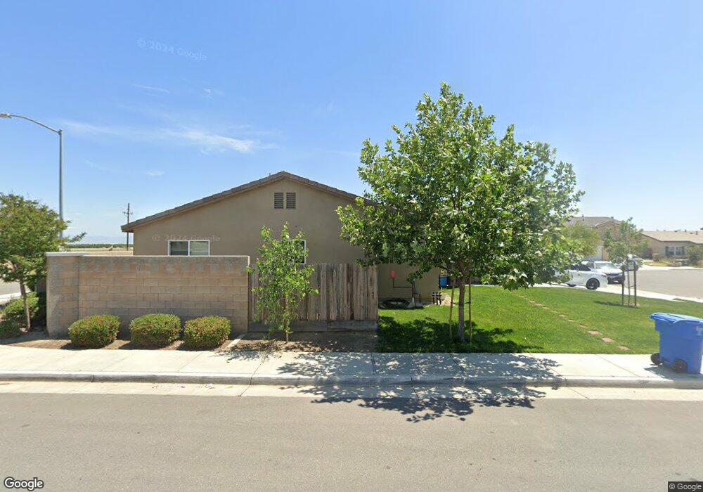
10024 Fire Island Dr Bakersfield, CA 93313
Panama NeighborhoodEstimated Value: $367,000 - $412,000
3
Beds
2
Baths
1,440
Sq Ft
$273/Sq Ft
Est. Value
About This Home
This home is located at 10024 Fire Island Dr, Bakersfield, CA 93313 and is currently estimated at $392,901, approximately $272 per square foot. 10024 Fire Island Dr is a home located in Kern County with nearby schools including Panama Elementary School, Stonecreek Junior High School, and Ridgeview High School.
Ownership History
Date
Name
Owned For
Owner Type
Purchase Details
Closed on
Aug 20, 2020
Sold by
Meraz Onesimo Rodriguez
Bought by
Meraz Onesimo Rodriguez and Godoy Andrea
Current Estimated Value
Home Financials for this Owner
Home Financials are based on the most recent Mortgage that was taken out on this home.
Original Mortgage
$222,250
Outstanding Balance
$177,700
Interest Rate
3%
Mortgage Type
New Conventional
Estimated Equity
$215,201
Purchase Details
Closed on
Jan 24, 2019
Sold by
Western Pacific Housing Inc
Bought by
Rodriguez Meraz Onesimo
Home Financials for this Owner
Home Financials are based on the most recent Mortgage that was taken out on this home.
Original Mortgage
$242,697
Interest Rate
4.4%
Mortgage Type
New Conventional
Create a Home Valuation Report for This Property
The Home Valuation Report is an in-depth analysis detailing your home's value as well as a comparison with similar homes in the area
Home Values in the Area
Average Home Value in this Area
Purchase History
| Date | Buyer | Sale Price | Title Company |
|---|---|---|---|
| Meraz Onesimo Rodriguez | $111,000 | Placer Title Company | |
| Rodriguez Meraz Onesimo | $255,500 | Fidelity National Title Co |
Source: Public Records
Mortgage History
| Date | Status | Borrower | Loan Amount |
|---|---|---|---|
| Open | Meraz Onesimo Rodriguez | $222,250 | |
| Previous Owner | Rodriguez Meraz Onesimo | $242,697 |
Source: Public Records
Tax History Compared to Growth
Tax History
| Year | Tax Paid | Tax Assessment Tax Assessment Total Assessment is a certain percentage of the fair market value that is determined by local assessors to be the total taxable value of land and additions on the property. | Land | Improvement |
|---|---|---|---|---|
| 2025 | $4,097 | $284,453 | $66,929 | $217,524 |
| 2024 | $4,026 | $278,876 | $65,617 | $213,259 |
| 2023 | $4,026 | $273,409 | $64,331 | $209,078 |
| 2022 | $3,863 | $268,049 | $63,070 | $204,979 |
| 2021 | $3,658 | $262,794 | $61,834 | $200,960 |
| 2020 | $3,604 | $260,100 | $61,200 | $198,900 |
| 2019 | $1,071 | $57,222 | $57,222 | $0 |
| 2018 | $737 | $55,000 | $55,000 | $0 |
Source: Public Records
Map
Nearby Homes
- 5831 Mardal Ave
- 5808 Esmerelda Ave
- 6021 Bogart Dr
- 6200 Whaleback Ave
- 6028 Bogart Dr
- 9402 Cobble Mountain Rd
- 9623 Kanosh Cobble Dr
- 9301 Cobble Mountain Rd
- 6230 Taft Hwy
- 6115 Cape Cod Ave
- 6201 Cape Cod Ave
- 5103 Green Clover Ave
- 6225 Thorton Ave
- 4620 Taft Hwy
- 6310 Thorton Ave
- 9003 Great Harvest Dr
- 6040 Samuelson St
- 5815 Pearl Ridge Dr
- 8505 Marble Ridge Way
- 5400 Saddleback Ridge Ct
- 10024 Fire Island Dr Unit Lot64
- 10004 Fire Island Dr Unit 1065
- 10004 Fire Island Dr
- 5717 Winnipeg Dr Unit Lot62
- 5717 Winnipeg Dr
- 5724 Winnipeg Dr Unit Lot39
- 5724 Winnipeg Dr
- 5721 Winnipeg Dr Unit Lot61
- 5721 Winnipeg Dr
- 5801 Commonwealth Ave Unit Lot38
- 5801 Commonwealth Ave
- 10000 Fire Island Dr
- 5728 Winnipeg Dr Unit Lot40
- 5728 Winnipeg Dr
- 5725 Winnipeg Dr Unit Lot60
- 5725 Winnipeg Dr
- 5805 Commonwealth Ave Unit Lot37
- 5805 Commonwealth Ave
- 9914 Fire Island Dr Unit Lot67
- 9914 Fire Island Dr