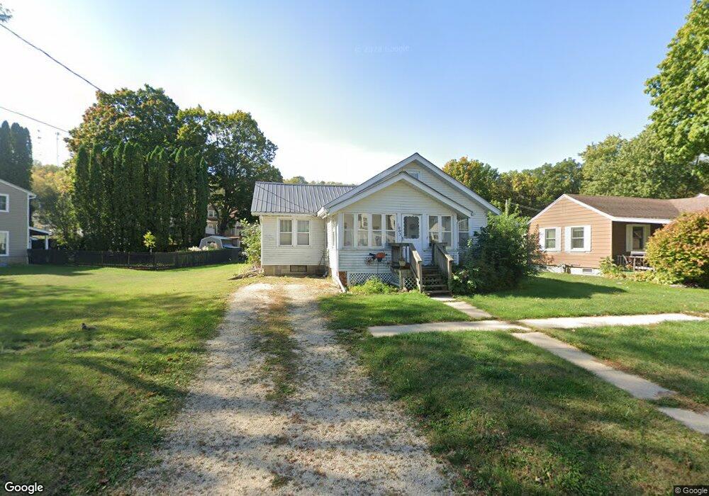
1003 1st St NW Elkader, IA 52043
Estimated Value: $104,000 - $137,000
2
Beds
1
Bath
900
Sq Ft
$135/Sq Ft
Est. Value
About This Home
This home is located at 1003 1st St NW, Elkader, IA 52043 and is currently estimated at $121,544, approximately $135 per square foot. 1003 1st St NW is a home located in Clayton County with nearby schools including Central Elementary School and Central Middle School/High School.
Ownership History
Date
Name
Owned For
Owner Type
Purchase Details
Closed on
Apr 13, 2011
Sold by
Federal National Mortgage Association
Bought by
Burns Jeramey R and Burns Dana M
Current Estimated Value
Purchase Details
Closed on
Jun 1, 2010
Sold by
Martin Guy H and Citifinancial Inc
Bought by
Federal National Mortgage Association
Create a Home Valuation Report for This Property
The Home Valuation Report is an in-depth analysis detailing your home's value as well as a comparison with similar homes in the area
Home Values in the Area
Average Home Value in this Area
Purchase History
| Date | Buyer | Sale Price | Title Company |
|---|---|---|---|
| Burns Jeramey R | $22,680 | None Available | |
| Federal National Mortgage Association | $54,832 | None Available |
Source: Public Records
Tax History Compared to Growth
Tax History
| Year | Tax Paid | Tax Assessment Tax Assessment Total Assessment is a certain percentage of the fair market value that is determined by local assessors to be the total taxable value of land and additions on the property. | Land | Improvement |
|---|---|---|---|---|
| 2025 | $1,980 | $94,088 | $13,248 | $80,840 |
| 2024 | $1,800 | $79,218 | $11,520 | $67,698 |
| 2023 | $1,324 | $79,218 | $11,520 | $67,698 |
| 2022 | $1,226 | $50,710 | $10,500 | $40,210 |
| 2021 | $1,148 | $50,710 | $10,500 | $40,210 |
| 2020 | $1,148 | $49,612 | $10,500 | $39,112 |
| 2019 | $1,082 | $49,612 | $10,500 | $39,112 |
| 2018 | $1,082 | $47,870 | $10,500 | $37,370 |
| 2017 | $1,118 | $47,870 | $10,500 | $37,370 |
| 2015 | $1,116 | $48,672 | $9,900 | $38,772 |
| 2014 | $1,050 | $48,672 | $9,900 | $38,772 |
Source: Public Records
Map
Nearby Homes
- 707 N Main St
- 710 Woodland Dr NW
- 702 N Main St
- 301 N 1st St
- 302 N 3rd St
- 117 S Main St
- 209 2nd St SW
- 0 E Bridge St
- 247 Franzen Ridge Rd
- 249 Franzen Ridge Rd
- 26642 Iowa 13
- 27766 Highway 13
- 0 13 Hwy Unit NBR20255145
- 14149 Iowa 56
- 27455 Harbor Rd
- TBD Country Rd
- 0 Grandview Rd
- 305 S Russell St
- TBD Birch Rd
- 100 Volga St
- 1001 1st St NW
- 1011 1st St NW
- 812 Carter St NW
- 1009 1st St NW
- 810 Carter St NW
- 1002 1st St NW
- 1002 1st St NW
- 814 Carter St NW
- 1002 NW First St
- 808 Carter St NW
- 1006 1st St NW
- 106 Hill St NW
- 1013 1st St NW
- 908 1st St NW
- 806 Carter St NW
- 906 1st St NW
- 1008 1st St NW
- 816 Carter St NW
- 102 Hill St NW
- 1015 N 1st St