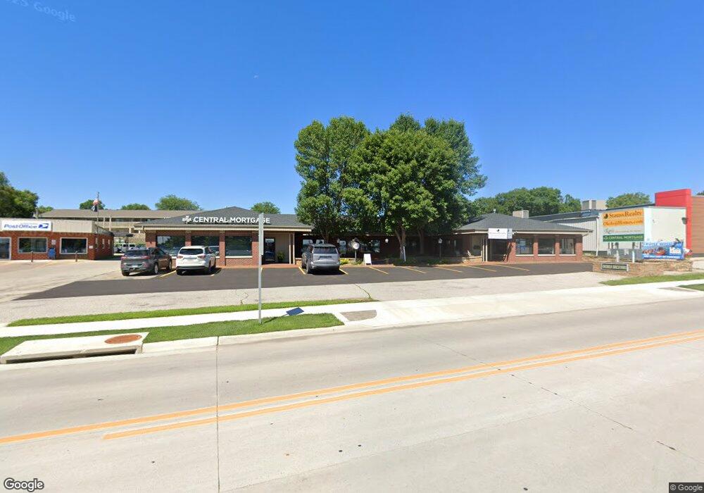
1003 Highway 71 S Okoboji, IA 51355
Estimated Value: $839,837
--
Bed
--
Bath
6,807
Sq Ft
$123/Sq Ft
Est. Value
About This Home
This home is located at 1003 Highway 71 S, Okoboji, IA 51355 and is currently estimated at $839,837, approximately $123 per square foot. 1003 Highway 71 S is a home located in Dickinson County with nearby schools including Okoboji Elementary School, Okoboji Middle School, and Okoboji High School.
Ownership History
Date
Name
Owned For
Owner Type
Purchase Details
Closed on
Dec 22, 2015
Sold by
Dewaay Okoboji Brickyard Llc
Bought by
Tropical Tours Llc
Current Estimated Value
Purchase Details
Closed on
May 8, 2009
Sold by
Denherder Carol A
Bought by
Dewaay Okoboji Brickyard L L C
Home Financials for this Owner
Home Financials are based on the most recent Mortgage that was taken out on this home.
Original Mortgage
$492,000
Interest Rate
4.85%
Mortgage Type
Credit Line Revolving
Purchase Details
Closed on
Dec 6, 2005
Sold by
Gfi Inc
Bought by
Denherder Carol A
Home Financials for this Owner
Home Financials are based on the most recent Mortgage that was taken out on this home.
Original Mortgage
$424,500
Interest Rate
6.2%
Mortgage Type
Future Advance Clause Open End Mortgage
Create a Home Valuation Report for This Property
The Home Valuation Report is an in-depth analysis detailing your home's value as well as a comparison with similar homes in the area
Home Values in the Area
Average Home Value in this Area
Purchase History
| Date | Buyer | Sale Price | Title Company |
|---|---|---|---|
| Tropical Tours Llc | -- | None Available | |
| Dewaay Okoboji Brickyard L L C | $465,000 | None Available | |
| Denherder Carol A | $425,000 | None Available |
Source: Public Records
Mortgage History
| Date | Status | Borrower | Loan Amount |
|---|---|---|---|
| Previous Owner | Dewaay Okoboji Brickyard L L C | $492,000 | |
| Previous Owner | Denherder Carol A | $424,500 |
Source: Public Records
Tax History Compared to Growth
Tax History
| Year | Tax Paid | Tax Assessment Tax Assessment Total Assessment is a certain percentage of the fair market value that is determined by local assessors to be the total taxable value of land and additions on the property. | Land | Improvement |
|---|---|---|---|---|
| 2025 | $7,676 | $537,800 | $128,800 | $409,000 |
| 2024 | $7,676 | $494,400 | $128,800 | $365,600 |
| 2023 | $6,338 | $494,400 | $128,800 | $365,600 |
| 2022 | $5,582 | $382,000 | $126,000 | $256,000 |
| 2021 | $5,582 | $382,000 | $126,000 | $256,000 |
| 2020 | $5,722 | $382,000 | $126,000 | $256,000 |
| 2019 | $5,214 | $382,000 | $126,000 | $256,000 |
| 2018 | $5,186 | $367,800 | $121,300 | $246,500 |
| 2017 | $5,186 | $367,800 | $121,300 | $246,500 |
| 2016 | $4,600 | $360,700 | $118,900 | $241,800 |
| 2015 | $6,202 | $360,700 | $118,900 | $241,800 |
| 2014 | $6,850 | $463,600 | $175,400 | $288,200 |
| 2013 | $7,868 | $463,600 | $175,400 | $288,200 |
Source: Public Records
Map
Nearby Homes
- 1103 Sanborn Ave Unit 4
- 1103 Sanborn Ave Unit 5
- 1103 Sanborn Ave Unit 3
- 1020 U S Highway 71 S Unit 10
- 1020 U S Highway 71 S Unit 2
- 1020 U S Highway 71 S Unit 6
- 1102 U S Highway 71 S
- 1201 Lake Shore Dr
- 1302 U S Highway 71 Unit 19
- 1302 U S Highway 71 Unit 1
- 1302 U S Highway 71 Unit 30
- 1302 U S Highway 71 Unit 2
- 1302 U S Highway 71 Unit 26
- 1302 U S Highway 71 Unit 9
- 1302 U S Highway 71 Unit 8
- 1302 U S Highway 71 Unit 31
- 1302 U S Highway 71 Unit 17
- 1302 U S Highway 71 Unit 5
- 1302 U S Highway 71 Unit 24
- 1302 U S Highway 71 Unit 13
- 1013 Highway 71 S
- 1009 Highway 71 S
- 1000 Sanborn Ave
- 1103 Sanborn Ave Unit 11
- 1103 Sanborn Ave Unit 10
- 1103 Sanborn Ave Unit 8
- 1103 Sanborn Ave Unit 7
- 1103 Sanborn Ave
- 1107 Sanborn Ave
- 1021 Highway 71 S
- 1021 U S Highway 71 S
- 1102 Depot Ave
- 1100 Depot Ave
- 1020 U S 71
- 1027 Highway 71 S
- 1020 Highway 71 S
- 1104 Depot Ave
- 1102 Sanborn Ave
- 1104 Sanborn Ave
- 1028 U S Highway 71 S