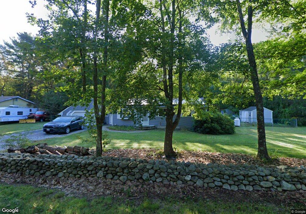
1003 N Brookfield Rd Oakham, MA 01068
Estimated Value: $346,000 - $362,180
3
Beds
1
Bath
1,008
Sq Ft
$348/Sq Ft
Est. Value
About This Home
This home is located at 1003 N Brookfield Rd, Oakham, MA 01068 and is currently estimated at $350,545, approximately $347 per square foot. 1003 N Brookfield Rd is a home located in Worcester County with nearby schools including Quabbin Regional Middle School and Quabbin Regional High School.
Ownership History
Date
Name
Owned For
Owner Type
Purchase Details
Closed on
Feb 1, 1991
Sold by
Kirk Eamonn J and Kirk Laura A
Bought by
Adams Christopher M and Adams Kathleen T
Current Estimated Value
Home Financials for this Owner
Home Financials are based on the most recent Mortgage that was taken out on this home.
Original Mortgage
$80,000
Interest Rate
9.52%
Mortgage Type
Purchase Money Mortgage
Create a Home Valuation Report for This Property
The Home Valuation Report is an in-depth analysis detailing your home's value as well as a comparison with similar homes in the area
Home Values in the Area
Average Home Value in this Area
Purchase History
| Date | Buyer | Sale Price | Title Company |
|---|---|---|---|
| Adams Christopher M | $107,000 | -- | |
| Adams Christopher M | $107,000 | -- |
Source: Public Records
Mortgage History
| Date | Status | Borrower | Loan Amount |
|---|---|---|---|
| Open | Adams Christopher M | $22,500 | |
| Closed | Adams Christopher M | $82,000 | |
| Closed | Adams Christopher M | $80,000 |
Source: Public Records
Tax History Compared to Growth
Tax History
| Year | Tax Paid | Tax Assessment Tax Assessment Total Assessment is a certain percentage of the fair market value that is determined by local assessors to be the total taxable value of land and additions on the property. | Land | Improvement |
|---|---|---|---|---|
| 2025 | $3,177 | $275,100 | $119,800 | $155,300 |
| 2024 | $2,993 | $270,100 | $117,400 | $152,700 |
| 2023 | $2,824 | $244,100 | $103,000 | $141,100 |
| 2022 | $2,809 | $220,800 | $89,600 | $131,200 |
| 2021 | $2,721 | $209,000 | $87,000 | $122,000 |
| 2020 | $2,615 | $193,000 | $84,100 | $108,900 |
| 2019 | $2,687 | $185,200 | $79,000 | $106,200 |
| 2018 | $2,557 | $168,200 | $68,700 | $99,500 |
| 2017 | $2,435 | $170,900 | $68,700 | $102,200 |
| 2016 | $2,339 | $168,300 | $66,100 | $102,200 |
| 2015 | $2,302 | $168,300 | $66,100 | $102,200 |
| 2014 | $2,181 | $168,300 | $66,100 | $102,200 |
Source: Public Records
Map
Nearby Homes
- 21 Spencer Rd
- 49 Oak Ln
- 38-3 Edson
- 103 Barre Rd
- 241 N Brookfield Rd
- 76 N Brookfield Rd
- 1109 New Braintree Rd
- 21 Wildbrook Dr
- 926 Old Turnpike Rd
- 252 Pleasantdale Rd
- 379 Adams Rd
- 238 Barre Paxton Rd Unit 238
- Lot 11 Pleasantdale Rd
- 64 Prospect St
- Lot 38 Edson Rd
- 38 Edson Rd
- 13 Washburn Terrace
- 356 Hunt Rd
- Lot 2 Barrack Hill Rd
- 0 Barrack Hill Rd Unit 73395148
- 1019 N Brookfield Rd
- 993 N Brookfield Rd
- 1004 N Brookfield Rd
- 973 N Brookfield Rd
- 547 Ware Corner Rd
- 1043 N Brookfield Rd
- 79 Bechan Rd
- 0 Spencer Rd Unit 70813097
- 0 Spencer Rd Unit 70866010
- 0 Spencer Rd Unit 70917147
- 0 Spencer Rd Unit 71289708
- 0 Spencer Rd Unit 71920077
- 0 Spencer Rd Unit 71955430
- 0 Spencer Rd Unit 73216993
- LOT A Lincoln Rd
- LOT 2 Old Turnpike Rd
- LOT 2 Long View Estates
- LOT 10 Long View Estates
- LOT 5 Long View Estates
- LOT-D 3 Dennis Whitney Rd