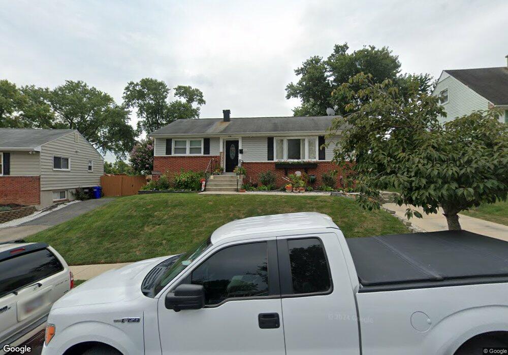
1004 10th St Laurel, MD 20707
Estimated Value: $406,000 - $449,850
Studio
3
Baths
1,056
Sq Ft
$404/Sq Ft
Est. Value
About This Home
This home is located at 1004 10th St, Laurel, MD 20707 and is currently estimated at $426,213, approximately $403 per square foot. 1004 10th St is a home located in Prince George's County with nearby schools including Scotchtown Hills Elementary School, Dwight D. Eisenhower Middle School, and Laurel High School.
Ownership History
Date
Name
Owned For
Owner Type
Purchase Details
Closed on
Oct 14, 2005
Sold by
White James A
Bought by
Berrios Carlos R Etal
Current Estimated Value
Home Financials for this Owner
Home Financials are based on the most recent Mortgage that was taken out on this home.
Original Mortgage
$70,000
Outstanding Balance
$37,278
Interest Rate
5.68%
Mortgage Type
Future Advance Clause Open End Mortgage
Estimated Equity
$388,935
Purchase Details
Closed on
Aug 12, 2005
Sold by
White James A
Bought by
Berrios Carlos R Etal
Home Financials for this Owner
Home Financials are based on the most recent Mortgage that was taken out on this home.
Original Mortgage
$280,000
Interest Rate
5.75%
Mortgage Type
Adjustable Rate Mortgage/ARM
Purchase Details
Closed on
Sep 11, 1997
Sold by
Meckley Warren E
Bought by
White James A
Create a Home Valuation Report for This Property
The Home Valuation Report is an in-depth analysis detailing your home's value as well as a comparison with similar homes in the area
Home Values in the Area
Average Home Value in this Area
Purchase History
| Date | Buyer | Sale Price | Title Company |
|---|---|---|---|
| Berrios Carlos R Etal | $350,000 | -- | |
| Berrios Carlos R Etal | $350,000 | -- | |
| White James A | $128,900 | -- |
Source: Public Records
Mortgage History
| Date | Status | Borrower | Loan Amount |
|---|---|---|---|
| Open | Berrios Carlos R Etal | $70,000 | |
| Open | Berrios Carlos R Etal | $280,000 | |
| Closed | Berrios Carlos R Etal | $70,000 | |
| Previous Owner | Berrios Carlos R Etal | $280,000 |
Source: Public Records
Tax History
| Year | Tax Paid | Tax Assessment Tax Assessment Total Assessment is a certain percentage of the fair market value that is determined by local assessors to be the total taxable value of land and additions on the property. | Land | Improvement |
|---|---|---|---|---|
| 2025 | $6,394 | $369,500 | $100,500 | $269,000 |
| 2024 | $6,394 | $344,233 | -- | -- |
| 2023 | $5,894 | $318,967 | $0 | $0 |
| 2022 | $5,383 | $293,700 | $75,500 | $218,200 |
| 2021 | $5,187 | $284,767 | $0 | $0 |
| 2020 | $5,024 | $275,833 | $0 | $0 |
| 2019 | $4,872 | $266,900 | $75,200 | $191,700 |
| 2018 | $4,639 | $253,633 | $0 | $0 |
| 2017 | $4,412 | $240,367 | $0 | $0 |
| 2016 | -- | $227,100 | $0 | $0 |
| 2015 | $3,652 | $221,833 | $0 | $0 |
| 2014 | $3,652 | $216,567 | $0 | $0 |
Source: Public Records
Map
Nearby Homes
- 1012 Ward St
- 1028 Ward St
- 903 Montrose Ave
- 1000 8th St
- 15008 Courtland Place
- 8218 Londonderry Ct
- 15012 Wheatland Place
- 916 Philip Powers Dr
- 1202 Marton St
- 1016 Phillip Powers Dr
- 501 8th St
- 1116 Westview Terrace
- 8040 Sandy Spring Rd
- 15307 Arbory Way
- 1211 Snowden Place
- 910 Montgomery St Unit A
- 1103 Montgomery St
- 7712 Erica Ln
- 14633 Cambridge Cir
- 7601 Carissa Ln
Your Personal Tour Guide
Ask me questions while you tour the home.