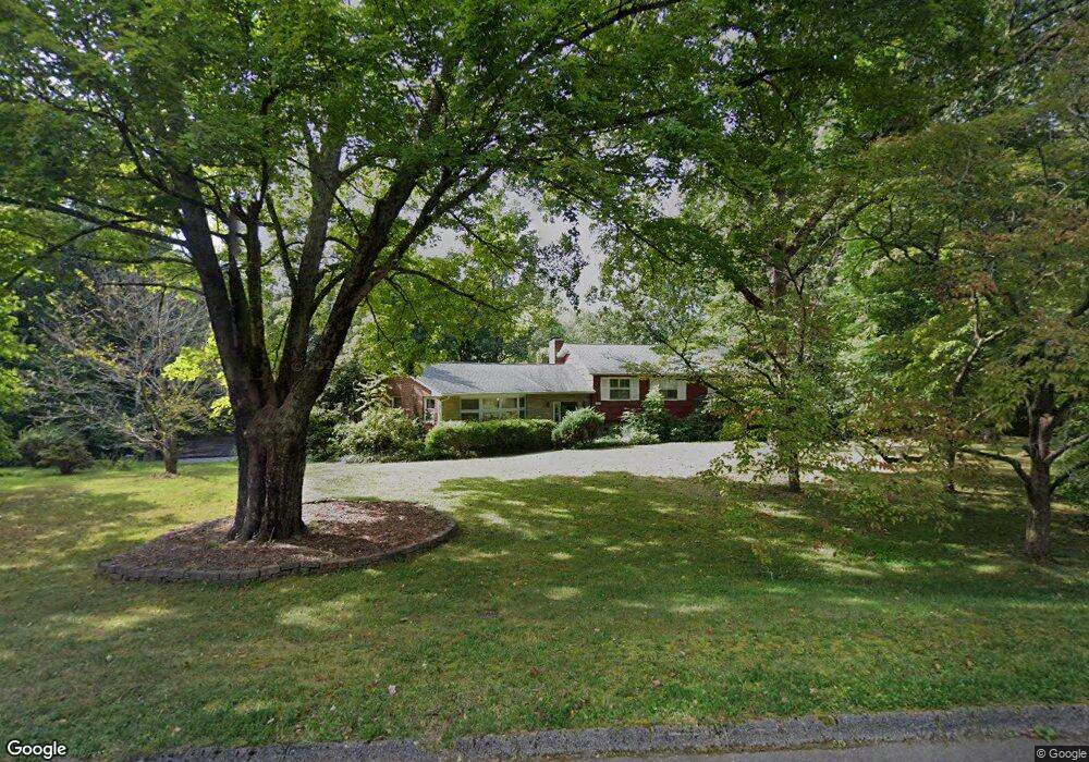
1004 Buckthorn Dr Knoxville, TN 37912
Uptown Knoxville NeighborhoodEstimated Value: $470,470 - $563,000
5
Beds
3
Baths
3,365
Sq Ft
$155/Sq Ft
Est. Value
About This Home
This home is located at 1004 Buckthorn Dr, Knoxville, TN 37912 and is currently estimated at $523,118, approximately $155 per square foot. 1004 Buckthorn Dr is a home located in Knox County with nearby schools including Sterchi Elementary School, Gresham Middle School, and Central High School.
Ownership History
Date
Name
Owned For
Owner Type
Purchase Details
Closed on
May 27, 1998
Sold by
Thomas Robert F and Thomas Katherine C
Bought by
Underwood David A and Underwood Lisa S
Current Estimated Value
Home Financials for this Owner
Home Financials are based on the most recent Mortgage that was taken out on this home.
Original Mortgage
$134,300
Outstanding Balance
$27,008
Interest Rate
7.11%
Mortgage Type
Purchase Money Mortgage
Estimated Equity
$496,110
Create a Home Valuation Report for This Property
The Home Valuation Report is an in-depth analysis detailing your home's value as well as a comparison with similar homes in the area
Home Values in the Area
Average Home Value in this Area
Purchase History
| Date | Buyer | Sale Price | Title Company |
|---|---|---|---|
| Underwood David A | $167,900 | East Tn Title Ins Agency Inc |
Source: Public Records
Mortgage History
| Date | Status | Borrower | Loan Amount |
|---|---|---|---|
| Open | Underwood David A | $134,300 |
Source: Public Records
Tax History Compared to Growth
Tax History
| Year | Tax Paid | Tax Assessment Tax Assessment Total Assessment is a certain percentage of the fair market value that is determined by local assessors to be the total taxable value of land and additions on the property. | Land | Improvement |
|---|---|---|---|---|
| 2024 | $3,003 | $80,950 | $0 | $0 |
| 2023 | $3,003 | $80,950 | $0 | $0 |
| 2022 | $3,003 | $80,950 | $0 | $0 |
| 2021 | $3,191 | $69,600 | $0 | $0 |
| 2020 | $3,191 | $69,600 | $0 | $0 |
| 2019 | $3,191 | $69,600 | $0 | $0 |
| 2018 | $3,191 | $69,600 | $0 | $0 |
| 2017 | $3,191 | $69,600 | $0 | $0 |
| 2016 | $3,558 | $0 | $0 | $0 |
| 2015 | $3,558 | $0 | $0 | $0 |
| 2014 | $3,558 | $0 | $0 | $0 |
Source: Public Records
Map
Nearby Homes
- 0 Oaklett Dr Unit 1284831
- 847 Sterchi Park Way Unit H847
- 5614 Wassman Rd
- 0 Rifle Range Dr Unit 1294861
- 715 Cedar Ln Unit 118
- 715 Cedar Ln Unit 129
- 805 Cedar Ln Unit C10
- 6150 Pembridge Rd
- 5800 Parkdale Rd
- 1100 Cedar Ln
- 553 Greystoke Ln
- 6005 Stratford Park Blvd
- 5704 Lutie Rd
- 1115 W Parkway Ave
- 1044 W Parkway Ave
- 5915 Nature Ln
- 1021 Fair Dr
- 533 Greystoke Ln
- 421 Oakcrest Rd
- 1501 Cedar Ln
- 1000 Buckthorn Dr
- 1000 Buckthorn Dr Unit 2
- 1001 Buckthorn Dr
- 1007 Buckthorn Dr
- 901 Snowdon Dr
- 904 Snowdon Dr
- 1015 Buckthorn Dr
- 1016 Buckthorn Dr
- 905 Snowdon Dr
- 908 Snowdon Dr
- 1010 Pilleaux Dr
- 1001 Oaklett Dr
- 1021 Buckthorn Dr
- 1005 Oaklett Dr
- 909 Snowdon Dr
- 1020 Buckthorn Dr
- 5907 Paula Rd
- 1000 Cumberland View Cir
- 912 Snowdon Dr
- 1009 Oaklett Dr