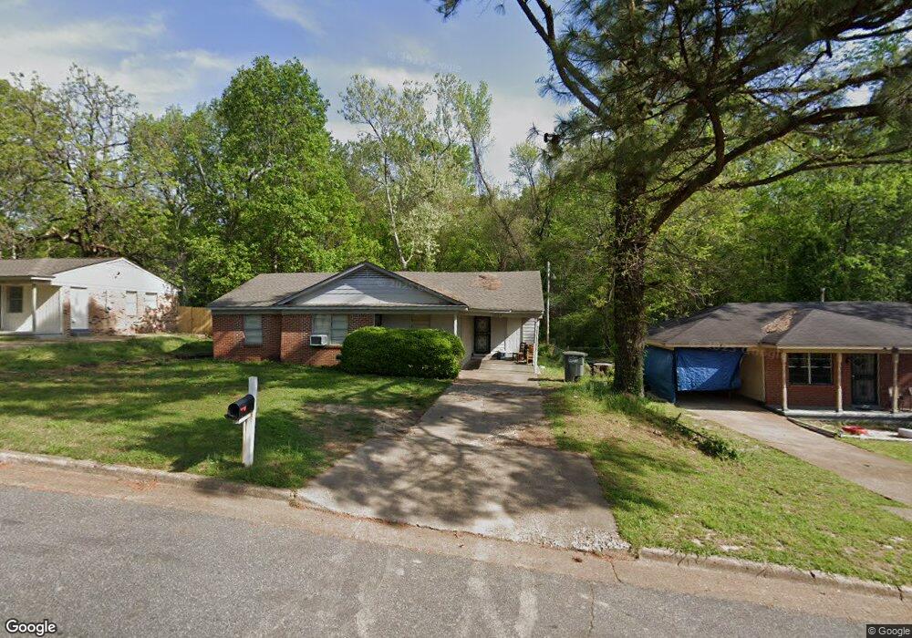
1004 Leacrest Ave Memphis, TN 38109
Westwood NeighborhoodEstimated Value: $76,421 - $87,000
3
Beds
1
Bath
913
Sq Ft
$90/Sq Ft
Est. Value
About This Home
This home is located at 1004 Leacrest Ave, Memphis, TN 38109 and is currently estimated at $81,855, approximately $89 per square foot. 1004 Leacrest Ave is a home located in Shelby County with nearby schools including Levi Elementary School, Chickasaw Middle School, and Westwood High School.
Ownership History
Date
Name
Owned For
Owner Type
Purchase Details
Closed on
Apr 29, 2011
Sold by
The Secretary Of Housing & Urban Develop
Bought by
Scott Keith
Current Estimated Value
Purchase Details
Closed on
Sep 1, 2010
Sold by
Tennessee Housing Development Agency
Bought by
Secretary Of Housing & Urban Development
Purchase Details
Closed on
Mar 18, 2010
Sold by
Adams Mary L and Adams Mary
Bought by
Tennessee Housing Development Agency
Purchase Details
Closed on
Nov 22, 1996
Sold by
Williamson Willie B and Williamson Hattie M
Bought by
Adams Mary L
Home Financials for this Owner
Home Financials are based on the most recent Mortgage that was taken out on this home.
Original Mortgage
$44,400
Interest Rate
7.83%
Mortgage Type
FHA
Create a Home Valuation Report for This Property
The Home Valuation Report is an in-depth analysis detailing your home's value as well as a comparison with similar homes in the area
Home Values in the Area
Average Home Value in this Area
Purchase History
| Date | Buyer | Sale Price | Title Company |
|---|---|---|---|
| Scott Keith | $14,410 | None Available | |
| Secretary Of Housing & Urban Development | -- | None Available | |
| Tennessee Housing Development Agency | $42,282 | None Available | |
| Adams Mary L | $44,000 | -- | |
| Adams Mary L | $44,000 | -- |
Source: Public Records
Mortgage History
| Date | Status | Borrower | Loan Amount |
|---|---|---|---|
| Previous Owner | Adams Mary L | $44,400 | |
| Closed | Adams Mary L | $2,469 |
Source: Public Records
Tax History
| Year | Tax Paid | Tax Assessment Tax Assessment Total Assessment is a certain percentage of the fair market value that is determined by local assessors to be the total taxable value of land and additions on the property. | Land | Improvement |
|---|---|---|---|---|
| 2025 | $417 | $17,775 | $2,575 | $15,200 |
| 2024 | $417 | $12,300 | $2,125 | $10,175 |
| 2023 | $749 | $12,300 | $2,125 | $10,175 |
| 2022 | $749 | $12,300 | $2,125 | $10,175 |
| 2021 | $758 | $12,300 | $2,125 | $10,175 |
| 2020 | $803 | $11,075 | $2,125 | $8,950 |
| 2019 | $803 | $11,075 | $2,125 | $8,950 |
| 2018 | $802 | $11,075 | $2,125 | $8,950 |
| 2017 | $455 | $11,075 | $2,125 | $8,950 |
| 2016 | $448 | $10,250 | $0 | $0 |
| 2014 | $448 | $10,250 | $0 | $0 |
Source: Public Records
Map
Nearby Homes
- 963 Leacrest Ave
- 931 W Raines Rd
- 896 Pawnee Ave
- 896 Leacrest Ave
- 1233 W Raines Rd
- 1307 W Raines Rd
- 1097 W Raines Rd
- 1088 Western Park Dr
- 4087 Weaver Rd
- 4118 Westmont Rd
- 0 Weaver Rd
- 4282 Westmont Rd
- 812 Leacrest Ave
- 808 Mohawk Ave
- 436 Western Park Dr
- 4413 Bluebell St
- 803 Ledbetter Ave
- 785 Pawnee Ave
- 1170 Shadowline Dr
- 4399 Pepper Tree Rd
- 996 Leacrest Ave
- 1018 Leacrest Ave
- 1003 Leacrest Ave
- 1024 Leacrest Ave
- 4216 Lawnview St
- 4217 Brookway St
- 4196 Brookway St
- 978 Leacrest Ave
- 1030 Leacrest Ave
- 4224 Lawnview St
- 4225 Brookway St
- 4217 Lawnview St
- 1038 Leacrest Ave
- 977 Leacrest Ave
- 968 Leacrest Ave
- 4230 Lawnview St
- 4231 Brookway St
- 1035 Leacrest Ave
- 4225 Lawnview St
- 1044 Leacrest Ave
Your Personal Tour Guide
Ask me questions while you tour the home.