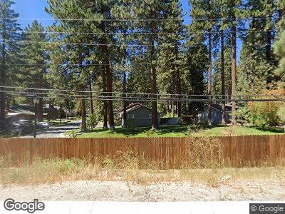
1004 Myron Dr Zephyr Cove, NV 89448
Estimated Value: $799,000 - $1,169,000
--
Bed
--
Bath
1,958
Sq Ft
$509/Sq Ft
Est. Value
About This Home
This home is located at 1004 Myron Dr, Zephyr Cove, NV 89448 and is currently estimated at $996,380, approximately $508 per square foot. 1004 Myron Dr is a home with nearby schools including Zephyr Cove Elementary School, George Whittell High School, and Douglas County High School.
Ownership History
Date
Name
Owned For
Owner Type
Purchase Details
Closed on
May 21, 2025
Sold by
Sirk Michael and Sirk Bonnye
Bought by
Sirk Family Trust and Sirk
Current Estimated Value
Purchase Details
Closed on
Apr 11, 2013
Sold by
Salazar Anthony T and Salazar Donica
Bought by
Sirk Michael and Sirk Bonnye
Create a Home Valuation Report for This Property
The Home Valuation Report is an in-depth analysis detailing your home's value as well as a comparison with similar homes in the area
Home Values in the Area
Average Home Value in this Area
Purchase History
| Date | Buyer | Sale Price | Title Company |
|---|---|---|---|
| Sirk Family Trust | -- | None Listed On Document | |
| Sirk Michael | $365,000 | First American Title Reno |
Source: Public Records
Mortgage History
| Date | Status | Borrower | Loan Amount |
|---|---|---|---|
| Previous Owner | Sirk Michael | $510,000 | |
| Previous Owner | Sirk Michael | $424,100 | |
| Previous Owner | Sirk Michael | $56,500 | |
| Previous Owner | Sirk Michael | $395,500 | |
| Previous Owner | Salazar Anthony T | $366,000 | |
| Previous Owner | Salazar Anthony T | $75,000 |
Source: Public Records
Tax History Compared to Growth
Tax History
| Year | Tax Paid | Tax Assessment Tax Assessment Total Assessment is a certain percentage of the fair market value that is determined by local assessors to be the total taxable value of land and additions on the property. | Land | Improvement |
|---|---|---|---|---|
| 2025 | $5,123 | $228,027 | $166,250 | $61,777 |
| 2024 | $4,778 | $220,379 | $157,500 | $62,879 |
| 2023 | $4,778 | $215,604 | $157,500 | $58,104 |
| 2022 | $4,396 | $194,547 | $140,000 | $54,547 |
| 2021 | $4,071 | $181,662 | $129,500 | $52,162 |
| 2020 | $3,938 | $181,111 | $129,500 | $51,611 |
| 2019 | $3,794 | $161,317 | $110,250 | $51,067 |
| 2018 | $3,621 | $154,882 | $105,000 | $49,882 |
| 2017 | $3,473 | $141,204 | $91,000 | $50,204 |
| 2016 | $3,387 | $138,462 | $91,000 | $47,462 |
| 2015 | $3,283 | $138,462 | $91,000 | $47,462 |
| 2014 | $3,182 | $135,469 | $91,000 | $44,469 |
Source: Public Records
Map
Nearby Homes
- 161 Willow Dr
- 1030 Lynn Way
- 189 Ray Way
- 88 Skyland Ct
- 88 Skyland Ct
- 1080 Skyland Dr
- 712 Lakeview Dr
- 1146 Highway 50
- 1227 Highway 50
- 1280 Hidden Woods Dr
- 1227 Us Highway 50
- 1263 Hidden Woods Dr
- 213 Cedar Ridge
- 210 Cedar Ridge
- 1208 Tahoe Glen Dr
- 1206 Tahoe Glen Dr
- 699 Lakeview Dr
- 638 N Martin Dr
- 223 Lyons Ave
- 664 Lookout Rd
