Estimated Value: $216,311 - $623,000
2
Beds
1
Bath
1,728
Sq Ft
$282/Sq Ft
Est. Value
About This Home
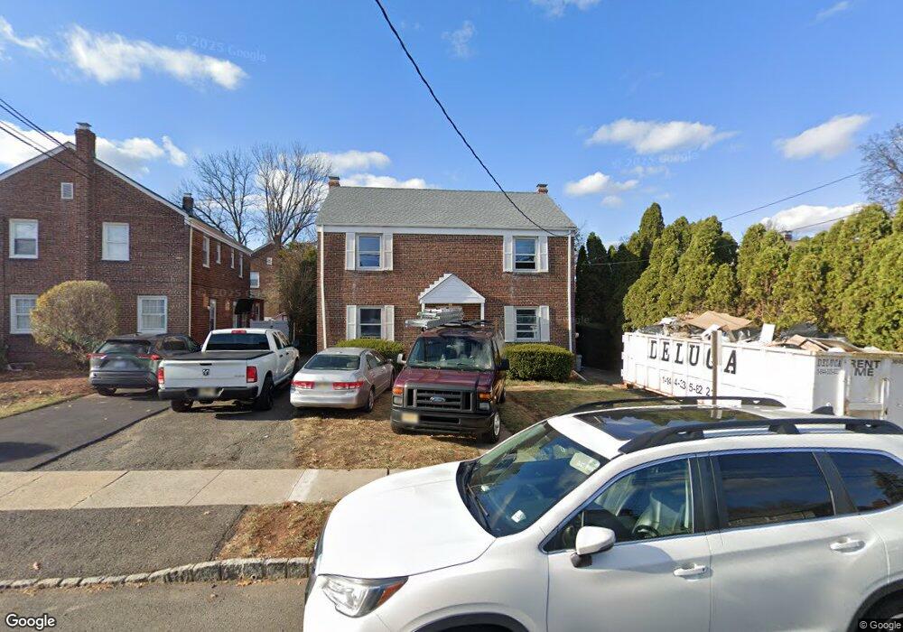
This home is located at 1004 Norton Rd, Union, NJ 07083 and is currently estimated at $487,328, approximately $282 per square foot. 1004 Norton Rd is a home located in Union County with nearby schools including Livingston Elementary School, Union High School, and St Michael Parish School.
Ownership History
Date
Name
Owned For
Owner Type
Purchase Details
Closed on
Sep 28, 2024
Sold by
Richard Erdman D and Richard Erdmann D
Bought by
Day Maya R
Current Estimated Value
Home Financials for this Owner
Home Financials are based on the most recent Mortgage that was taken out on this home.
Original Mortgage
$654,792
Outstanding Balance
$647,563
Interest Rate
6.09%
Mortgage Type
FHA
Estimated Equity
-$160,235
Purchase Details
Closed on
Oct 1, 1998
Sold by
Morasse Cathryn T
Bought by
Erdman D Richard
Create a Home Valuation Report for This Property
The Home Valuation Report is an in-depth analysis detailing your home's value as well as a comparison with similar homes in the area
Home Values in the Area
Average Home Value in this Area
Purchase History
| Date | Buyer | Sale Price | Title Company |
|---|---|---|---|
| Day Maya R | $550,000 | Foundation Title | |
| Day Maya R | $550,000 | Foundation Title | |
| Erdman D Richard | -- | -- |
Source: Public Records
Mortgage History
| Date | Status | Borrower | Loan Amount |
|---|---|---|---|
| Open | Day Maya R | $654,792 | |
| Closed | Day Maya R | $654,792 |
Source: Public Records
Tax History
| Year | Tax Paid | Tax Assessment Tax Assessment Total Assessment is a certain percentage of the fair market value that is determined by local assessors to be the total taxable value of land and additions on the property. | Land | Improvement |
|---|---|---|---|---|
| 2025 | $10,773 | $48,200 | $20,000 | $28,200 |
| 2024 | $10,444 | $48,200 | $20,000 | $28,200 |
| 2023 | $10,444 | $48,200 | $20,000 | $28,200 |
| 2022 | $10,082 | $48,200 | $20,000 | $28,200 |
| 2021 | $9,837 | $48,200 | $20,000 | $28,200 |
| 2020 | $9,641 | $48,200 | $20,000 | $28,200 |
| 2019 | $9,511 | $48,200 | $20,000 | $28,200 |
| 2018 | $9,349 | $48,200 | $20,000 | $28,200 |
| 2017 | $9,211 | $48,200 | $20,000 | $28,200 |
| 2016 | $8,986 | $48,200 | $20,000 | $28,200 |
| 2015 | $8,837 | $48,200 | $20,000 | $28,200 |
| 2014 | $8,639 | $48,200 | $20,000 | $28,200 |
Source: Public Records
Map
Nearby Homes
- 1453 Morris Ave
- 950 Carteret Ave
- 365 Broadwell Ave
- 1393 Cornell Place
- 985 Arnet Ave
- 969 Arnet Ave
- 875 Salem Rd
- 1250 Erhardt St
- 1611 N Sunset Place
- 169 Valley View Rd
- 600 Plymouth Rd
- 292 Crann St
- 130 Valley View Rd
- 564 Chapman St
- 542 Leo St
- 537 Us Highway 22
- 1218 Schmidt Ave
- 525 Us Highway 22
- 404 Burroughs Terrace
- 401 Burroughs Terrace
- 1010 Norton Rd
- 1461 Morris Ave
- 1014 Norton Rd
- 1007 Azalea Rd
- 1011 Azalea Rd
- 1465 Morris Ave
- 1011 Norton Rd
- 1018 Norton Rd
- 1019 Azalea Rd
- 1015 Norton Rd
- 1460 Morris Ave
- 1020 Norton Rd
- 1023 Azalea Rd
- 1021 Norton Rd
- 1026 Norton Rd
- 1025 Norton Rd
- 1027 Azalea Rd
- 1008 Azalea Rd
- 1496 Brookside Dr
- 1 Midland Blvd
Your Personal Tour Guide
Ask me questions while you tour the home.