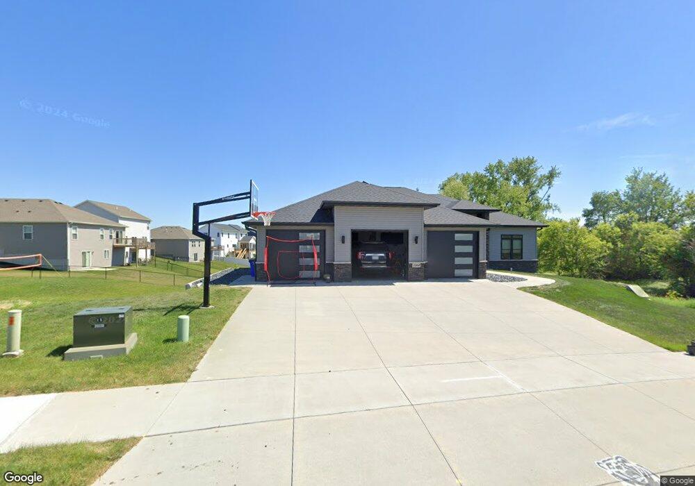
1004 W Orange St West Branch, IA 52358
Estimated Value: $408,000 - $637,182
5
Beds
3
Baths
1,909
Sq Ft
$271/Sq Ft
Est. Value
About This Home
This home is located at 1004 W Orange St, West Branch, IA 52358 and is currently estimated at $518,061, approximately $271 per square foot. 1004 W Orange St is a home with nearby schools including Hoover Elementary School, West Branch Middle School, and West Branch High School.
Ownership History
Date
Name
Owned For
Owner Type
Purchase Details
Closed on
May 12, 2021
Sold by
Meadows Development Inc
Bought by
Malloy Mark and Malloy Amanda
Current Estimated Value
Purchase Details
Closed on
Mar 25, 2020
Sold by
Mente Construction Co
Bought by
Malloy Mark C and Malloy Amanda M
Home Financials for this Owner
Home Financials are based on the most recent Mortgage that was taken out on this home.
Original Mortgage
$436,500
Interest Rate
3.4%
Mortgage Type
New Conventional
Create a Home Valuation Report for This Property
The Home Valuation Report is an in-depth analysis detailing your home's value as well as a comparison with similar homes in the area
Home Values in the Area
Average Home Value in this Area
Purchase History
| Date | Buyer | Sale Price | Title Company |
|---|---|---|---|
| Malloy Mark | $70,000 | None Listed On Document | |
| Malloy Mark C | $68,000 | None Available |
Source: Public Records
Mortgage History
| Date | Status | Borrower | Loan Amount |
|---|---|---|---|
| Previous Owner | Malloy Mark C | $436,500 |
Source: Public Records
Tax History Compared to Growth
Tax History
| Year | Tax Paid | Tax Assessment Tax Assessment Total Assessment is a certain percentage of the fair market value that is determined by local assessors to be the total taxable value of land and additions on the property. | Land | Improvement |
|---|---|---|---|---|
| 2025 | $10,578 | $657,690 | $78,860 | $578,830 |
| 2024 | $10,578 | $632,810 | $78,860 | $553,950 |
| 2023 | $10,194 | $617,590 | $78,860 | $538,730 |
| 2022 | $9,242 | $486,830 | $56,950 | $429,880 |
| 2021 | $10 | $486,830 | $56,950 | $429,880 |
| 2020 | $0 | $490 | $490 | $0 |
Source: Public Records
Map
Nearby Homes
- 212 Dawson Dr
- Lot 19 Meadows Subdivision Part 6
- Lot 17 Meadows Subdivision Part 6
- Lot 16 Meadows Subdivision Part 6
- Lot 18 Meadows Subdivision Part 6
- Lot 11 Meadows Subdivision Part 6
- Lot 14 Meadows Subdivision Part 6
- Lot 15 Meadows Subdivision Part 6
- Lot 6 Meadows Subdivision Part 6
- Lot 13 Meadows Subdivision Part 6
- Lot 3 Meadows Subdivision Part 6
- Lots 1 & 2
- Lot 12 Meadows Subdivision Part 6
- Lot 8 Meadows Subdivision Part 6
- Lot 9 Meadows Subdivision Part 6
- Lot 7 Meadows Subdivision Part 6
- Lot 10 Meadows Subdivision Part 6
- Lot 5 Meadows Subdivision Part 6
- Lot 4 Meadows Subdivision Part 6
- 719 Sullivan St
- Lot 29 the Meadows Subdivision Part 4b Unit 1006 & 1008 Prairie
- Lot 18 the Meadows Subdivision Part 4b Unit 401 & 403 Dawson Dri
- Lot 18 the Meadows Subdivision Part 4b
- Lot 29 the Meadows Subdivision Part 4b
- 302 Dawson Dr
- Lot 13 the Meadows Subdivision Part 4b Unit 421 & 423 Dawson Dri
- Lot 13 the Meadows Subdivision Part 4b
- Lot 34 the Meadows Subdivision Part 4b
- Lot 17 the Meadows Subdivision Part 4a
- 300 Dawson Dr
- 210 Dawson Dr Lot 24
- 208 Dawson Dr Lot 25
- 208 Dawson Dr Lot 25
- Lot 3 the Meadows Subdivision Part 4b Unit 1001 & 1003 Prairie
- Lot 12 the Meadows Subdivision Part 4b Unit 425 & 427 Dawson Dr.
- Lot 3 the Meadows Subdivision Part 4b
- Lot 12 the Meadows Subdivision Part 4b
- Lot 44 the Meadows Subdivision Part 4b
- Lot 35 the Meadows Subdivision Part 4b
- 304 Dawson Dr