
Seller's Agent in 2025
Jennifer Farrell
RE/MAX
(515) 779-7500
45 in this area
383 Total Sales
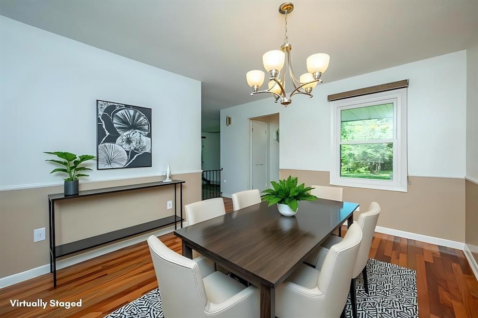
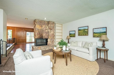
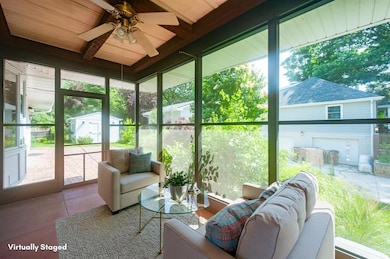
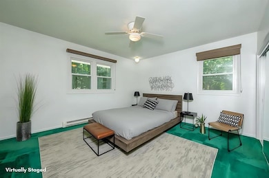
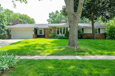
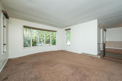
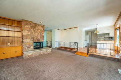
Spacious Mid-century walk-out ranch with nearly a 1/2 acre in desirable West Des Moines neighborhood! 4+ bedrooms, 3.5 baths, 3-season porch, dining room with hardwood floors, eat-in kitchen, and dual living areas divided by a stunning stone fireplace. Lower level offers a spacious rec room, wet bar, and walkout access. A huge bedroom with double closets, another big non-conforming 5th bedroom and 3/4 bath complete the lower level. Mature trees, garden shed, and plenty of room to entertain. Main floor laundry.
| Date | Type | Sale Price | Title Company |
|---|---|---|---|
| Fiduciary Deed | $362,500 | None Listed On Document | |
| Quit Claim Deed | -- | None Listed On Document | |
| Quit Claim Deed | -- | None Listed On Document | |
| Interfamily Deed Transfer | -- | Chicago Title Servicelink Di | |
| Warranty Deed | $143,500 | -- |
| Date | Status | Loan Amount | Loan Type |
|---|---|---|---|
| Open | $225,003 | New Conventional | |
| Previous Owner | $98,990 | New Conventional | |
| Previous Owner | $115,000 | No Value Available |
| Date | Event | Price | Change | Sq Ft Price |
|---|---|---|---|---|
| 08/08/2025 08/08/25 | Sold | $362,500 | -1.8% | $191 / Sq Ft |
| 06/26/2025 06/26/25 | Pending | -- | -- | -- |
| 06/19/2025 06/19/25 | Price Changed | $369,000 | -1.6% | $195 / Sq Ft |
| 06/17/2025 06/17/25 | For Sale | $375,000 | -- | $198 / Sq Ft |
| Year | Tax Paid | Tax Assessment Tax Assessment Total Assessment is a certain percentage of the fair market value that is determined by local assessors to be the total taxable value of land and additions on the property. | Land | Improvement |
|---|---|---|---|---|
| 2024 | $5,360 | $355,600 | $70,300 | $285,300 |
| 2023 | $5,378 | $355,600 | $70,300 | $285,300 |
| 2022 | $5,314 | $287,400 | $59,400 | $228,000 |
| 2021 | $5,126 | $287,400 | $59,400 | $228,000 |
| 2020 | $5,077 | $264,200 | $54,500 | $209,700 |
| 2019 | $4,943 | $264,200 | $54,500 | $209,700 |
| 2018 | $4,952 | $248,000 | $49,500 | $198,500 |
| 2017 | $4,594 | $248,000 | $49,500 | $198,500 |
| 2016 | $4,494 | $223,900 | $44,100 | $179,800 |
| 2015 | $4,450 | $223,900 | $44,100 | $179,800 |
| 2014 | $4,161 | $211,700 | $41,000 | $170,700 |
Seller's Agent in 2025
Jennifer Farrell
RE/MAX
(515) 779-7500
45 in this area
383 Total Sales
Buyer's Agent in 2025
Micole Van Walbeek
RE/MAX
(515) 333-8292
38 in this area
245 Total Sales
Source: Des Moines Area Association of REALTORS®
MLS Number: 720427
APN: 320-02191009001
Disclaimer: Certain information contained herein is derived from information provided by parties other than Homes.com. All information provided is deemed reliable, but is not guaranteed to be accurate and should be independently verified.
![]() IDX information is provided exclusively for personal, non-commercial use, and may not be used for any purpose other than to identify prospective properties consumers may be interested in purchasing. Information is deemed reliable but not guaranteed.
IDX information is provided exclusively for personal, non-commercial use, and may not be used for any purpose other than to identify prospective properties consumers may be interested in purchasing. Information is deemed reliable but not guaranteed.