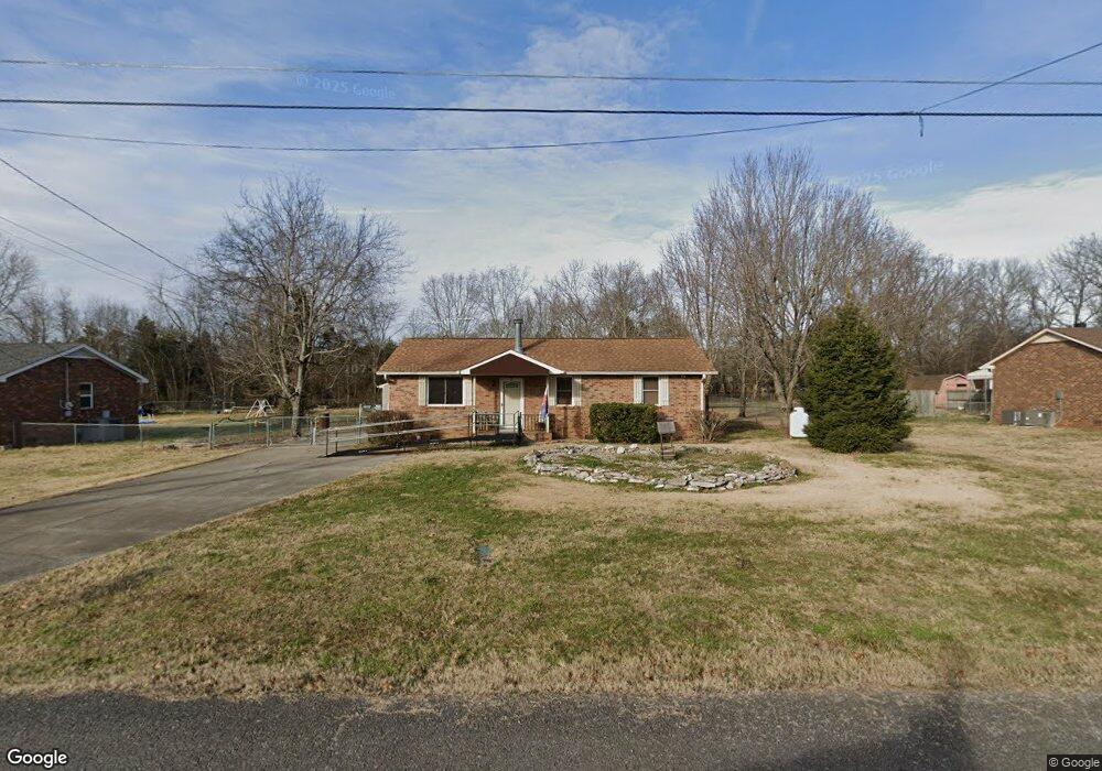
1005 Ashwood Dr Mount Juliet, TN 37122
Estimated Value: $250,721 - $354,000
--
Bed
1
Bath
1,075
Sq Ft
$275/Sq Ft
Est. Value
About This Home
This home is located at 1005 Ashwood Dr, Mount Juliet, TN 37122 and is currently estimated at $295,930, approximately $275 per square foot. 1005 Ashwood Dr is a home located in Rutherford County with nearby schools including John Colemon Elementary School, Smyrna Middle School, and Smyrna High School.
Ownership History
Date
Name
Owned For
Owner Type
Purchase Details
Closed on
Apr 2, 2025
Sold by
Cook Susan M and Kurek Diane C
Bought by
Diane Catherine Kurek Living Trust and Kurek
Current Estimated Value
Purchase Details
Closed on
Sep 13, 2023
Sold by
Kurek Diane C
Bought by
Kurek Diane C and Kurek Timothy M
Purchase Details
Closed on
Jan 27, 1997
Sold by
Kurek Jerome B
Bought by
Bolin Imogene W Trustee
Create a Home Valuation Report for This Property
The Home Valuation Report is an in-depth analysis detailing your home's value as well as a comparison with similar homes in the area
Home Values in the Area
Average Home Value in this Area
Purchase History
| Date | Buyer | Sale Price | Title Company |
|---|---|---|---|
| Diane Catherine Kurek Living Trust | -- | None Listed On Document | |
| Kurek Diane C | -- | None Listed On Document | |
| Bolin Imogene W Trustee | -- | -- |
Source: Public Records
Tax History Compared to Growth
Tax History
| Year | Tax Paid | Tax Assessment Tax Assessment Total Assessment is a certain percentage of the fair market value that is determined by local assessors to be the total taxable value of land and additions on the property. | Land | Improvement |
|---|---|---|---|---|
| 2025 | -- | $60,225 | $13,750 | $46,475 |
| 2024 | -- | $58,850 | $13,750 | $45,100 |
| 2023 | $1,104 | $58,850 | $13,750 | $45,100 |
| 2022 | $951 | $58,850 | $13,750 | $45,100 |
| 2021 | $777 | $35,025 | $7,500 | $27,525 |
| 2020 | $777 | $35,025 | $7,500 | $27,525 |
| 2019 | $777 | $35,025 | $7,500 | $27,525 |
| 2018 | $735 | $35,025 | $0 | $0 |
| 2017 | $759 | $28,325 | $0 | $0 |
| 2016 | $759 | $28,325 | $0 | $0 |
| 2015 | $759 | $28,325 | $0 | $0 |
| 2014 | $704 | $28,325 | $0 | $0 |
| 2013 | -- | $29,475 | $0 | $0 |
Source: Public Records
Map
Nearby Homes
- 3875 Rockdale Fellowship Rd
- 4558 Weakley Ln
- 4084 N Lamar Rd
- 2560 Couchville Pike
- 1985 Couchville Pike
- 1100 Weakley Ln
- 108 Austin Ave
- 124 Laural Hill Dr
- 132 Laural Hill Dr
- 326 Lynnwood Blvd
- 316 Lynnwood Blvd
- 314 Lynnwood Blvd
- 318 Lynnwood Blvd
- 301 Blackland Dr
- 2000 Tee Time Trace
- 618 Club View Way
- 614 Club View Way
- 2001 Tee Time Trace
- 608 Club View Way
- 603 Club View Way
- 1007 Ashwood Dr
- 1003 Ashwood Dr
- 1009 Ashwood Dr
- 1001 Ashwood Dr
- 3308 Rockdale Fellowship Rd
- 1006 Ashwood Dr
- 1011 Ashwood Dr
- 1004 Ashwood Dr
- 1008 Ashwood Dr
- 1010 Ashwood Dr
- 1002 Ashwood Dr
- 3346 Rockdale Fellowship Rd
- 1013 Ashwood Dr
- 1012 Ashwood Dr
- 1014 Ashwood Dr
- 3420 Rockdale Fellowship Rd
- 3041 Rockdale Fellowship Rd
- 3208 Rockdale Fellowship Rd
- 1 N Lamar Rd
- 0 N Lamar Rd