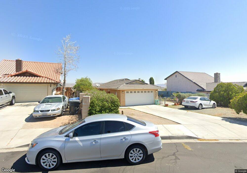
1005 Broadway Ave Barstow, CA 92311
Estimated Value: $283,000 - $320,000
3
Beds
2
Baths
1,239
Sq Ft
$240/Sq Ft
Est. Value
About This Home
This home is located at 1005 Broadway Ave, Barstow, CA 92311 and is currently estimated at $297,958, approximately $240 per square foot. 1005 Broadway Ave is a home located in San Bernardino County with nearby schools including Crestline Elementary School, Barstow Junior High School, and Barstow High School.
Ownership History
Date
Name
Owned For
Owner Type
Purchase Details
Closed on
Apr 29, 2014
Sold by
Loupas Patricia J
Bought by
Loupas Patricia J and Loupas Samantha Christine
Current Estimated Value
Purchase Details
Closed on
Aug 1, 2013
Sold by
Boyce Dennis G
Bought by
Loupas Patricia J
Purchase Details
Closed on
Dec 3, 2001
Sold by
Sharp Walter S
Bought by
Boyce Dennis G and Boyce Debby J
Home Financials for this Owner
Home Financials are based on the most recent Mortgage that was taken out on this home.
Original Mortgage
$89,095
Interest Rate
7.11%
Mortgage Type
VA
Purchase Details
Closed on
Jul 3, 1997
Sold by
Rock Henry R and Rock Danny R
Bought by
Sharp Walter S and Sharp Ursula
Home Financials for this Owner
Home Financials are based on the most recent Mortgage that was taken out on this home.
Original Mortgage
$71,250
Interest Rate
7.58%
Create a Home Valuation Report for This Property
The Home Valuation Report is an in-depth analysis detailing your home's value as well as a comparison with similar homes in the area
Home Values in the Area
Average Home Value in this Area
Purchase History
| Date | Buyer | Sale Price | Title Company |
|---|---|---|---|
| Loupas Patricia J | -- | None Available | |
| Loupas Patricia J | $115,000 | First American Title Co | |
| Boyce Dennis G | $86,500 | Fidelity National Title Ins | |
| Sharp Walter S | $75,000 | Chicago Title Co |
Source: Public Records
Mortgage History
| Date | Status | Borrower | Loan Amount |
|---|---|---|---|
| Previous Owner | Boyce Dennis G | $89,095 | |
| Previous Owner | Sharp Walter S | $71,250 |
Source: Public Records
Tax History Compared to Growth
Tax History
| Year | Tax Paid | Tax Assessment Tax Assessment Total Assessment is a certain percentage of the fair market value that is determined by local assessors to be the total taxable value of land and additions on the property. | Land | Improvement |
|---|---|---|---|---|
| 2025 | $1,587 | $140,973 | $35,241 | $105,732 |
| 2024 | $1,587 | $138,209 | $34,550 | $103,659 |
| 2023 | $1,554 | $135,499 | $33,873 | $101,626 |
| 2022 | $1,547 | $132,842 | $33,209 | $99,633 |
| 2021 | $1,502 | $130,237 | $32,558 | $97,679 |
| 2020 | $1,505 | $128,901 | $32,224 | $96,677 |
| 2019 | $1,426 | $126,373 | $31,592 | $94,781 |
| 2018 | $1,496 | $123,896 | $30,973 | $92,923 |
| 2017 | $1,353 | $121,467 | $30,366 | $91,101 |
| 2016 | $1,337 | $119,086 | $29,771 | $89,315 |
| 2015 | $1,309 | $117,297 | $29,324 | $87,973 |
| 2014 | $1,300 | $115,000 | $28,750 | $86,250 |
Source: Public Records
Map
Nearby Homes
- 2013 Rushmore Dr
- 0 E Rimrock Rd
- 1000 Windy Pass Unit 95
- 1000 Windy Pass Unit 61
- 1000 Windy Pass Unit Spc 146
- 1000 Windy Pass Unit 130
- 761 Upton Dr
- 761 Rimrock Rd
- 37 Rimrock Rd
- 1020 Monterey Ave
- 1230 Sunshine Dr
- 1260 Mirage Dr
- 2036 Harvard Dr
- 621 Rimrock Rd
- 433 Oakmont Dr
- 600 Rimrock Rd Unit 28
- 1120 Tecate Dr
- 1330 Astral Dr
- 500 Mcbroom Ave
- 1504 Church St
- 1009 Broadway Ave
- 1001 Broadway Ave
- 1004 Zion Dr
- 1000 Zion Dr
- 1008 Zion Dr
- 1004 Broadway Ave
- 1017 Broadway Ave
- 1000 Broadway Ave
- 1008 Broadway Ave
- 937 Broadway Ave
- 1012 Broadway Ave
- 2037 Sequoia Dr
- 1021 Broadway Ave
- 2204 Dove Ave
- 2040 Yosemite Dr
- 1016 Broadway Ave
- 2032 Sequoia Dr
- 2208 Dove Ave
- 2033 Sequoia Dr
- 933 Broadway Ave