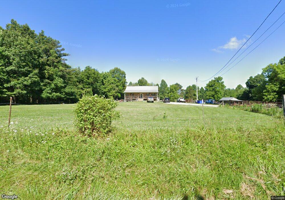
1005 Chestnut Ridge Rd Allardt, TN 38504
Estimated Value: $216,000 - $335,000
5
Beds
3
Baths
2,400
Sq Ft
$116/Sq Ft
Est. Value
About This Home
This home is located at 1005 Chestnut Ridge Rd, Allardt, TN 38504 and is currently estimated at $278,069, approximately $115 per square foot. 1005 Chestnut Ridge Rd is a home located in Fentress County.
Ownership History
Date
Name
Owned For
Owner Type
Purchase Details
Closed on
Dec 28, 2018
Sold by
Lewallen Bradley
Bought by
Rinker Robert and Rinker Lana
Current Estimated Value
Purchase Details
Closed on
Oct 8, 2010
Sold by
Tompkins Sandra Voiles
Bought by
Lewallen Bradley
Purchase Details
Closed on
Jul 2, 2003
Bought by
Tompkins Sandra Voiles Etvir Keith
Create a Home Valuation Report for This Property
The Home Valuation Report is an in-depth analysis detailing your home's value as well as a comparison with similar homes in the area
Home Values in the Area
Average Home Value in this Area
Purchase History
| Date | Buyer | Sale Price | Title Company |
|---|---|---|---|
| Rinker Robert | $84,000 | None Available | |
| Lewallen Bradley | $43,000 | -- | |
| Tompkins Sandra Voiles Etvir Keith | $20,000 | -- |
Source: Public Records
Tax History Compared to Growth
Tax History
| Year | Tax Paid | Tax Assessment Tax Assessment Total Assessment is a certain percentage of the fair market value that is determined by local assessors to be the total taxable value of land and additions on the property. | Land | Improvement |
|---|---|---|---|---|
| 2024 | $683 | $50,575 | $5,325 | $45,250 |
| 2023 | $683 | $50,575 | $5,325 | $45,250 |
| 2022 | $558 | $29,225 | $2,175 | $27,050 |
| 2021 | $558 | $29,225 | $2,175 | $27,050 |
| 2020 | $558 | $29,225 | $2,175 | $27,050 |
| 2019 | $558 | $29,225 | $2,175 | $27,050 |
| 2018 | $558 | $29,200 | $2,150 | $27,050 |
| 2017 | $429 | $21,625 | $1,800 | $19,825 |
| 2016 | $429 | $21,625 | $1,800 | $19,825 |
| 2015 | $429 | $21,604 | $0 | $0 |
| 2014 | $429 | $21,604 | $0 | $0 |
Source: Public Records
Map
Nearby Homes
- 0 13 44 Ac Chestnut Ridge Rd
- 13.44 AC Chestnut Ridge Rd
- 4676 Rugby Pike
- 0 Sam Smith Rd Unit LotWP001 23395947
- 0 Sam Smith Rd Unit RTC2865905
- 0 Sam Smith Rd Unit 236295
- 305 Griffin Ln
- 145 Horse Haven Rd
- 0 Stockton Rd
- 54 E Ridge Rd
- 326 Goad Mill Ln
- 154 Mount Helen Rd
- 2230 Shirley Rd
- 21.31 Cole Place Rd
- 0 72 Acres Cole Place Rd
- 3305 Rugby Pike
- Lot 1 Hwy 52 and Brewstertown Rd
- lot 17 Long Ridge Way
- 3251 Rugby Pike
- 182 Stockton Chapel Rd
- 1005 Chestnut Ridge Rd
- 1002 Chestnut Ridge Rd
- 955 Chestnut Ridge Rd
- 1035 Chestnut Ridge Rd
- 944 Chestnut Ridge Rd
- 0 Chesntnut Ridge Rd Unit 1199088
- 1000 Chestnut Ridge Rd
- 0 Chestnut Ridge Rd Unit 146042
- 0 Chestnut Ridge Rd Unit 665422
- 0 Chestnut Ridge Rd Unit 713636
- 0 Chestnut Ridge Rd Unit 758355
- 0 Chestnut Ridge Rd Unit 734933
- 0 Chestnut Ridge Rd
- 200 Hm Brooks Rd
- 921 Chestnut Ridge Rd
- 176 Hm Brooks Rd
- 915 Chestnut Ridge Rd
- 4125 Rugby Pike
- 175 H M Brooks Rd
- 901 Chestnut Ridge Rd