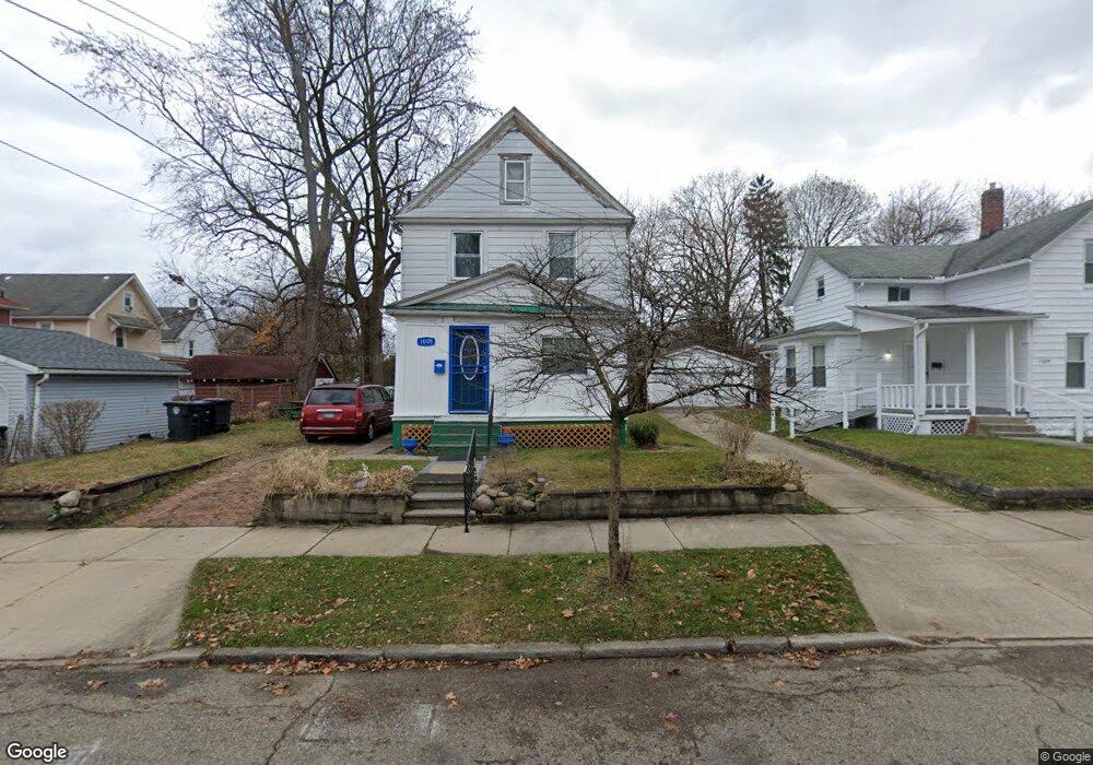
1005 Lane St Akron, OH 44307
Sherbondy Hill NeighborhoodEstimated Value: $52,000 - $69,000
3
Beds
1
Bath
1,124
Sq Ft
$55/Sq Ft
Est. Value
About This Home
This home is located at 1005 Lane St, Akron, OH 44307 and is currently estimated at $61,322, approximately $54 per square foot. 1005 Lane St is a home located in Summit County with nearby schools including St. Bernard-St. Mary Elementary School.
Ownership History
Date
Name
Owned For
Owner Type
Purchase Details
Closed on
Oct 30, 2023
Sold by
Parmer Willie E and Parmer Elizabeth
Bought by
Parmer William C and Parmer Dorothy
Current Estimated Value
Purchase Details
Closed on
Mar 15, 2022
Sold by
Parmer Willie E and Parmer Elizabeth
Bought by
Parmer William C and Parmer Dorothy
Purchase Details
Closed on
Sep 23, 2020
Sold by
Parmer and Debra
Bought by
Parmer Willie E and Parmer Oscar
Purchase Details
Closed on
Sep 18, 2020
Sold by
Parmer and Debra
Bought by
Parmer Willie E and Parmer Oscar
Purchase Details
Closed on
Aug 9, 2015
Sold by
Parmer Charles
Bought by
Parmer Charles and Parmer Cora Lee
Purchase Details
Closed on
Aug 29, 2014
Sold by
Parmer Core Lee
Bought by
Parmer Charles
Create a Home Valuation Report for This Property
The Home Valuation Report is an in-depth analysis detailing your home's value as well as a comparison with similar homes in the area
Home Values in the Area
Average Home Value in this Area
Purchase History
| Date | Buyer | Sale Price | Title Company |
|---|---|---|---|
| Parmer William C | -- | None Listed On Document | |
| Parmer William C | -- | None Listed On Document | |
| Parmer Willie E | -- | Manes Gregg A | |
| Parmer Willie E | -- | Manes Gregg A | |
| Parmer Charles | -- | Attorney | |
| Parmer Charles | -- | Attorney |
Source: Public Records
Tax History Compared to Growth
Tax History
| Year | Tax Paid | Tax Assessment Tax Assessment Total Assessment is a certain percentage of the fair market value that is determined by local assessors to be the total taxable value of land and additions on the property. | Land | Improvement |
|---|---|---|---|---|
| 2025 | $629 | $10,445 | $3,413 | $7,032 |
| 2024 | $629 | $10,445 | $3,413 | $7,032 |
| 2023 | $629 | $10,445 | $3,413 | $7,032 |
| 2022 | $495 | $6,146 | $2,009 | $4,137 |
| 2021 | $506 | $6,146 | $2,009 | $4,137 |
| 2020 | $95 | $6,150 | $2,010 | $4,140 |
| 2019 | $95 | $5,490 | $2,770 | $2,720 |
| 2018 | $95 | $5,490 | $2,770 | $2,720 |
| 2017 | $95 | $5,490 | $2,770 | $2,720 |
| 2016 | $95 | $5,570 | $2,770 | $2,800 |
| 2015 | $95 | $5,570 | $2,770 | $2,800 |
| 2014 | $95 | $5,570 | $2,770 | $2,800 |
| 2013 | $95 | $5,960 | $2,770 | $3,190 |
Source: Public Records
Map
Nearby Homes
- 949 Raymond St
- 1001 Celina Ave
- 1063 Raymond St
- 364 Campbell St
- 1132 Bristol Terrace
- 677 Vernon Odom Blvd
- 817 Raymond St
- 721 Vernon Odom Blvd
- 737 Vernon Odom Blvd
- 794 Ruth Ave
- 834 Kenyon St
- 1174 La Croix Ave
- 639 Bellevue Ave
- 776 Krause Ct
- 963 Penn Ave
- 985 Diana Ave
- 738 Longview Ave
- 564 Euclid Ave
- 810 Amherst St
- 670 Euclid Ave