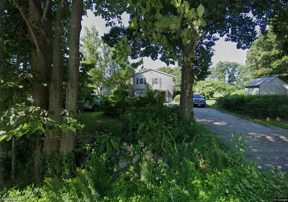
1005 Meadow Ln Dunbarton, NH 03046
Estimated Value: $501,035 - $596,000
4
Beds
3
Baths
1,519
Sq Ft
$359/Sq Ft
Est. Value
About This Home
This home is located at 1005 Meadow Ln, Dunbarton, NH 03046 and is currently estimated at $544,759, approximately $358 per square foot. 1005 Meadow Ln is a home located in Merrimack County with nearby schools including Dunbarton Elementary School, Bow Memorial School, and Bow High School.
Ownership History
Date
Name
Owned For
Owner Type
Purchase Details
Closed on
Dec 26, 2012
Sold by
French Nicole M
Bought by
French Joseph M and French Nicole M
Current Estimated Value
Home Financials for this Owner
Home Financials are based on the most recent Mortgage that was taken out on this home.
Original Mortgage
$221,000
Outstanding Balance
$156,434
Interest Rate
3.38%
Mortgage Type
Purchase Money Mortgage
Estimated Equity
$467,147
Purchase Details
Closed on
Nov 4, 1993
Bought by
French Joseph M and French Nicole M
Create a Home Valuation Report for This Property
The Home Valuation Report is an in-depth analysis detailing your home's value as well as a comparison with similar homes in the area
Home Values in the Area
Average Home Value in this Area
Purchase History
| Date | Buyer | Sale Price | Title Company |
|---|---|---|---|
| French Joseph M | -- | -- | |
| French Joseph M | -- | -- |
Source: Public Records
Mortgage History
| Date | Status | Borrower | Loan Amount |
|---|---|---|---|
| Open | French Joseph M | $221,000 | |
| Previous Owner | French Joseph M | $235,200 |
Source: Public Records
Tax History Compared to Growth
Tax History
| Year | Tax Paid | Tax Assessment Tax Assessment Total Assessment is a certain percentage of the fair market value that is determined by local assessors to be the total taxable value of land and additions on the property. | Land | Improvement |
|---|---|---|---|---|
| 2024 | $7,748 | $293,700 | $92,700 | $201,000 |
| 2023 | $7,510 | $293,700 | $92,700 | $201,000 |
| 2022 | $6,749 | $293,700 | $92,700 | $201,000 |
| 2021 | $6,876 | $293,700 | $92,700 | $201,000 |
| 2020 | $6,544 | $293,700 | $92,700 | $201,000 |
| 2018 | $5,412 | $240,200 | $76,700 | $163,500 |
| 2017 | $6,152 | $240,200 | $76,700 | $163,500 |
| 2016 | $5,760 | $240,200 | $76,700 | $163,500 |
| 2015 | $5,666 | $240,200 | $76,700 | $163,500 |
| 2014 | $5,329 | $252,100 | $76,700 | $175,400 |
| 2013 | $5,297 | $252,100 | $76,700 | $175,400 |
Source: Public Records
Map
Nearby Homes
- 18 Country Club Dr
- 22 Fairway Dr
- 17 Gary Rd
- 3 Stephanie Rd
- 5 Karen Rd
- 186 Kimball Pond Rd
- 106 Rangeway Rd
- 602 Black Brook Rd
- 22 Greenwood Rd
- 88 Saunders Rd
- 371 Tibbetts Hill Rd
- 1003 School St
- 140 Robert Rogers Rd
- 13 Stark Hwy N
- 155 Clough Park Rd
- 31 Chuck St S
- 62 Jasmine Ln
- 33 Orchard St
- 45 Range Rd
- 73 Guys Ln
- 1011 Meadow Ln
- 35 Hilltop Ln
- 23 Fairway Dr
- 61 Fairway Dr
- 47 Hilltop Ln
- 50 Hilltop Ln
- 58 Fairway Dr
- 14 Fairway Dr
- 56 Hilltop Ln
- 32 Hilltop Ln
- 40 Hilltop Ln
- 250 Stark Hwy S
- 1013 Meadow Ln
- Lot 4 Hilltop Ln
- 1015 Meadow Ln
- Lot 11 Meadow Ln
- Lot 8 Meadow Ln
- 18 Country Club Ln
- 1017 Meadow Ln
- 268 Stark Hwy S