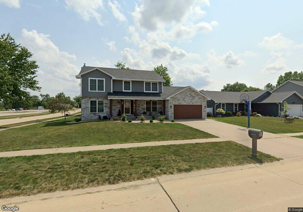
1005 Milstead Dr Hiawatha, IA 52233
Estimated Value: $367,000 - $382,000
4
Beds
5
Baths
2,290
Sq Ft
$162/Sq Ft
Est. Value
About This Home
This home is located at 1005 Milstead Dr, Hiawatha, IA 52233 and is currently estimated at $371,344, approximately $162 per square foot. 1005 Milstead Dr is a home located in Linn County with nearby schools including Hiawatha Elementary School, Harding Middle School, and John F. Kennedy High School.
Ownership History
Date
Name
Owned For
Owner Type
Purchase Details
Closed on
Mar 1, 2006
Sold by
Hutcheson Todd E and Hutcheson Cindy L
Bought by
Hagge Michael D and Goedken Rhinda J
Current Estimated Value
Home Financials for this Owner
Home Financials are based on the most recent Mortgage that was taken out on this home.
Original Mortgage
$168,000
Outstanding Balance
$96,120
Interest Rate
6.38%
Mortgage Type
Fannie Mae Freddie Mac
Estimated Equity
$275,224
Create a Home Valuation Report for This Property
The Home Valuation Report is an in-depth analysis detailing your home's value as well as a comparison with similar homes in the area
Home Values in the Area
Average Home Value in this Area
Purchase History
| Date | Buyer | Sale Price | Title Company |
|---|---|---|---|
| Hagge Michael D | $217,500 | None Available |
Source: Public Records
Mortgage History
| Date | Status | Borrower | Loan Amount |
|---|---|---|---|
| Open | Hagge Michael D | $168,000 |
Source: Public Records
Tax History Compared to Growth
Tax History
| Year | Tax Paid | Tax Assessment Tax Assessment Total Assessment is a certain percentage of the fair market value that is determined by local assessors to be the total taxable value of land and additions on the property. | Land | Improvement |
|---|---|---|---|---|
| 2025 | $5,822 | $393,200 | $42,500 | $350,700 |
| 2024 | $5,288 | $400,000 | $42,500 | $357,500 |
| 2023 | $5,288 | $364,700 | $42,500 | $322,200 |
| 2022 | $5,222 | $269,700 | $42,500 | $227,200 |
| 2021 | $5,508 | $269,700 | $42,500 | $227,200 |
| 2020 | $5,508 | $265,600 | $42,500 | $223,100 |
| 2019 | $4,938 | $240,100 | $37,800 | $202,300 |
| 2018 | $4,848 | $240,100 | $37,800 | $202,300 |
| 2017 | $4,856 | $227,400 | $37,800 | $189,600 |
| 2016 | $4,856 | $227,400 | $37,800 | $189,600 |
| 2015 | $4,868 | $227,400 | $37,800 | $189,600 |
| 2014 | $4,682 | $227,400 | $37,800 | $189,600 |
| 2013 | $4,554 | $227,400 | $37,800 | $189,600 |
Source: Public Records
Map
Nearby Homes
- 1026 Eisenhower Rd
- 40 11th Ave
- 306 10th Ave
- 1284 Rainbow Blvd
- 1364 Cress Pkwy
- 1213 Raney St
- 1213 Bowler St
- 3 N Center Point Rd
- 1 N Center Point Rd
- 2838 Anne Dr
- 2596 Anne Ln
- 250 N 16th Ave
- 5455 Blairs Ferry Rd NE
- 114 Northwood Dr
- 115 N 18th Ave
- 780 Ryan Ave
- 2131 Blairs Ferry Rd NE
- 109 E Willman St
- 402 Cimarron Dr Unit 402
- 1816 Emmy Ln
- 1015 Milstead Dr
- 1000 Lyndhurst Dr
- 1025 Milstead Dr
- 1010 Lyndhurst Dr
- 1008 Lyndhurst Dr
- 1020 Lyndhurst Dr
- 1031 Milstead Dr
- 1000 Milstead Dr
- 1010 Milstead Dr
- 1028 Lyndhurst Dr
- 1020 Milstead Dr
- 1037 Milstead Dr
- 1028 Milstead Dr
- 1005 Lyndhurst Dr
- 1034 Lyndhurst Dr
- 1015 Lyndhurst Dr
- 1025 Lyndhurst Dr
- 1034 Milstead Dr
- 1041 Milstead Dr
- 1031 Lyndhurst Dr