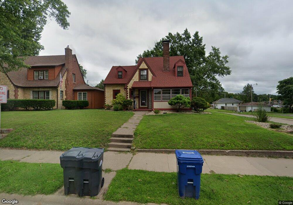
1005 N 2nd St Clinton, IA 52732
Estimated Value: $137,000 - $149,092
3
Beds
2
Baths
1,636
Sq Ft
$88/Sq Ft
Est. Value
About This Home
This home is located at 1005 N 2nd St, Clinton, IA 52732 and is currently estimated at $144,023, approximately $88 per square foot. 1005 N 2nd St is a home located in Clinton County with nearby schools including Whittier Elementary School, Clinton Middle School, and Clinton High School.
Ownership History
Date
Name
Owned For
Owner Type
Purchase Details
Closed on
May 30, 2025
Sold by
Bradour Stacy M and Rickerl Christopher
Bought by
Dickau Tricia L
Current Estimated Value
Home Financials for this Owner
Home Financials are based on the most recent Mortgage that was taken out on this home.
Original Mortgage
$145,319
Outstanding Balance
$144,947
Interest Rate
6.83%
Mortgage Type
FHA
Estimated Equity
-$924
Purchase Details
Closed on
Jul 21, 2006
Sold by
Nissen Michael D
Bought by
Bradour Stacy M
Home Financials for this Owner
Home Financials are based on the most recent Mortgage that was taken out on this home.
Original Mortgage
$65,900
Interest Rate
6.82%
Mortgage Type
New Conventional
Create a Home Valuation Report for This Property
The Home Valuation Report is an in-depth analysis detailing your home's value as well as a comparison with similar homes in the area
Home Values in the Area
Average Home Value in this Area
Purchase History
| Date | Buyer | Sale Price | Title Company |
|---|---|---|---|
| Dickau Tricia L | $148,000 | None Listed On Document | |
| Bradour Stacy M | $71,000 | None Available |
Source: Public Records
Mortgage History
| Date | Status | Borrower | Loan Amount |
|---|---|---|---|
| Open | Dickau Tricia L | $145,319 | |
| Previous Owner | Bradour Stacy M | $65,900 |
Source: Public Records
Tax History Compared to Growth
Tax History
| Year | Tax Paid | Tax Assessment Tax Assessment Total Assessment is a certain percentage of the fair market value that is determined by local assessors to be the total taxable value of land and additions on the property. | Land | Improvement |
|---|---|---|---|---|
| 2024 | $2,060 | $120,870 | $15,680 | $105,190 |
| 2023 | $2,026 | $120,870 | $15,680 | $105,190 |
| 2022 | $1,620 | $83,068 | $9,405 | $73,663 |
| 2021 | $1,720 | $83,068 | $9,405 | $73,663 |
| 2020 | $1,720 | $83,068 | $9,405 | $73,663 |
| 2019 | $1,776 | $83,068 | $0 | $0 |
| 2018 | $1,726 | $83,068 | $0 | $0 |
| 2017 | $1,780 | $83,068 | $0 | $0 |
| 2016 | $1,718 | $83,068 | $0 | $0 |
| 2015 | $1,718 | $83,068 | $0 | $0 |
| 2014 | $1,724 | $83,068 | $0 | $0 |
| 2013 | -- | $0 | $0 | $0 |
Source: Public Records
Map
Nearby Homes
- 1013 N 2nd St
- 923 Pershing Blvd
- 1022 Pershing Blvd
- 924 N 3rd St
- 828 Park Place
- 704 N 3rd St
- 728 Park Place
- 1423 Pershing Blvd
- 348 6th Ave N
- 620 N 4th St
- 700 N Bluff Blvd
- 1022 Hickory Hill Ct
- 1522 N 4th St
- 515 Woodland Dr
- 582 Breezy Point Dr
- 504 6th Ave N
- 510 6th Ave N
- 320 16th Ave N
- 591 Breezy Point Dr
- 312 N 3rd St
- 1017 N 2nd St
- 1015 N 2nd St
- 1011 N 2nd St
- 1001 N 2nd St
- 1004 N 2nd St
- 1023 N 2nd St
- 927 N 2nd St
- 104 10th Ave N
- 1012 Roosevelt St
- 215 10th Ave N
- 217 10th Ave N
- 101 10th Ave N
- 1001 Pershing Blvd
- 111 11th Ave N
- 1022 Roosevelt St
- 1018 Roosevelt St
- 1001 Roosevelt St
- 1011 Pershing Blvd
- 1007 Pershing Blvd
- 1015 Pershing Blvd