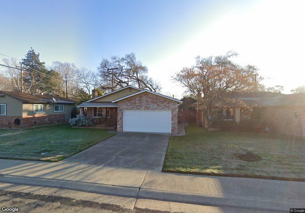
1005 Poplar Ave West Sacramento, CA 95691
South West Capitol to 80 NeighborhoodEstimated Value: $272,000 - $497,000
3
Beds
1
Bath
1,494
Sq Ft
$279/Sq Ft
Est. Value
About This Home
This home is located at 1005 Poplar Ave, West Sacramento, CA 95691 and is currently estimated at $416,288, approximately $278 per square foot. 1005 Poplar Ave is a home located in Yolo County with nearby schools including Westmore Oaks Elementary School, River City High, and Sacramento Valley Charter School.
Ownership History
Date
Name
Owned For
Owner Type
Purchase Details
Closed on
Jun 13, 2024
Sold by
Moore Phyllis
Bought by
Phyllis Irene Moore Living Trust and Moore
Current Estimated Value
Purchase Details
Closed on
Mar 16, 2005
Sold by
Moore John and Moore Phyllis
Bought by
Moore John and Moore Phyllis
Home Financials for this Owner
Home Financials are based on the most recent Mortgage that was taken out on this home.
Original Mortgage
$16,000
Interest Rate
5.53%
Mortgage Type
Credit Line Revolving
Create a Home Valuation Report for This Property
The Home Valuation Report is an in-depth analysis detailing your home's value as well as a comparison with similar homes in the area
Home Values in the Area
Average Home Value in this Area
Purchase History
| Date | Buyer | Sale Price | Title Company |
|---|---|---|---|
| Phyllis Irene Moore Living Trust | -- | None Listed On Document | |
| Moore John | -- | Title Court |
Source: Public Records
Mortgage History
| Date | Status | Borrower | Loan Amount |
|---|---|---|---|
| Previous Owner | Moore John | $16,000 |
Source: Public Records
Tax History Compared to Growth
Tax History
| Year | Tax Paid | Tax Assessment Tax Assessment Total Assessment is a certain percentage of the fair market value that is determined by local assessors to be the total taxable value of land and additions on the property. | Land | Improvement |
|---|---|---|---|---|
| 2025 | $996 | $79,363 | $13,129 | $66,234 |
| 2023 | $996 | $76,283 | $12,620 | $63,663 |
| 2022 | $930 | $74,788 | $12,373 | $62,415 |
| 2021 | $920 | $73,323 | $12,131 | $61,192 |
| 2020 | $879 | $72,572 | $12,007 | $60,565 |
| 2019 | $866 | $71,150 | $11,772 | $59,378 |
| 2018 | $849 | $69,756 | $11,542 | $58,214 |
| 2017 | $838 | $68,389 | $11,316 | $57,073 |
| 2016 | $825 | $67,049 | $11,095 | $55,954 |
| 2015 | $740 | $66,043 | $10,929 | $55,114 |
| 2014 | $740 | $64,750 | $10,715 | $54,035 |
Source: Public Records
Map
Nearby Homes
- 1908 Proctor Ave
- 1925 Willow Ave
- 1021 Sycamore Ave
- 1832 Rockrose Rd
- 1716 Rockrose Rd
- 830 Pecan St
- 2012 Michigan Blvd
- 528 Chaparral Way
- 431 Poplar Ave
- 1712 Ferndale Cir
- 417 Westacre Rd Unit 22
- 417 Westacre Rd Unit 2
- 710 Glide Ave Unit 66
- 785 Dolomite Ct
- 788 Pearlite Ct
- 1549 Virginia Ave
- 1050 W Capitol Ave Unit 10
- 1050 W Capitol Ave Unit 33
- 1826 Maryland Ave
- 839 Graphite Ln
- 1009 Poplar Ave
- 1001 Poplar Ave
- 1013 Poplar Ave
- 1017 Poplar Ave
- 1004 Poplar Ave
- 1000 Poplar Ave
- 1008 Poplar Ave
- 1828 Evergreen Ave
- 1012 Poplar Ave
- 1824 Evergreen Ave
- 1021 Poplar Ave
- 1820 Evergreen Ave
- 1900 Evergreen Ave
- 1016 Poplar Ave
- 1005 Balsam St
- 1816 Evergreen Ave
- 1009 Balsam St
- 1909 Evergreen Ave
- 1904 Evergreen Ave
- 1013 Balsam St