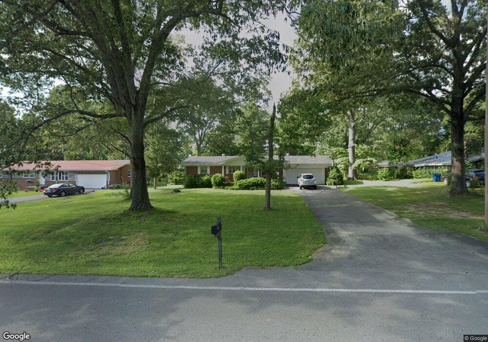
1005 Royal Trail Manchester, TN 37355
Estimated Value: $210,120 - $261,000
--
Bed
2
Baths
1,188
Sq Ft
$205/Sq Ft
Est. Value
About This Home
This home is located at 1005 Royal Trail, Manchester, TN 37355 and is currently estimated at $243,530, approximately $204 per square foot. 1005 Royal Trail is a home located in Coffee County with nearby schools including Westwood Middle School and Temple Baptist Christian School.
Ownership History
Date
Name
Owned For
Owner Type
Purchase Details
Closed on
May 23, 2025
Sold by
Hart Ellen and Briggs Thurston
Bought by
Briggs Ellen and Hill Jamie T
Current Estimated Value
Home Financials for this Owner
Home Financials are based on the most recent Mortgage that was taken out on this home.
Original Mortgage
$100,000
Outstanding Balance
$99,658
Interest Rate
6.83%
Mortgage Type
New Conventional
Estimated Equity
$143,872
Purchase Details
Closed on
Feb 13, 2009
Sold by
Hart Matthew
Bought by
Briggs Thurston
Purchase Details
Closed on
Nov 22, 2006
Sold by
Jernigan Steve
Bought by
Hart Matthew
Purchase Details
Closed on
Mar 2, 2006
Sold by
Prince Daniel N
Bought by
Jernigan Steve
Purchase Details
Closed on
Aug 13, 2003
Sold by
Welborn Jack C and Welborn Carolyn P
Bought by
Prince Daniel N and Prince Erin N
Create a Home Valuation Report for This Property
The Home Valuation Report is an in-depth analysis detailing your home's value as well as a comparison with similar homes in the area
Home Values in the Area
Average Home Value in this Area
Purchase History
| Date | Buyer | Sale Price | Title Company |
|---|---|---|---|
| Briggs Ellen | -- | None Listed On Document | |
| Briggs Ellen | -- | None Listed On Document | |
| Briggs Thurston | -- | -- | |
| Hart Matthew | $97,000 | -- | |
| Jernigan Steve | $97,000 | -- | |
| Prince Daniel N | $90,500 | -- |
Source: Public Records
Mortgage History
| Date | Status | Borrower | Loan Amount |
|---|---|---|---|
| Open | Briggs Ellen | $100,000 | |
| Closed | Briggs Ellen | $100,000 | |
| Previous Owner | Prince Daniel N | $77,600 | |
| Previous Owner | Prince Daniel N | $19,400 |
Source: Public Records
Tax History Compared to Growth
Tax History
| Year | Tax Paid | Tax Assessment Tax Assessment Total Assessment is a certain percentage of the fair market value that is determined by local assessors to be the total taxable value of land and additions on the property. | Land | Improvement |
|---|---|---|---|---|
| 2024 | $1,372 | $32,525 | $5,000 | $27,525 |
| 2023 | $1,372 | $32,525 | $0 | $0 |
| 2022 | $1,181 | $32,525 | $5,000 | $27,525 |
| 2021 | $1,107 | $24,175 | $3,000 | $21,175 |
| 2020 | $1,107 | $24,175 | $3,000 | $21,175 |
| 2019 | $1,107 | $24,175 | $3,000 | $21,175 |
| 2018 | $1,107 | $24,175 | $3,000 | $21,175 |
| 2017 | $1,205 | $22,975 | $3,000 | $19,975 |
| 2016 | $1,205 | $22,975 | $3,000 | $19,975 |
| 2015 | $1,205 | $22,975 | $3,000 | $19,975 |
| 2014 | $1,205 | $22,977 | $0 | $0 |
Source: Public Records
Map
Nearby Homes
- 905 Royal Trail
- 1203 Edgewood Dr
- 1306 Mcmahan St
- 1003 Kennedy Dr
- 112 Reynard St
- 142 Heritage Cir
- 422 Heritage Cir
- 355 W Doak Rd
- 121 Regalwood Dr
- 1550 S Spring St
- 195 Hamilton Ct
- 0 Forrestwood Dr
- 23 Regalwood Dr
- 1841 Hills Chapel Rd
- Lot 51 Philips
- 1619 Hills Chapel Rd
- 1212 Woodcrest Dr
- 2674 New Tullahoma Hwy
- 12 Fox Creek Ct
- 1221 Hillcrest Dr
- 1003 Royal Trail
- 1007 Royal Trail
- 1104 Shady Ln
- 1001 Royal Trail
- 1102 Shady Ln
- 1106 Shady Ln
- 1009 Royal Trail
- 1006 Royal Trail
- 1011 Royal Trail
- 1002 Royal Trail
- 1100 Shady Ln
- 1200 Shady Ln
- 0 2nd Ave
- 1000 Royal Trail
- 7408 Shady Grove Rd
- 1008 Royal Trail
- 120 Timber Cir
- 117 Timber Cir
- 105 Timber Cir
- 106 Timber Cir