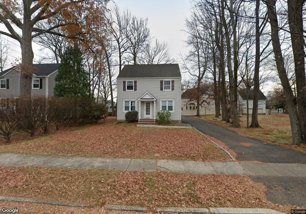
1005 South Ave W Westfield, NJ 07090
Estimated Value: $672,000 - $896,000
2
Beds
1
Bath
1,624
Sq Ft
$476/Sq Ft
Est. Value
About This Home
This home is located at 1005 South Ave W, Westfield, NJ 07090 and is currently estimated at $772,653, approximately $475 per square foot. 1005 South Ave W is a home located in Union County with nearby schools including McKinley Elementary School, Edison Intermediate School, and Westfield Senior High School.
Ownership History
Date
Name
Owned For
Owner Type
Purchase Details
Closed on
Jan 25, 2001
Sold by
Mastrocola Michael and Mastrocola Lynn K
Bought by
Mastrocola Michael and Mastrocola Lynn
Current Estimated Value
Purchase Details
Closed on
Apr 22, 1997
Sold by
Feygin Anatol and Feygin Kim
Bought by
Mastrocola Michael and Mastrocola Lynn K
Home Financials for this Owner
Home Financials are based on the most recent Mortgage that was taken out on this home.
Original Mortgage
$130,000
Interest Rate
6.5%
Create a Home Valuation Report for This Property
The Home Valuation Report is an in-depth analysis detailing your home's value as well as a comparison with similar homes in the area
Home Values in the Area
Average Home Value in this Area
Purchase History
| Date | Buyer | Sale Price | Title Company |
|---|---|---|---|
| Mastrocola Michael | -- | -- | |
| Mastrocola Michael | $190,000 | -- |
Source: Public Records
Mortgage History
| Date | Status | Borrower | Loan Amount |
|---|---|---|---|
| Closed | Mastrocola Michael | $130,000 |
Source: Public Records
Tax History Compared to Growth
Tax History
| Year | Tax Paid | Tax Assessment Tax Assessment Total Assessment is a certain percentage of the fair market value that is determined by local assessors to be the total taxable value of land and additions on the property. | Land | Improvement |
|---|---|---|---|---|
| 2025 | $10,089 | $448,000 | $243,200 | $204,800 |
| 2024 | $9,883 | $448,000 | $243,200 | $204,800 |
| 2023 | $9,883 | $448,000 | $243,200 | $204,800 |
| 2022 | $9,672 | $448,000 | $243,200 | $204,800 |
| 2021 | $9,690 | $448,000 | $243,200 | $204,800 |
| 2020 | $9,668 | $448,000 | $243,200 | $204,800 |
| 2019 | $9,632 | $448,000 | $243,200 | $204,800 |
| 2018 | $10,850 | $116,700 | $35,800 | $80,900 |
| 2017 | $10,790 | $116,700 | $35,800 | $80,900 |
| 2016 | $10,537 | $116,700 | $35,800 | $80,900 |
| 2015 | $10,327 | $116,700 | $35,800 | $80,900 |
| 2014 | $9,986 | $116,700 | $35,800 | $80,900 |
Source: Public Records
Map
Nearby Homes
- 554 Hort St
- 350 W Dudley Ave
- 119 N Scotch Plains Ave
- 654 North Ave W
- 524 Edgar Rd
- 410 Edgar Rd
- 517 Clark St
- 650 Coleman Place
- 126 Ludlow Place
- 119 Lamberts Mill Rd
- 2314 Longfellow Ave
- 2154 W Broad St
- 515 Trinity Place Unit 3FN
- 260 Prospect St Unit C12
- 614 Dorian Rd
- 2212 Shady Ln
- 2087 Meadowview Rd
- 234 Seneca Place
- 143 Stanmore Place
- 840 Dorian Rd
- 1009 South Ave W
- 945 South Ave W
- 1011 South Ave W
- 428 Palsted Ave
- 941 South Ave W
- 420 Palsted Ave
- 1017 South Ave W
- 937 South Ave W
- 937 South Ave W Unit 1
- 937 South Ave W Unit 2
- 416 Palsted Ave
- 412 Palsted Ave
- 940 South Ave W Unit C
- 940 South Ave W
- 933 South Ave W
- 1008 South Ave W
- 602 Roosevelt St
- 1016 South Ave W
- 601 Roosevelt St
- 544 Hort St