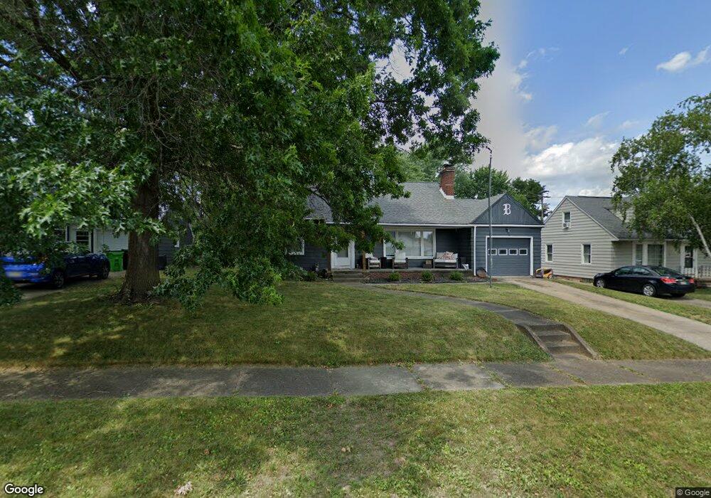
1005 Vincent Blvd Alliance, OH 44601
Estimated Value: $157,638 - $179,000
2
Beds
1
Bath
1,653
Sq Ft
$100/Sq Ft
Est. Value
About This Home
This home is located at 1005 Vincent Blvd, Alliance, OH 44601 and is currently estimated at $165,160, approximately $99 per square foot. 1005 Vincent Blvd is a home located in Stark County with nearby schools including Alliance Early Learning School, Alliance Intermediate School at Northside, and Alliance Middle School.
Ownership History
Date
Name
Owned For
Owner Type
Purchase Details
Closed on
Apr 4, 2024
Sold by
Bolog Frank A
Bought by
Bolog Frank B and Bolog Ben
Current Estimated Value
Purchase Details
Closed on
Nov 28, 2000
Sold by
Smithyman Jane L and Smithyman Jane I
Bought by
Bolog Frank A
Home Financials for this Owner
Home Financials are based on the most recent Mortgage that was taken out on this home.
Original Mortgage
$60,800
Interest Rate
7.86%
Mortgage Type
Purchase Money Mortgage
Create a Home Valuation Report for This Property
The Home Valuation Report is an in-depth analysis detailing your home's value as well as a comparison with similar homes in the area
Home Values in the Area
Average Home Value in this Area
Purchase History
| Date | Buyer | Sale Price | Title Company |
|---|---|---|---|
| Bolog Frank B | -- | None Listed On Document | |
| Bolog Frank B | -- | None Listed On Document | |
| Bolog Frank A | $76,000 | -- |
Source: Public Records
Mortgage History
| Date | Status | Borrower | Loan Amount |
|---|---|---|---|
| Previous Owner | Bolog Frank A | $60,800 |
Source: Public Records
Tax History
| Year | Tax Paid | Tax Assessment Tax Assessment Total Assessment is a certain percentage of the fair market value that is determined by local assessors to be the total taxable value of land and additions on the property. | Land | Improvement |
|---|---|---|---|---|
| 2025 | $2,703 | $41,480 | $12,570 | $28,910 |
| 2024 | $883 | $41,480 | $12,570 | $28,910 |
| 2023 | $1,643 | $38,010 | $11,060 | $26,950 |
| 2022 | $1,575 | $38,010 | $11,060 | $26,950 |
| 2021 | $1,579 | $38,010 | $11,060 | $26,950 |
| 2020 | $1,477 | $33,220 | $9,590 | $23,630 |
| 2019 | $1,458 | $33,220 | $9,590 | $23,630 |
Source: Public Records
Map
Nearby Homes
- 1539 Parkway Blvd
- 864 W College Rd
- 1016 Roseland Rd
- 1534 Fernwood Blvd
- 720 Vincent Blvd
- 1156 Parkside Dr
- 1718 Fernwood Blvd
- 1310 Overlook Dr
- 1044 Glamorgan St
- 1114 Briarcliff Ave
- 0 Federal Ave
- 1601 Raywood Rd
- 2120 Blenheim Ave
- 664 Fairview Place
- 203 Glamorgan St
- 1235 Spring Ridge Cir Unit 17A
- 2580 Edgewood Ave
- 535 S Mckinley Ave
- 2625 Belleflower Dr
- 621 S Haines Ave
- 991 Vincent Blvd
- 1019 Vincent Blvd
- 1015 Vincent Blvd
- 979 Vincent Blvd
- 1029 Vincent Blvd
- 998 Cornell Dr
- 1014 Cornell Dr
- 978 Cornell Dr
- 1022 Cornell Dr
- 1008 Vincent Blvd
- 998 Vincent Blvd
- 967 Vincent Blvd
- 1039 Vincent Blvd
- 1018 Vincent Blvd
- 968 Cornell Dr
- 984 Vincent Blvd
- 1028 Vincent Blvd
- 972 Vincent Blvd
- 1049 Vincent Blvd
- 1042 Cornell Dr
Your Personal Tour Guide
Ask me questions while you tour the home.