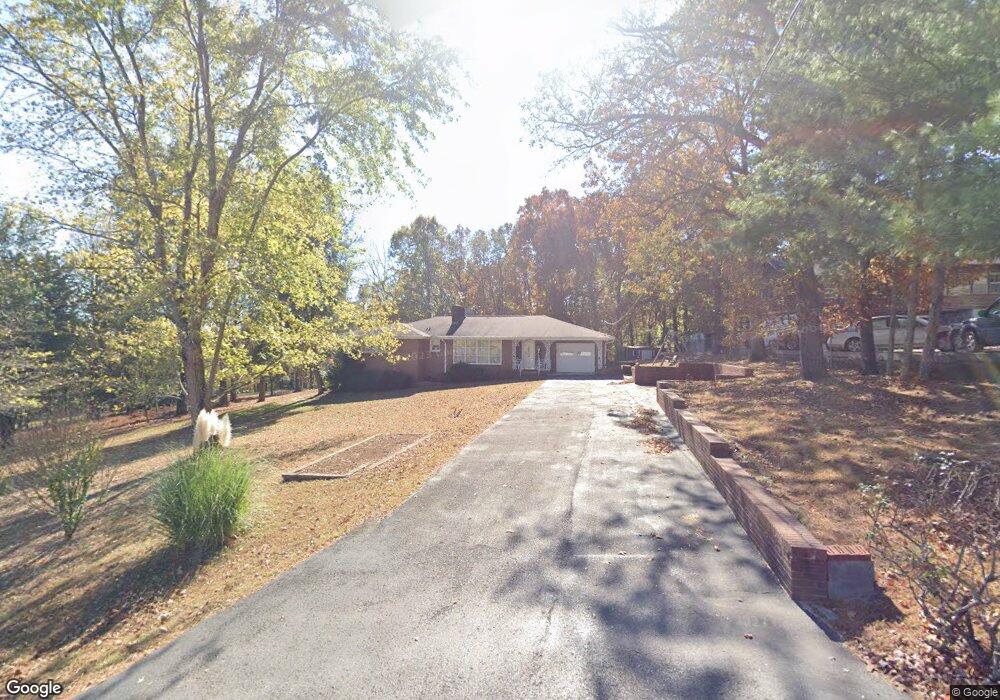
10050 Forrest Dr Ooltewah, TN 37363
Estimated Value: $388,288 - $402,000
--
Bed
--
Bath
2,439
Sq Ft
$162/Sq Ft
Est. Value
About This Home
This home is located at 10050 Forrest Dr, Ooltewah, TN 37363 and is currently estimated at $394,822, approximately $161 per square foot. 10050 Forrest Dr is a home located in Hamilton County with nearby schools including Apison Elementary School, Ooltewah Middle School, and Ooltewah High School.
Ownership History
Date
Name
Owned For
Owner Type
Purchase Details
Closed on
Oct 7, 2025
Sold by
Winters David R and Winters Judith B
Bought by
Koorenny Robert E and Koorenny Sara N
Current Estimated Value
Home Financials for this Owner
Home Financials are based on the most recent Mortgage that was taken out on this home.
Original Mortgage
$315,200
Outstanding Balance
$315,200
Interest Rate
5.5%
Mortgage Type
New Conventional
Estimated Equity
$79,622
Purchase Details
Closed on
Apr 4, 2024
Sold by
Raymond H Brodersen Living Trust and Brodersen Helen Marie
Bought by
Winters David and Winters Judith V
Purchase Details
Closed on
May 3, 2002
Sold by
Brodersen Raymond H and Brodersen Emma J
Bought by
Brodersen Raymond H and Brodersen Ellen H
Purchase Details
Closed on
Apr 3, 2000
Sold by
Brodersen Raymond H
Bought by
Brodersen Raymond H and Winters Judith Ann
Create a Home Valuation Report for This Property
The Home Valuation Report is an in-depth analysis detailing your home's value as well as a comparison with similar homes in the area
Home Values in the Area
Average Home Value in this Area
Purchase History
| Date | Buyer | Sale Price | Title Company |
|---|---|---|---|
| Koorenny Robert E | $394,000 | Title Guaranty & Trust | |
| Winters David | -- | None Listed On Document | |
| Brodersen Helen Marie | -- | None Listed On Document | |
| Brodersen Raymond H | -- | -- | |
| Brodersen Raymond H | -- | Title Escrow Chattanooga Inc |
Source: Public Records
Mortgage History
| Date | Status | Borrower | Loan Amount |
|---|---|---|---|
| Open | Koorenny Robert E | $315,200 |
Source: Public Records
Tax History Compared to Growth
Tax History
| Year | Tax Paid | Tax Assessment Tax Assessment Total Assessment is a certain percentage of the fair market value that is determined by local assessors to be the total taxable value of land and additions on the property. | Land | Improvement |
|---|---|---|---|---|
| 2024 | $1,077 | $48,125 | $0 | $0 |
| 2023 | $2,111 | $55,500 | $0 | $0 |
| 2022 | $2,022 | $55,500 | $0 | $0 |
| 2021 | $2,022 | $55,500 | $0 | $0 |
| 2020 | $2,026 | $45,675 | $0 | $0 |
| 2019 | $2,026 | $45,675 | $0 | $0 |
| 2018 | $1,847 | $45,675 | $0 | $0 |
| 2017 | $1,847 | $45,675 | $0 | $0 |
| 2016 | $1,801 | $0 | $0 | $0 |
| 2015 | $1,801 | $43,325 | $0 | $0 |
| 2014 | $1,801 | $0 | $0 | $0 |
Source: Public Records
Map
Nearby Homes
- 4363 University Dr
- 4094 University Dr
- 10035 Shagbark Trail
- 0 Bowen Trail Unit 19102809
- 9677 Bowen Trail
- 9230 White Ash Dr
- 3911 Darbo Ln
- 4988 Saginaw Ln
- 4973 Saginaw Ln
- 9795 Trestle Cir
- 9888 Trestle Cir
- 9892 Trestle Cir
- 9877 Trestle Cir
- 9885 Trestle Cir
- 9891 Trestle Cir
- 4073 Barnsley Loop
- 4067 Barnsley Loop
- 4053 Barnsley Loop
- 9614 Mulberry Gap Way
- 4129 Barnsley Loop
- 4734 Forest Dr
- 4730 Forest Dr
- 4738 Forest Dr
- 4715 Forest Dr
- 56 Forest Dr
- 4705 Forest Dr
- 4704 Forest Dr
- 4207 Forest Dr
- 10058 Forest Dr
- 10058 Forrest Dr
- 10046 Forrest Dr
- 10051 Forrest Dr
- 10051 Forest Dr
- 10042 Forrest Dr
- 10047 Forrest Dr
- 4099 University Dr
- 4115 University Dr
- 10039 Forrest Dr
- 10043 Forrest Dr
- 4369 University Dr