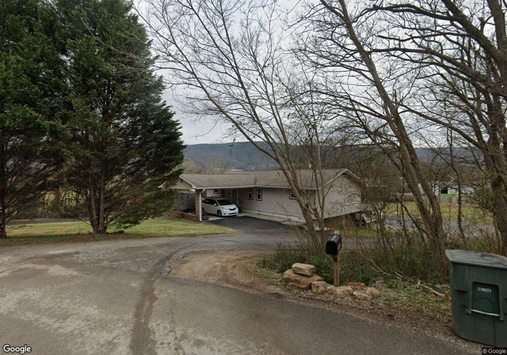
10059 Miller Rd Soddy Daisy, TN 37379
Estimated Value: $248,000 - $313,075
3
Beds
3
Baths
1,701
Sq Ft
$169/Sq Ft
Est. Value
About This Home
This home is located at 10059 Miller Rd, Soddy Daisy, TN 37379 and is currently estimated at $286,769, approximately $168 per square foot. 10059 Miller Rd is a home located in Hamilton County with nearby schools including Ivy Academy Inc and New South Daisy Christian Academy.
Ownership History
Date
Name
Owned For
Owner Type
Purchase Details
Closed on
Jul 8, 2009
Sold by
Wells Fargo
Bought by
Brown Derek H
Current Estimated Value
Home Financials for this Owner
Home Financials are based on the most recent Mortgage that was taken out on this home.
Original Mortgage
$85,500
Outstanding Balance
$54,571
Interest Rate
4.88%
Mortgage Type
New Conventional
Estimated Equity
$232,198
Purchase Details
Closed on
Mar 12, 2009
Sold by
Lawrence David Wayne and Lawrence Tammi Gwen
Bought by
Wells Fargo and Norwest Bank Of Minnesota National Assoc
Purchase Details
Closed on
Dec 3, 1999
Sold by
Frizzell Carl Eugene and Frizzell Margaret Faye
Bought by
Frizzell Carla D
Purchase Details
Closed on
Dec 15, 1997
Sold by
Skiles Clyde E and Skiles Wanda J
Bought by
Lawrence David Wayne and Lawrence Tammi Gwen
Home Financials for this Owner
Home Financials are based on the most recent Mortgage that was taken out on this home.
Original Mortgage
$96,300
Interest Rate
7.23%
Mortgage Type
Balloon
Create a Home Valuation Report for This Property
The Home Valuation Report is an in-depth analysis detailing your home's value as well as a comparison with similar homes in the area
Home Values in the Area
Average Home Value in this Area
Purchase History
| Date | Buyer | Sale Price | Title Company |
|---|---|---|---|
| Brown Derek H | $95,000 | None Available | |
| Wells Fargo | $116,032 | None Available | |
| Frizzell Carla D | -- | -- | |
| Lawrence David Wayne | $90,000 | -- |
Source: Public Records
Mortgage History
| Date | Status | Borrower | Loan Amount |
|---|---|---|---|
| Open | Brown Derek H | $85,500 | |
| Previous Owner | Lawrence David Wayne | $96,300 | |
| Closed | Lawrence David Wayne | $10,700 |
Source: Public Records
Tax History Compared to Growth
Tax History
| Year | Tax Paid | Tax Assessment Tax Assessment Total Assessment is a certain percentage of the fair market value that is determined by local assessors to be the total taxable value of land and additions on the property. | Land | Improvement |
|---|---|---|---|---|
| 2024 | $898 | $40,150 | $0 | $0 |
| 2023 | $1,355 | $40,150 | $0 | $0 |
| 2022 | $1,355 | $40,150 | $0 | $0 |
| 2021 | $1,355 | $40,150 | $0 | $0 |
| 2020 | $1,371 | $33,075 | $0 | $0 |
| 2019 | $1,371 | $33,075 | $0 | $0 |
| 2018 | $1,371 | $33,075 | $0 | $0 |
| 2017 | $1,371 | $33,075 | $0 | $0 |
| 2016 | $1,341 | $0 | $0 | $0 |
| 2015 | $1,341 | $32,350 | $0 | $0 |
| 2014 | $1,341 | $0 | $0 | $0 |
Source: Public Records
Map
Nearby Homes
- 10206 Card Rd
- 9839 Walnut St
- 10280 Card Rd
- 874 Ponderosa Dr
- 698 Green Pond Rd
- 10192 Big Pine Ln
- 110 Mountain View Dr
- 110 Mountainview Dr
- 9885 Lovell Rd
- 9851 Millsaps St
- 0 Lovell Rd Unit 1523036
- 623 Sunset Valley Dr
- 9811 Lovell Rd
- 168 Turner Rd
- 9693 W Ridge Trail Rd
- 9606 Shooting Star Cir
- 9709 Lovell Rd
- 9607 Barbee Rd Unit 87
- 9443 Harris St
- 201 Northern Trails Dr
- 10070 Miller Rd
- 10053 Miller Rd
- 10049 Miller Rd
- 10105 Miller Rd
- 9995 Miller Rd
- 628 Neighbors Dr
- 10109 Miller Rd
- 624 Neighbors Dr
- 627 Neighbors Dr
- 10030 Miller Rd
- 622 Neighbors Dr Unit 2
- 623 Neighbors Dr
- 505 Neighbors Dr
- 618 Neighbors Dr
- 621 Neighbors Dr
- 509 Neighbors Dr
- 616 Neighbors Dr
- 0 Neighbors Dr Unit 1031626
- 0 Neighbors Dr
- 617 Neighbors Dr