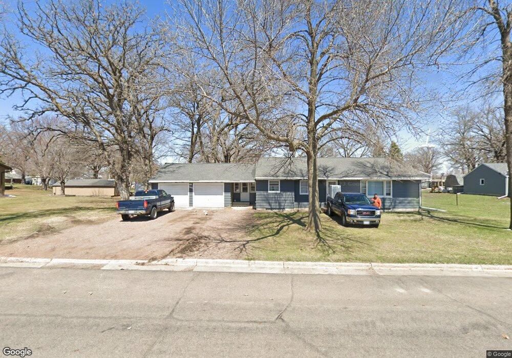
1006 Division St Brownton, MN 55312
Estimated Value: $212,000 - $250,000
3
Beds
2
Baths
1,230
Sq Ft
$186/Sq Ft
Est. Value
About This Home
This home is located at 1006 Division St, Brownton, MN 55312 and is currently estimated at $228,838, approximately $186 per square foot. 1006 Division St is a home with nearby schools including Lincoln Elementary School, Lakeside Elementary School, and Glencoe-Silver Lake Jr. High School.
Ownership History
Date
Name
Owned For
Owner Type
Purchase Details
Closed on
Dec 20, 2013
Sold by
Winterfeldt Martin Martin
Bought by
Spaude Jesse Jesse
Current Estimated Value
Purchase Details
Closed on
Nov 24, 2010
Sold by
Winterfeldt Aaron K and Winterfeldt Aaron Karl
Bought by
Winterfeldt Aaron K and Aaron K Winterfeldt Trust
Purchase Details
Closed on
Dec 3, 2008
Sold by
Winterfeldt Christina M and Winterfeldt Christina Marie
Bought by
Winterfeldt Aaron Karl
Create a Home Valuation Report for This Property
The Home Valuation Report is an in-depth analysis detailing your home's value as well as a comparison with similar homes in the area
Home Values in the Area
Average Home Value in this Area
Purchase History
| Date | Buyer | Sale Price | Title Company |
|---|---|---|---|
| Spaude Jesse Jesse | $42,000 | -- | |
| Winterfeldt Aaron K | -- | -- | |
| Winterfeldt Aaron Karl | -- | -- |
Source: Public Records
Tax History Compared to Growth
Tax History
| Year | Tax Paid | Tax Assessment Tax Assessment Total Assessment is a certain percentage of the fair market value that is determined by local assessors to be the total taxable value of land and additions on the property. | Land | Improvement |
|---|---|---|---|---|
| 2024 | $2,630 | $158,100 | $44,200 | $113,900 |
| 2023 | $2,430 | $158,100 | $44,200 | $113,900 |
| 2022 | $2,350 | $135,000 | $38,400 | $96,600 |
| 2021 | $2,390 | $117,600 | $33,500 | $84,100 |
| 2020 | $2,486 | $117,600 | $33,500 | $84,100 |
| 2019 | $1,782 | $112,400 | $30,500 | $81,900 |
| 2018 | $1,848 | $0 | $0 | $0 |
| 2017 | $1,588 | $0 | $0 | $0 |
| 2016 | $1,528 | $0 | $0 | $0 |
| 2015 | $1,388 | $0 | $0 | $0 |
| 2014 | -- | $0 | $0 | $0 |
Source: Public Records
Map
Nearby Homes
- 752 2nd St N
- 531 2nd St N
- 221 3rd Ave S
- 237 5th St N
- 7612 Plum Ave
- 122 2nd Ave S
- xxx Lot 3 Division St W
- 304 1st Ave N
- Lot 2 U S Highway 212
- XXX US Hwy 212
- xxx Lot 2 Us Hwy 212
- 16452 90th St
- 11742 Sunset Cir
- 11655 Sunset Cir
- 7900 Lace Ave
- 7900 Lace Ave N
- 13198 100th St
- 15554 130th St
- Lot 2 Tagus Ave
- 12893 County Road 7
- 1010 Division St
- 180 11th Ave N
- 180 11th Ave N
- 180 11th Ave N
- 1002 Division St
- 1011 2nd St N
- 942 Division St
- 1003 2nd St N
- 936 Division St
- 981 2nd St N
- 981 981 2nd-Street-n
- 931 Division St
- 930 930 Division St
- 930 Division St E
- 976 2nd St N
- 973 2nd St N
- 1020 2nd St N
- 1002 2nd St N
- 826 Division St E
- 982 2nd St N