Estimated Value: $181,000 - $258,000
3
Beds
2
Baths
1,928
Sq Ft
$106/Sq Ft
Est. Value
About This Home
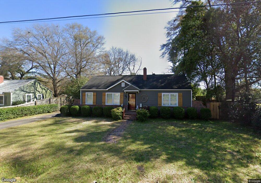
This home is located at 1006 Duncan Ave, Perry, GA 31069 and is currently estimated at $204,977, approximately $106 per square foot. 1006 Duncan Ave is a home located in Houston County with nearby schools including Tucker Elementary School, Perry Middle School, and Perry High School.
Ownership History
Date
Name
Owned For
Owner Type
Purchase Details
Closed on
Jul 26, 2002
Sold by
Layson Robert Gerald
Bought by
Layson Robert Gerald and Layson Darlene*
Current Estimated Value
Purchase Details
Closed on
Jul 30, 1999
Sold by
Layson Darlene
Bought by
Layson Robert Gerald
Purchase Details
Closed on
Sep 2, 1980
Sold by
Delmar John E
Bought by
Layson Robert Gerald and Wheeler Darl
Purchase Details
Closed on
Jun 13, 1977
Sold by
Morris Robert
Bought by
Delmar John E
Purchase Details
Closed on
Jun 10, 1977
Sold by
Morris Robert W and Morris Dorothy H
Bought by
Delmar John E
Purchase Details
Closed on
Aug 28, 1956
Bought by
Morris Robert
Purchase Details
Closed on
Sep 20, 1948
Bought by
Morris Robert
Create a Home Valuation Report for This Property
The Home Valuation Report is an in-depth analysis detailing your home's value as well as a comparison with similar homes in the area
Home Values in the Area
Average Home Value in this Area
Purchase History
| Date | Buyer | Sale Price | Title Company |
|---|---|---|---|
| Layson Robert Gerald | -- | -- | |
| Layson Robert Gerald | -- | -- | |
| Layson Robert Gerald | -- | -- | |
| Delmar John E | -- | -- | |
| Delmar John E | -- | -- | |
| Morris Robert | -- | -- | |
| Morris Robert | -- | -- |
Source: Public Records
Tax History Compared to Growth
Tax History
| Year | Tax Paid | Tax Assessment Tax Assessment Total Assessment is a certain percentage of the fair market value that is determined by local assessors to be the total taxable value of land and additions on the property. | Land | Improvement |
|---|---|---|---|---|
| 2024 | $1,605 | $44,920 | $5,520 | $39,400 |
| 2023 | $1,348 | $37,680 | $5,520 | $32,160 |
| 2022 | $758 | $34,960 | $5,520 | $29,440 |
| 2021 | $692 | $31,920 | $5,520 | $26,400 |
| 2020 | $674 | $31,000 | $5,520 | $25,480 |
| 2019 | $674 | $31,000 | $5,520 | $25,480 |
| 2018 | $674 | $31,000 | $5,520 | $25,480 |
| 2017 | $674 | $31,000 | $5,520 | $25,480 |
| 2016 | $675 | $31,000 | $5,520 | $25,480 |
| 2015 | $677 | $31,000 | $5,520 | $25,480 |
| 2014 | -- | $31,000 | $5,520 | $25,480 |
| 2013 | -- | $31,000 | $5,520 | $25,480 |
Source: Public Records
Map
Nearby Homes
- 903 Massee Ln
- 905 Massee Ln
- 1207 Tucker Rd
- 624 Pine Ridge St
- 630 Pine Ridge St
- 113 Pridgen Pass
- 104 Pridgen Pass
- 126 Bramblewood Ln
- 104 Gunner Ln
- 625 Cooper St
- 706 Hillcrest Ave
- 0 Carroll Aly
- 1212 Swift St
- 202 Martin Luther King jr Dr
- 202 Martin Luther King Junior Dr
- 1207 Swift St
- 914 Bess St
- 1343 Wf Ragin Dr
- 1406 Main St
- 609 Marsha Dr
- 1004 Duncan Ave
- 625 Tolleson Ave
- 1010 Duncan Ave
- 1005 Duncan Ave
- 1007 Duncan Ave
- 627 Tolleson Ave
- 1012 Duncan Ave
- 1012 Duncan Ave Unit 232
- 1009 Duncan Ave
- 1001 Duncan Ave
- 1011 Duncan Ave
- 622 Tolleson Ave
- 1013 Duncan Ave
- 702 Washington St
- 1016 Duncan Ave
- 904 Duncan Ave
- 708 Washington St
- 628 Tolleson Ave
- 624 Tolleson Ave
- 705 Washington St