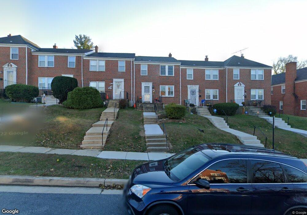
1006 Harwall Rd Gwynn Oak, MD 21207
Estimated Value: $226,000 - $257,000
--
Bed
1
Bath
1,200
Sq Ft
$198/Sq Ft
Est. Value
About This Home
This home is located at 1006 Harwall Rd, Gwynn Oak, MD 21207 and is currently estimated at $237,345, approximately $197 per square foot. 1006 Harwall Rd is a home located in Baltimore County with nearby schools including Edmondson Heights Elementary School, Southwest Academy, and Woodlawn High School.
Ownership History
Date
Name
Owned For
Owner Type
Purchase Details
Closed on
Jun 27, 2024
Sold by
Stewart Samuel L and Stewart Kisha
Bought by
Stewart Family Living Trust and Stewart
Current Estimated Value
Purchase Details
Closed on
Sep 1, 2005
Sold by
Brown Veronica A
Bought by
Stewart Samuel L and Robinson Kisha N
Home Financials for this Owner
Home Financials are based on the most recent Mortgage that was taken out on this home.
Original Mortgage
$170,000
Interest Rate
8.12%
Mortgage Type
Adjustable Rate Mortgage/ARM
Create a Home Valuation Report for This Property
The Home Valuation Report is an in-depth analysis detailing your home's value as well as a comparison with similar homes in the area
Home Values in the Area
Average Home Value in this Area
Purchase History
| Date | Buyer | Sale Price | Title Company |
|---|---|---|---|
| Stewart Family Living Trust | -- | None Listed On Document | |
| Stewart Family Living Trust | -- | None Listed On Document | |
| Stewart Samuel L | $170,000 | -- |
Source: Public Records
Mortgage History
| Date | Status | Borrower | Loan Amount |
|---|---|---|---|
| Previous Owner | Stewart Samuel L | $170,000 |
Source: Public Records
Tax History Compared to Growth
Tax History
| Year | Tax Paid | Tax Assessment Tax Assessment Total Assessment is a certain percentage of the fair market value that is determined by local assessors to be the total taxable value of land and additions on the property. | Land | Improvement |
|---|---|---|---|---|
| 2025 | $2,580 | $160,667 | -- | -- |
| 2024 | $2,580 | $153,400 | $48,000 | $105,400 |
| 2023 | $1,259 | $148,933 | $0 | $0 |
| 2022 | $2,441 | $144,467 | $0 | $0 |
| 2021 | $2,458 | $140,000 | $48,000 | $92,000 |
| 2020 | $2,458 | $136,700 | $0 | $0 |
| 2019 | $2,717 | $133,400 | $0 | $0 |
| 2018 | $2,566 | $130,100 | $44,200 | $85,900 |
| 2017 | $2,441 | $128,100 | $0 | $0 |
| 2016 | $1,963 | $126,100 | $0 | $0 |
| 2015 | $1,963 | $124,100 | $0 | $0 |
| 2014 | $1,963 | $124,100 | $0 | $0 |
Source: Public Records
Map
Nearby Homes
- 961 Saint Agnes Ln
- 1422 N Forest Park Ave
- 1201 Saint Agnes Ln
- 1143 Granville Rd
- 1515 Langford Rd
- 5466 Addington Rd
- 1171 Granville Rd
- 1525 Clairidge Rd
- 1428 Clairidge Rd
- 1638 N Forest Park Ave
- 1427 Barrett Rd
- 1405 Ingleside Ave
- 711 W Hills Pkwy
- 5201 Old Frederick Rd
- 5901 Sunset Ave
- 5902 Prince George St
- 6 Cromarty Rd
- 1206 Ingleside Ave
- 1715 Langford Rd
- 639 Plymouth Rd
- 1004 Harwall Rd
- 1008 Harwall Rd
- 1002 Harwall Rd
- 1010 Harwall Rd
- 1012 Harwall Rd
- 1000 Harwall Rd
- 1014 Harwall Rd
- 1016 Harwall Rd
- 1018 Harwall Rd
- 986 Masefield Rd
- 984 Masefield Rd
- 988 Masefield Rd
- 990 Masefield Rd
- 982 Masefield Rd
- 980 Masefield Rd
- 1020 Harwall Rd
- 1007 Harwall Rd
- 1005 Harwall Rd
- 1009 Harwall Rd
- 978 Masefield Rd