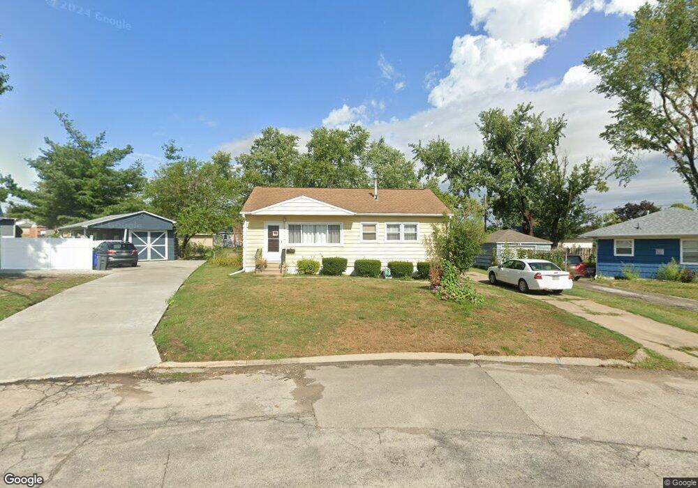
1007 Brockman Dr SE Cedar Rapids, IA 52403
Estimated Value: $143,000 - $157,000
3
Beds
2
Baths
864
Sq Ft
$174/Sq Ft
Est. Value
About This Home
This home is located at 1007 Brockman Dr SE, Cedar Rapids, IA 52403 and is currently estimated at $150,439, approximately $174 per square foot. 1007 Brockman Dr SE is a home located in Linn County with nearby schools including Erskine Elementary School, McKinley STEAM Academy, and George Washington High School.
Ownership History
Date
Name
Owned For
Owner Type
Purchase Details
Closed on
Mar 11, 2015
Sold by
Estate Of Joanne Marie Gorsh
Bought by
Dilts Dale Lle and Dilts Deborah Ann
Current Estimated Value
Home Financials for this Owner
Home Financials are based on the most recent Mortgage that was taken out on this home.
Original Mortgage
$56,250
Outstanding Balance
$19,562
Interest Rate
2.96%
Mortgage Type
New Conventional
Estimated Equity
$130,877
Create a Home Valuation Report for This Property
The Home Valuation Report is an in-depth analysis detailing your home's value as well as a comparison with similar homes in the area
Home Values in the Area
Average Home Value in this Area
Purchase History
| Date | Buyer | Sale Price | Title Company |
|---|---|---|---|
| Dilts Dale Lle | $75,000 | None Available |
Source: Public Records
Mortgage History
| Date | Status | Borrower | Loan Amount |
|---|---|---|---|
| Open | Dilts Dale Lle | $56,250 |
Source: Public Records
Tax History Compared to Growth
Tax History
| Year | Tax Paid | Tax Assessment Tax Assessment Total Assessment is a certain percentage of the fair market value that is determined by local assessors to be the total taxable value of land and additions on the property. | Land | Improvement |
|---|---|---|---|---|
| 2025 | $2,334 | $145,500 | $35,300 | $110,200 |
| 2024 | $2,474 | $143,000 | $35,300 | $107,700 |
| 2023 | $2,474 | $131,900 | $32,100 | $99,800 |
| 2022 | $2,336 | $117,300 | $28,900 | $88,400 |
| 2021 | $2,318 | $112,800 | $28,900 | $83,900 |
| 2020 | $2,318 | $105,100 | $22,500 | $82,600 |
| 2019 | $2,174 | $100,900 | $22,500 | $78,400 |
| 2018 | $2,024 | $100,900 | $22,500 | $78,400 |
| 2017 | $2,048 | $94,000 | $22,500 | $71,500 |
| 2016 | $1,966 | $92,500 | $22,500 | $70,000 |
| 2015 | $2,021 | $94,957 | $22,491 | $72,466 |
| 2014 | $1,836 | $94,957 | $22,491 | $72,466 |
| 2013 | $1,792 | $94,957 | $22,491 | $72,466 |
Source: Public Records
Map
Nearby Homes
- 3630 Mt Vernon Rd SE Unit 6
- 1111 Brockman Dr SE
- 707 40th St SE
- 1013 36th St SE
- 1241 38th St SE
- 654 34th St SE
- 651 34th St SE
- TBD 42nd St SE
- 2227 Kestrel Dr SE
- 2403 Kestrel Dr SE
- 2416 Kestrel Dr SE
- 2226 Kestrel Dr SE
- 3112 Peregrine Ct SE
- 2306 Kestrel Dr SE
- 2420 Kestrel Dr SE
- 2409 Kestrel Dr SE
- 2421 Kestrel Dr SE
- 2221 Kestrel Dr SE
- 2415 Kestrel Dr SE
- 2312 Kestrel Dr SE
- 1015 Brockman Dr SE
- 1001 38th St SE
- 914 Harold Dr SE
- 1019 Brockman Dr SE
- 923 38th St SE
- 1010 Harold Dr SE
- 1002 Harold Dr SE
- 1018 Harold Dr SE
- 1006 Brockman Dr SE
- 1101 Brockman Dr SE
- 1025 38th St SE
- 1022 Harold Dr SE
- 1000 38th St SE
- 938 38th St SE
- 1008 38th St SE
- 1100 Harold Dr SE
- 1100 Brockman Dr SE
- 932 38th St SE
- 1103 Brockman Dr SE
- 1016 38th St SE