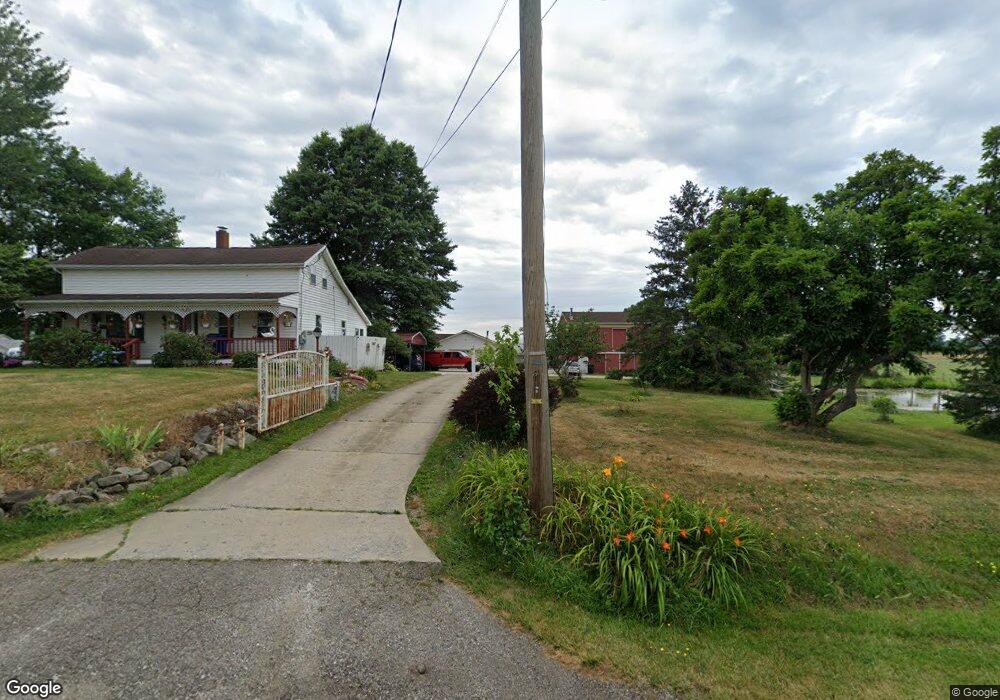
1007 State Route 183 Atwater, OH 44201
Estimated Value: $265,000 - $423,000
2
Beds
1
Bath
1,699
Sq Ft
$200/Sq Ft
Est. Value
About This Home
This home is located at 1007 State Route 183, Atwater, OH 44201 and is currently estimated at $340,259, approximately $200 per square foot. 1007 State Route 183 is a home located in Portage County with nearby schools including Waterloo Elementary School, Waterloo Middle School, and Waterloo High School.
Ownership History
Date
Name
Owned For
Owner Type
Purchase Details
Closed on
Oct 5, 2018
Sold by
Miller Robert T and Miller Angelia E
Bought by
Miller Robert T and Miller Angelia E
Current Estimated Value
Purchase Details
Closed on
Apr 7, 2004
Sold by
Miller Robert T and Miller Angelia E
Bought by
Miller Robert T and Miller Angelia E
Purchase Details
Closed on
Jul 31, 1997
Sold by
Fassnacht Jerome L
Bought by
Miller Robert T and Miller Angelia E
Home Financials for this Owner
Home Financials are based on the most recent Mortgage that was taken out on this home.
Original Mortgage
$125,000
Outstanding Balance
$19,017
Interest Rate
7.71%
Mortgage Type
New Conventional
Estimated Equity
$321,242
Create a Home Valuation Report for This Property
The Home Valuation Report is an in-depth analysis detailing your home's value as well as a comparison with similar homes in the area
Home Values in the Area
Average Home Value in this Area
Purchase History
| Date | Buyer | Sale Price | Title Company |
|---|---|---|---|
| Miller Robert T | -- | None Available | |
| Miller Robert T | -- | None Available | |
| Miller Robert T | -- | Ams Title | |
| Miller Robert T | $175,000 | -- |
Source: Public Records
Mortgage History
| Date | Status | Borrower | Loan Amount |
|---|---|---|---|
| Open | Miller Robert T | $125,000 |
Source: Public Records
Tax History Compared to Growth
Tax History
| Year | Tax Paid | Tax Assessment Tax Assessment Total Assessment is a certain percentage of the fair market value that is determined by local assessors to be the total taxable value of land and additions on the property. | Land | Improvement |
|---|---|---|---|---|
| 2024 | $3,726 | $102,170 | $23,730 | $78,440 |
| 2023 | $3,581 | $85,020 | $17,780 | $67,240 |
| 2022 | $3,670 | $85,020 | $17,780 | $67,240 |
| 2021 | $3,649 | $85,020 | $17,780 | $67,240 |
| 2020 | $3,282 | $73,820 | $17,780 | $56,040 |
| 2019 | $3,287 | $73,820 | $17,780 | $56,040 |
| 2018 | $3,247 | $70,010 | $17,680 | $52,330 |
| 2017 | $3,247 | $70,010 | $17,680 | $52,330 |
| 2016 | $3,215 | $70,010 | $17,680 | $52,330 |
| 2015 | $3,275 | $70,010 | $17,680 | $52,330 |
| 2014 | $3,373 | $70,010 | $17,680 | $52,330 |
| 2013 | $3,340 | $70,010 | $17,680 | $52,330 |
Source: Public Records
Map
Nearby Homes
- 6727 Waterloo Rd
- 6453 Waterloo Rd
- 1015 Stroup Rd
- 1454 Hillcrest Dr
- 1452 Stroup Rd
- 7374 Virginia Rd
- 1440 Porter Rd
- 90 N Jefferson St
- 14920 Mccallum Ave NE
- 5615 Laubert Rd
- 5457 Waterloo Rd
- 5296 Eberly Rd
- 0 Industry Rd
- 2171 Alliance Rd
- 2265 Industry Rd
- 1628 New Milford Rd
- 14265 Reeder Ave NE
- 4829 Laubert Rd
- 2547 Industry Rd
- 0 New Milford Rd Unit 5119787
- 987 State Route 183
- 973 State Route 183
- 1046 State Route 183
- 1008 State Route 183
- 962 State Route 183
- 1060 Ohio 183
- 1098 State Route 183
- 1130 State Route 183
- 886 State Route 183
- 874 State Route 183
- 1172 State Route 183
- 836 State Route 183
- 1192 State Route 183
- 1204 State Route 183
- 1244 State Route 183
- 1253 State Route 183
- 6722 Waterloo Rd
- 1262 State Route 183
- 740 State Route 183
- 6692 Waterloo Rd