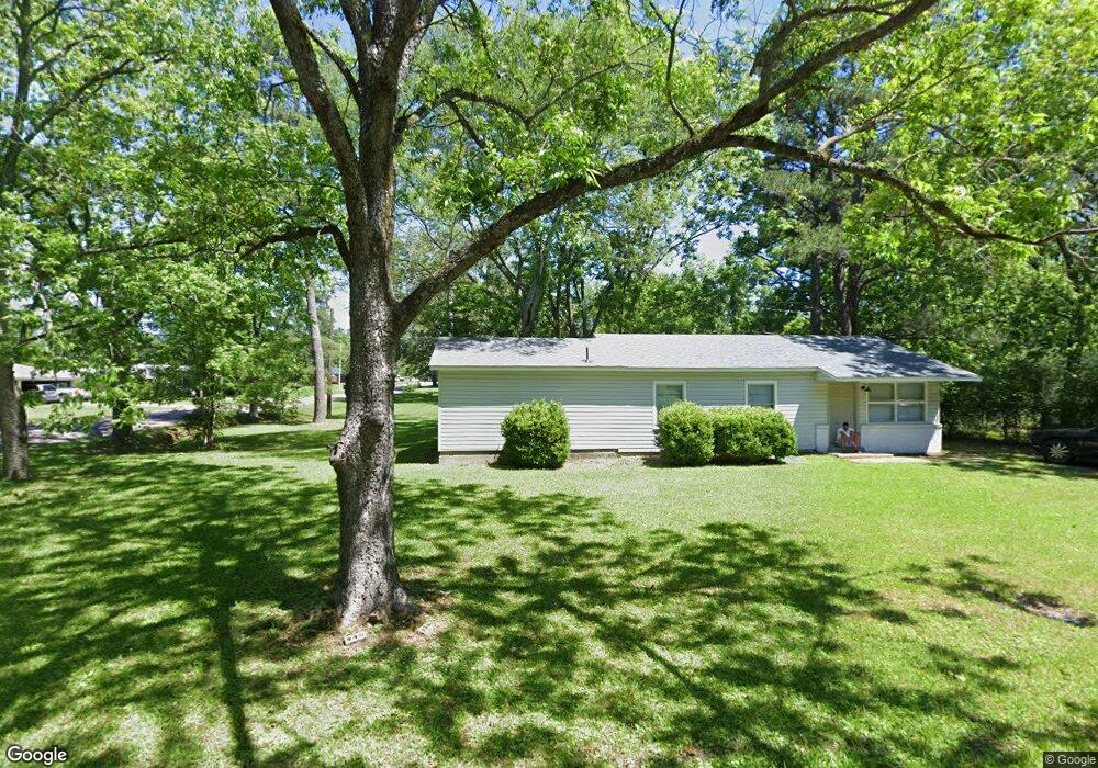
1007 Wood Ave West Point, MS 39773
Estimated Value: $70,000 - $138,000
3
Beds
--
Bath
1,659
Sq Ft
$68/Sq Ft
Est. Value
About This Home
This home is located at 1007 Wood Ave, West Point, MS 39773 and is currently estimated at $112,953, approximately $68 per square foot. 1007 Wood Ave is a home located in Clay County with nearby schools including East Side Elementary School, West Clay Elementary School, and Church Hill Elementary School.
Ownership History
Date
Name
Owned For
Owner Type
Purchase Details
Closed on
Aug 11, 2022
Sold by
Carrington Mortgage Services Llc
Bought by
Field Walter
Current Estimated Value
Purchase Details
Closed on
Sep 4, 2008
Sold by
Discon Donald J and Discon Virginia T
Bought by
Mcminn Tina
Purchase Details
Closed on
Dec 22, 2006
Sold by
Vanholm Hooks Van
Bought by
Discon Donald J and Discon Virginia T
Purchase Details
Closed on
Apr 25, 2006
Sold by
Courteau Emily Kaye
Bought by
Phh Mortage Corporation and Cendant Mortage Corporation
Create a Home Valuation Report for This Property
The Home Valuation Report is an in-depth analysis detailing your home's value as well as a comparison with similar homes in the area
Home Values in the Area
Average Home Value in this Area
Purchase History
| Date | Buyer | Sale Price | Title Company |
|---|---|---|---|
| Field Walter | $52,500 | None Listed On Document | |
| Mcminn Tina | -- | -- | |
| Discon Donald J | -- | -- | |
| Phh Mortage Corporation | $65,477 | -- |
Source: Public Records
Tax History Compared to Growth
Tax History
| Year | Tax Paid | Tax Assessment Tax Assessment Total Assessment is a certain percentage of the fair market value that is determined by local assessors to be the total taxable value of land and additions on the property. | Land | Improvement |
|---|---|---|---|---|
| 2024 | $667 | $12,303 | $1,654 | $10,649 |
| 2023 | $1,534 | $10,250 | $1,654 | $8,596 |
| 2022 | $234 | $6,834 | $1,103 | $5,731 |
| 2021 | $234 | $6,834 | $1,103 | $5,731 |
| 2020 | $233 | $6,834 | $1,103 | $5,731 |
| 2019 | $216 | $6,917 | $1,103 | $5,814 |
| 2018 | $202 | $6,917 | $1,103 | $5,814 |
| 2017 | $201 | $6,917 | $1,103 | $5,814 |
| 2016 | $185 | $6,781 | $1,103 | $5,678 |
| 2015 | $175 | $6,037 | $1,103 | $4,934 |
| 2014 | $369 | $6,037 | $1,103 | $4,934 |
| 2013 | $369 | $6,037 | $1,103 | $4,934 |
Source: Public Records
Map
Nearby Homes
- 1046 E Brame Ave
- 472 S Eshman Ave
- 551 E Westbrook St
- 44 Torbert Dr
- 480 E Westbrook St
- 1180 E Broad St
- 485 E Westbrook St
- 479 E Westbrook St
- 238 Calhoun St
- 1104 E Broad St
- 1153 E Broad St
- 15 David St
- 278 Converse Dr
- 329 Converse Dr
- 402 Cromwell St
- 26596 E Main St
- 27045 E Main St
- 26852 E Main St
- 26788 E Main St
- 500 Grove St