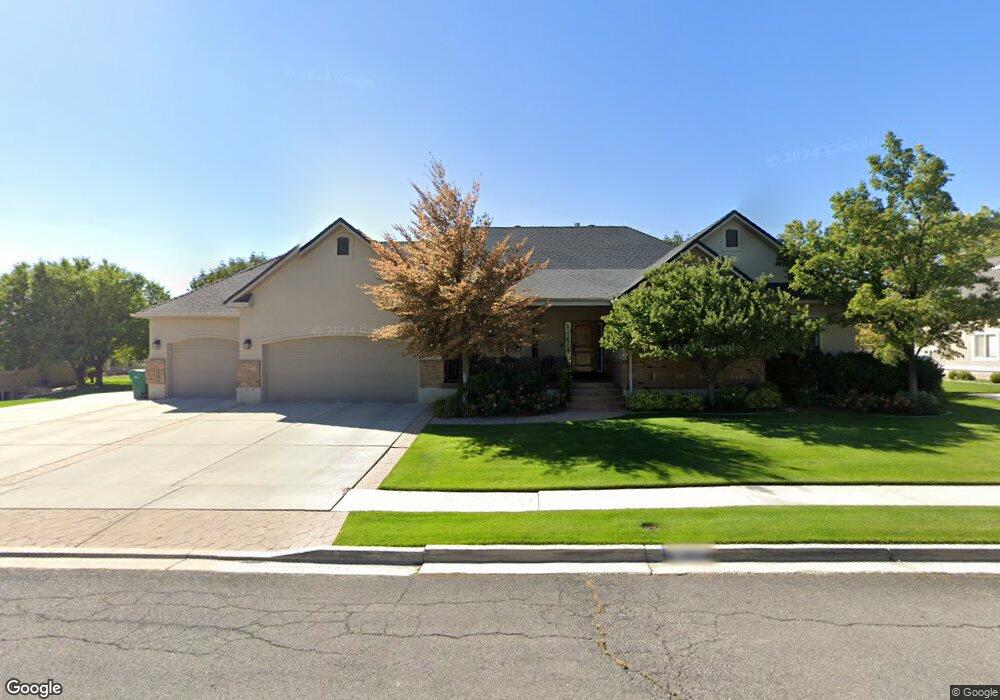
10071 N 6690 W Unit 19 Highland, UT 84003
Estimated Value: $932,000 - $1,154,723
4
Beds
4
Baths
3,082
Sq Ft
$342/Sq Ft
Est. Value
About This Home
This home is located at 10071 N 6690 W Unit 19, Highland, UT 84003 and is currently estimated at $1,055,431, approximately $342 per square foot. 10071 N 6690 W Unit 19 is a home located in Utah County with nearby schools including Freedom Elementary School, Mountain Ridge Junior High School, and American Fork High School.
Ownership History
Date
Name
Owned For
Owner Type
Purchase Details
Closed on
Jun 19, 2003
Sold by
Tanner Rachel Ryan
Bought by
Gray Jay D and Gray Alisha
Current Estimated Value
Home Financials for this Owner
Home Financials are based on the most recent Mortgage that was taken out on this home.
Original Mortgage
$80,500
Interest Rate
5.53%
Mortgage Type
Purchase Money Mortgage
Purchase Details
Closed on
Mar 1, 2002
Sold by
Jdd Investments
Bought by
Tanner Rachel Ryan
Home Financials for this Owner
Home Financials are based on the most recent Mortgage that was taken out on this home.
Original Mortgage
$190,000
Interest Rate
6.94%
Purchase Details
Closed on
Jul 6, 2001
Sold by
Stevens Robert L and Stevens Mary Jayne
Bought by
Jdd Investments
Create a Home Valuation Report for This Property
The Home Valuation Report is an in-depth analysis detailing your home's value as well as a comparison with similar homes in the area
Home Values in the Area
Average Home Value in this Area
Purchase History
| Date | Buyer | Sale Price | Title Company |
|---|---|---|---|
| Gray Jay D | -- | Equity Title Agency Inc | |
| Tanner Rachel Ryan | -- | Guardian Title | |
| Jdd Investments | -- | Guardian Title |
Source: Public Records
Mortgage History
| Date | Status | Borrower | Loan Amount |
|---|---|---|---|
| Closed | Gray Jay D | $80,500 | |
| Previous Owner | Tanner Rachel Ryan | $190,000 |
Source: Public Records
Tax History Compared to Growth
Tax History
| Year | Tax Paid | Tax Assessment Tax Assessment Total Assessment is a certain percentage of the fair market value that is determined by local assessors to be the total taxable value of land and additions on the property. | Land | Improvement |
|---|---|---|---|---|
| 2025 | $4,326 | $1,106,300 | $366,200 | $740,100 |
| 2024 | $4,326 | $534,325 | $0 | $0 |
| 2023 | $4,023 | $536,085 | $0 | $0 |
| 2022 | $3,690 | $476,795 | $0 | $0 |
| 2021 | $3,311 | $637,200 | $195,500 | $441,700 |
| 2020 | $3,173 | $598,800 | $170,000 | $428,800 |
| 2019 | $3,033 | $598,800 | $170,000 | $428,800 |
| 2018 | $3,153 | $591,700 | $162,900 | $428,800 |
| 2017 | $2,826 | $283,030 | $0 | $0 |
| 2016 | $2,901 | $271,535 | $0 | $0 |
| 2015 | $3,017 | $267,630 | $0 | $0 |
| 2014 | $2,860 | $251,515 | $0 | $0 |
Source: Public Records
Map
Nearby Homes
- 9967 N 6670 W
- 9924 N 6630 W Unit 9
- 6862 W 10205 N
- 6692 W 9770 N
- 6658 W 9720 N
- 10453 Canterbury Place
- 10434 N 6400 W
- 6190 W 10050 N
- 2273 N 1060 E
- 9435 N Aspen Hollow Cir
- 1438 N 400 W
- 859 E 2125 N
- 2208 N 825 E
- 6044 W 9740 N
- 5973 W 9960 N
- 11337 N 5950 W Unit 7
- 1616 N Summer Crest Dr
- 6358 W 10830 N
- 6271 W 10830 St N
- 6299 W 10950 N
- 10071 N 6690 W
- 6702 W 10050 N
- 10089 N 6690 W
- 10089 N 6690 W Unit 18
- 10062 N 6690 W
- 10062 N 6690 W Unit 41
- 6736 W 10050 N
- 6736 W 10050 N Unit 17
- 10078 N 6690 W
- 10078 N 6690 W Unit 42
- 10053 6690 W Unit 20
- 10099 N 6690 W
- 10099 N 6690 W Unit 17
- 10098 N 6690 W
- 10098 N 6690 W Unit 43
- 6705 W 10050 N
- 6664 W 10030 N
- 6664 W 10030 N Unit 40
- 6689 W 10050 N
- 6749 W 10125 N