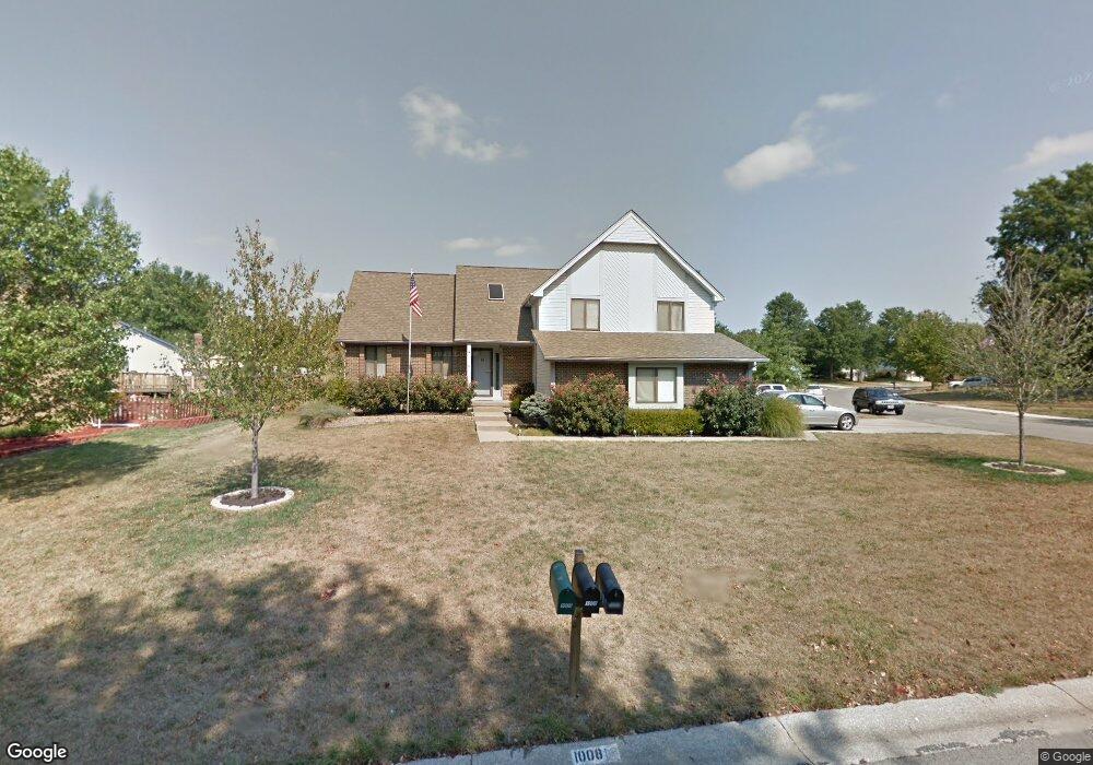
1008 Brookside Dr Raymore, MO 64083
Estimated Value: $325,000 - $363,000
3
Beds
2
Baths
1,950
Sq Ft
$176/Sq Ft
Est. Value
About This Home
This home is located at 1008 Brookside Dr, Raymore, MO 64083 and is currently estimated at $342,429, approximately $175 per square foot. 1008 Brookside Dr is a home located in Cass County with nearby schools including Eagle Glen Intermediate School, Raymore-Peculiar East Middle School, and Raymore-Peculiar Senior High School.
Ownership History
Date
Name
Owned For
Owner Type
Purchase Details
Closed on
Jan 27, 2016
Sold by
Seroka Albert D and Seroka Linda I
Bought by
Seroka Albert D and Seroka Linda I
Current Estimated Value
Home Financials for this Owner
Home Financials are based on the most recent Mortgage that was taken out on this home.
Original Mortgage
$252,000
Outstanding Balance
$192,743
Interest Rate
2.92%
Mortgage Type
Adjustable Rate Mortgage/ARM
Estimated Equity
$149,686
Create a Home Valuation Report for This Property
The Home Valuation Report is an in-depth analysis detailing your home's value as well as a comparison with similar homes in the area
Home Values in the Area
Average Home Value in this Area
Purchase History
| Date | Buyer | Sale Price | Title Company |
|---|---|---|---|
| Seroka Albert D | -- | Stewart Title Company |
Source: Public Records
Mortgage History
| Date | Status | Borrower | Loan Amount |
|---|---|---|---|
| Open | Seroka Albert D | $252,000 |
Source: Public Records
Tax History
| Year | Tax Paid | Tax Assessment Tax Assessment Total Assessment is a certain percentage of the fair market value that is determined by local assessors to be the total taxable value of land and additions on the property. | Land | Improvement |
|---|---|---|---|---|
| 2025 | $3,130 | $43,910 | $3,930 | $39,980 |
| 2024 | $3,130 | $38,460 | $3,580 | $34,880 |
| 2023 | $3,126 | $38,460 | $3,580 | $34,880 |
| 2022 | $2,787 | $34,060 | $3,580 | $30,480 |
| 2021 | $2,787 | $34,060 | $3,580 | $30,480 |
| 2020 | $2,724 | $32,700 | $3,580 | $29,120 |
| 2019 | $2,630 | $32,700 | $3,580 | $29,120 |
| 2018 | $2,417 | $29,030 | $2,860 | $26,170 |
| 2017 | $2,215 | $29,030 | $2,860 | $26,170 |
| 2016 | $2,215 | $27,610 | $2,860 | $24,750 |
| 2015 | $2,217 | $27,610 | $2,860 | $24,750 |
| 2014 | $2,218 | $27,610 | $2,860 | $24,750 |
| 2013 | -- | $27,610 | $2,860 | $24,750 |
Source: Public Records
Map
Nearby Homes
- 1105 Brookside Place
- 113 N Eastglen Dr
- 105 N Landcaster Dr
- 205 Johnston Pkwy
- 1206 Johnston Dr
- 208 N Pacific Ct
- 701 Hampstead Dr
- 205 N Pacific Ct
- 201 Johnston Dr
- 108 Rainbow Cir
- 110 S Westglen Dr
- 615 N Conway St
- 1601 Stasi Ave
- 518 Andypaul Ct
- 411 Eagle Glen Dr
- 1412 W Stone Blvd
- 1206 W Lucy Webb Rd
- 215 Scott Dr
- 1608 Cody Dr
- 0 Scott Dr
- 1010 Brookside Dr
- 1101 W Pleasant Dr
- 1102 Brookside Place
- 1006 Brookside Dr
- 1103 W Pleasant Dr
- 1009 Brookside Dr
- 1007 Brookside Dr
- 1011 Brookside Dr
- 201 Broadmoor Dr
- 1105 W Pleasant Dr
- 1005 Brookside Dr
- 1101 Brookside Place
- 1104 Brookside Place
- 1004 Brookside Dr
- 1013 Brookside Dr
- 1103 Brookside Place
- 1102 W Pleasant Dr
- 203 Broadmoor Dr
- 1003 Brookside Dr
- 1004 Silver Lake Dr
Your Personal Tour Guide
Ask me questions while you tour the home.