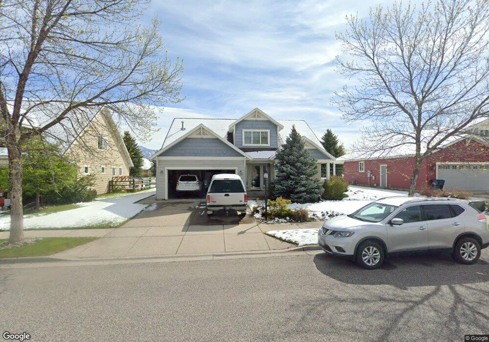
1008 Hunters Way Bozeman, MT 59718
Harvest Creek NeighborhoodEstimated Value: $692,000 - $724,000
3
Beds
3
Baths
1,943
Sq Ft
$366/Sq Ft
Est. Value
About This Home
This home is located at 1008 Hunters Way, Bozeman, MT 59718 and is currently estimated at $711,042, approximately $365 per square foot. 1008 Hunters Way is a home located in Gallatin County with nearby schools including Emily Dickinson School, Chief Joseph Middle School, and Gallatin High School.
Ownership History
Date
Name
Owned For
Owner Type
Purchase Details
Closed on
Sep 24, 2024
Sold by
Anthropocene Realty Management Llc
Bought by
Henson Don W
Current Estimated Value
Purchase Details
Closed on
Jan 3, 2010
Sold by
Newman Brian L
Bought by
Olivo Thomas G and Olivo Katherine M
Purchase Details
Closed on
Oct 20, 2005
Sold by
Stanley Michael H and Davis Lisa G
Bought by
Newman Brian L
Home Financials for this Owner
Home Financials are based on the most recent Mortgage that was taken out on this home.
Original Mortgage
$294,394
Interest Rate
5.67%
Mortgage Type
Purchase Money Mortgage
Create a Home Valuation Report for This Property
The Home Valuation Report is an in-depth analysis detailing your home's value as well as a comparison with similar homes in the area
Home Values in the Area
Average Home Value in this Area
Purchase History
| Date | Buyer | Sale Price | Title Company |
|---|---|---|---|
| Henson Don W | -- | Montana Title | |
| Olivo Thomas G | -- | Security Title Company | |
| Newman Brian L | -- | Security Title Co |
Source: Public Records
Mortgage History
| Date | Status | Borrower | Loan Amount |
|---|---|---|---|
| Previous Owner | Newman Brian L | $294,394 |
Source: Public Records
Tax History Compared to Growth
Tax History
| Year | Tax Paid | Tax Assessment Tax Assessment Total Assessment is a certain percentage of the fair market value that is determined by local assessors to be the total taxable value of land and additions on the property. | Land | Improvement |
|---|---|---|---|---|
| 2025 | $3,291 | $712,100 | $0 | $0 |
| 2024 | $4,971 | $746,800 | $0 | $0 |
| 2023 | $4,809 | $746,800 | $0 | $0 |
| 2022 | $3,444 | $449,200 | $0 | $0 |
| 2021 | $3,480 | $449,200 | $0 | $0 |
| 2020 | $3,477 | $406,900 | $0 | $0 |
| 2019 | $3,556 | $406,900 | $0 | $0 |
| 2018 | $3,271 | $346,800 | $0 | $0 |
| 2017 | $3,058 | $346,800 | $0 | $0 |
| 2016 | $2,895 | $306,700 | $0 | $0 |
| 2015 | $2,898 | $306,700 | $0 | $0 |
| 2014 | $2,496 | $155,449 | $0 | $0 |
Source: Public Records
Map
Nearby Homes
- 911 N Aster Ave
- 2619 Annie St
- 1140 N 27th Ave Unit 2
- 3241 Annie St
- 3108 Oliver St
- 894 Rogers Way
- 515 Michael Grove Ave Unit 60
- 1585 N 25th Ave Unit A
- 488 Meriwether Ave
- 470 Meriwether Ave
- 302 Swayback Ln
- 357 Swayback Ln
- 111 White Horse Loop
- 454 Meriwether Ave
- 440 Meriwether Ave
- 520 Valley Dr
- 560 Christopher Way
- 745 Rogers Way
- 887 Hanson St
- 1599 Bora Way
- 1004 Hunters Way
- 1012 Hunters Way
- 932 Hunters Way
- 1016 Hunters Way
- 2902 Farmall St
- 2903 Farmall St
- 1020 Hunters Way
- 926 Hunters Way
- 2901 Annie St
- 2906 Farmall St
- 1003 Buckrake Ave
- 1007 Buckrake Ave
- 1011 Buckrake Ave
- 999 Buckrake Ave
- 2907 Farmall St
- 2905 Annie St
- 1021 Hunters Way
- 1028 Hunters Way
- 1015 Buckrake Ave
- 2936 Farmall St